MyTopo
Dogtooth Peak California US Topo Map
Couldn't load pickup availability
Also explore the Dogtooth Peak Forest Service Topo of this same quad for updated USFS data
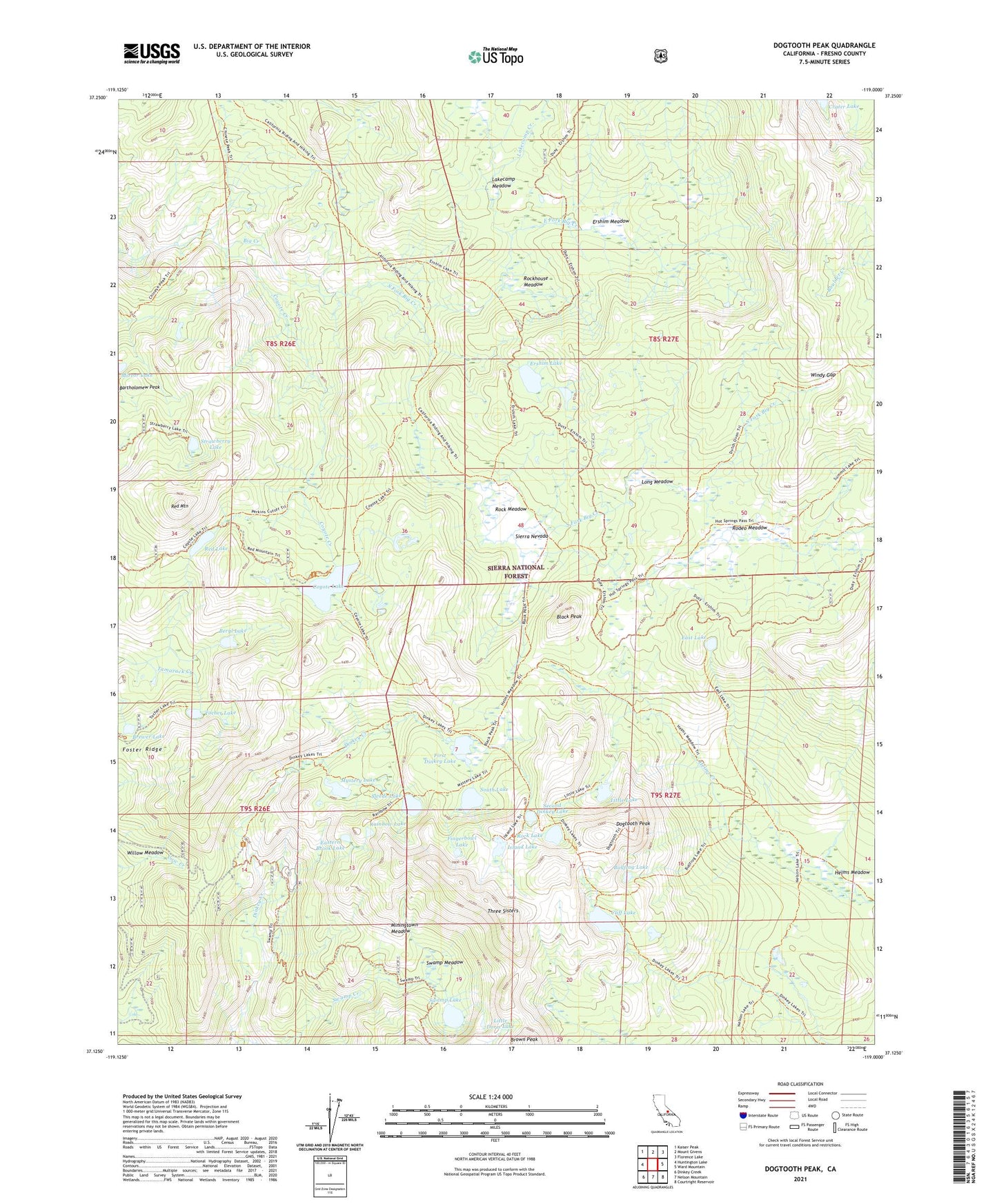
2021 topographic map quadrangle Dogtooth Peak in the state of California. Scale: 1:24000. Based on the newly updated USGS 7.5' US Topo map series, this map is in the following counties: Fresno. The map contains contour data, water features, and other items you are used to seeing on USGS maps, but also has updated roads and other features. This is the next generation of topographic maps. Printed on high-quality waterproof paper with UV fade-resistant inks.
Quads adjacent to this one:
West: Huntington Lake
Northwest: Kaiser Peak
North: Mount Givens
Northeast: Florence Lake
East: Ward Mountain
Southeast: Courtright Reservoir
South: Nelson Mountain
Southwest: Dinkey Creek
This map covers the same area as the classic USGS quad with code o37119b1.
Contains the following named places: Bartholomew Peak, Beryl Lake, Black Peak, Brewer Lake, Brown Peak, Bullfrog Lake, Cliff Lake, Coyote Creek, Coyote Lake, Dinkey Lakes Wilderness, Dinkey Trailhead, Dogtooth Peak, East Fork Big Creek, East Lake, Eastern Brook Lake, Ershim Lake, Ershim Meadow, Fingerbowl Lake, First Dinkey Lake, Foster Ridge, Helms Meadow, Island Lake, Lakecamp Creek, Lakecamp Meadow, Limestone Campsite, Little Doris Lake, Little Lake, Long Meadow, Miningtown Meadow, Mirror Lake, Mystery Lake, Perkins Camp, Qualls Camp, Rainbow Lake, Rainbow Mine, Red Lake, Red Mountain, Rock Lake, Rock Meadow, Rockhouse Meadow, Rodeo Meadow, Second Dinkey Lake, South Fork Big Creek, South Lake, Strawberry Lake, Swamp Lake, Swamp Meadow, Swede Lake, Three Sisters, Tocher Lake, Willow Meadow, Windy Gap, ZIP Code: 93634