
MyTopo
Nelson Mountain California US Topo Map
Couldn't load pickup availability
Also explore the Nelson Mountain Forest Service Topo of this same quad for updated USFS data
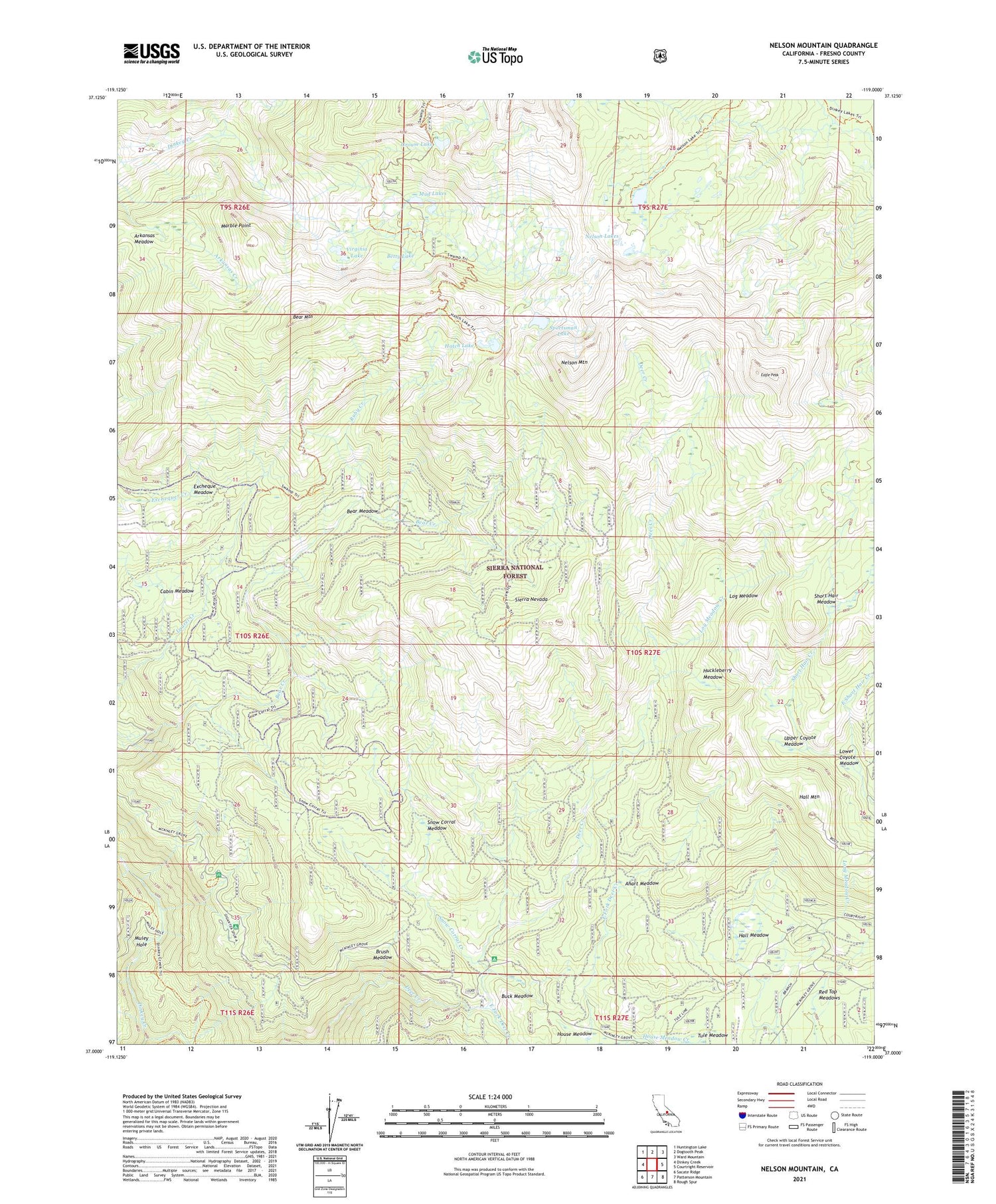
2021 topographic map quadrangle Nelson Mountain in the state of California. Scale: 1:24000. Based on the newly updated USGS 7.5' US Topo map series, this map is in the following counties: Fresno. The map contains contour data, water features, and other items you are used to seeing on USGS maps, but also has updated roads and other features. This is the next generation of topographic maps. Printed on high-quality waterproof paper with UV fade-resistant inks.
Quads adjacent to this one:
West: Dinkey Creek
Northwest: Huntington Lake
North: Dogtooth Peak
Northeast: Ward Mountain
East: Courtright Reservoir
Southeast: Rough Spur
South: Patterson Mountain
Southwest: Sacate Ridge
Contains the following named places: Ahart Meadow, Arkansas Meadow, Bear Meadow, Bear Mountain, Betty Lake, Brush Meadow, Buck Meadow, Buck Meadow Campground, Cabin Meadow, Chinquapin Lakes, Clydes Pack Station, Eagle Peak, East Fork Deer Creek, East Short Hair Creek, Excheque Meadow, Game Dike Mine, Giagantea Campground, Grouse Lake, Hall Meadow, Hall Mountain, Hatch Lake, House Meadow, Huckleberry Meadow, Log Meadow, Log Meadow Creek, Lower Coyote Meadow, Marble Point, McKinley Grove, McKinley Grove Picnic Area, Mud Lakes, Muley Hole, Nelson Lakes, Nelson Mountain, Red Top Meadows, Ruby Creek, Short Hair Meadow, Sierra Division, Snow Corral Creek, Snow Corral Meadow, Sportsman Lake, Swamp Creek, Tule Meadow, Upper Coyote Meadow, Virginia Lake


