MyTopo
Florence Lake California US Topo Map
Couldn't load pickup availability
Also explore the Florence Lake Forest Service Topo of this same quad for updated USFS data
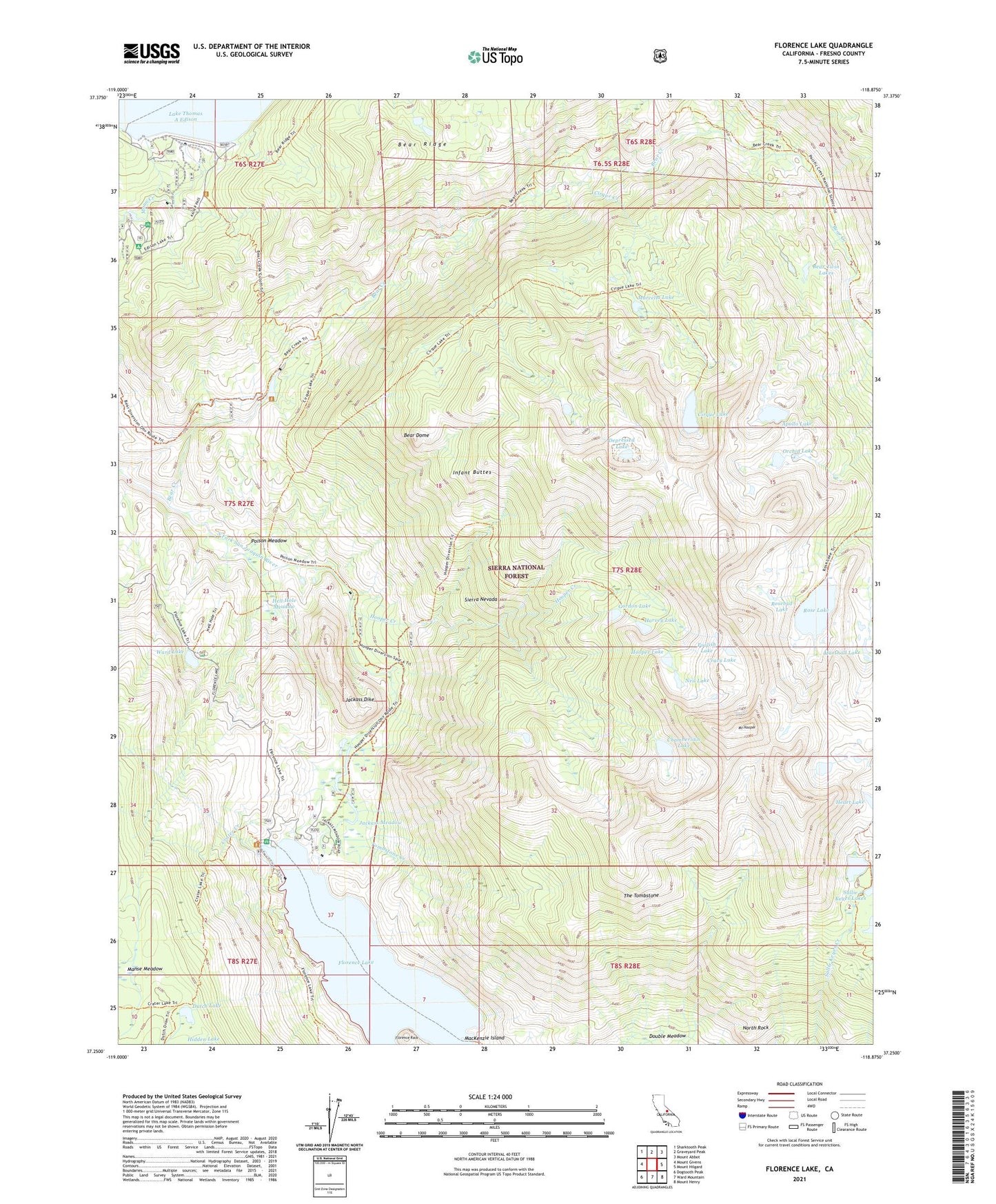
2021 topographic map quadrangle Florence Lake in the state of California. Scale: 1:24000. Based on the newly updated USGS 7.5' US Topo map series, this map is in the following counties: Fresno. The map contains contour data, water features, and other items you are used to seeing on USGS maps, but also has updated roads and other features. This is the next generation of topographic maps. Printed on high-quality waterproof paper with UV fade-resistant inks.
Quads adjacent to this one:
West: Mount Givens
Northwest: Sharktooth Peak
North: Graveyard Peak
Northeast: Mount Abbot
East: Mount Hilgard
Southeast: Mount Henry
South: Ward Mountain
Southwest: Dogtooth Peak
This map covers the same area as the classic USGS quad with code o37118c8.
Contains the following named places: Apollo Lake, Bear Creek, Bear Creek Diversion 104-000 Dam, Bear Diversion Dam, Bear Dome, Bear Twin Lakes, Chamberlain Lake, Cirque Creek, Cirque Lake, Crater Creek, Crazy Lake, Depressed Lake, Dutch Lake, Florence Lake, Florence Lake 104-009 Dam, Florence Lake Campground, Florence Lake Resort, Florence Rock, Foolish Lake, Gordon Lake, Harvey Lake, Heart Lake, Hell Hole Meadow, High Sierra Packstation, Hilgard Branch, Hooper Creek, Hooper Diversion Dam, Hooper Lake, Infant Buttes, Jackass Dike, Jackass Meadow, Jackass's Meadows Campground, Kip Camp, Lost Valley Pack Station, MacKenzie Island, Manse Meadow, Marcella Lake, Marshall Lake, Mono Creek Campground, Mono Creek Diversion 104-012 Dam, Mono Creek Packstation, Mount Hooper, Neil Lake, North Rock, Orchid Lake, Poison Meadow, Rose Lake, Rosebud Lake, The Tombstone, Tombstone Creek, Vermilion Valley 104-023 Dam, Vermilion Valley Dam, Ward Lake, Ward Lake Campground