MyTopo
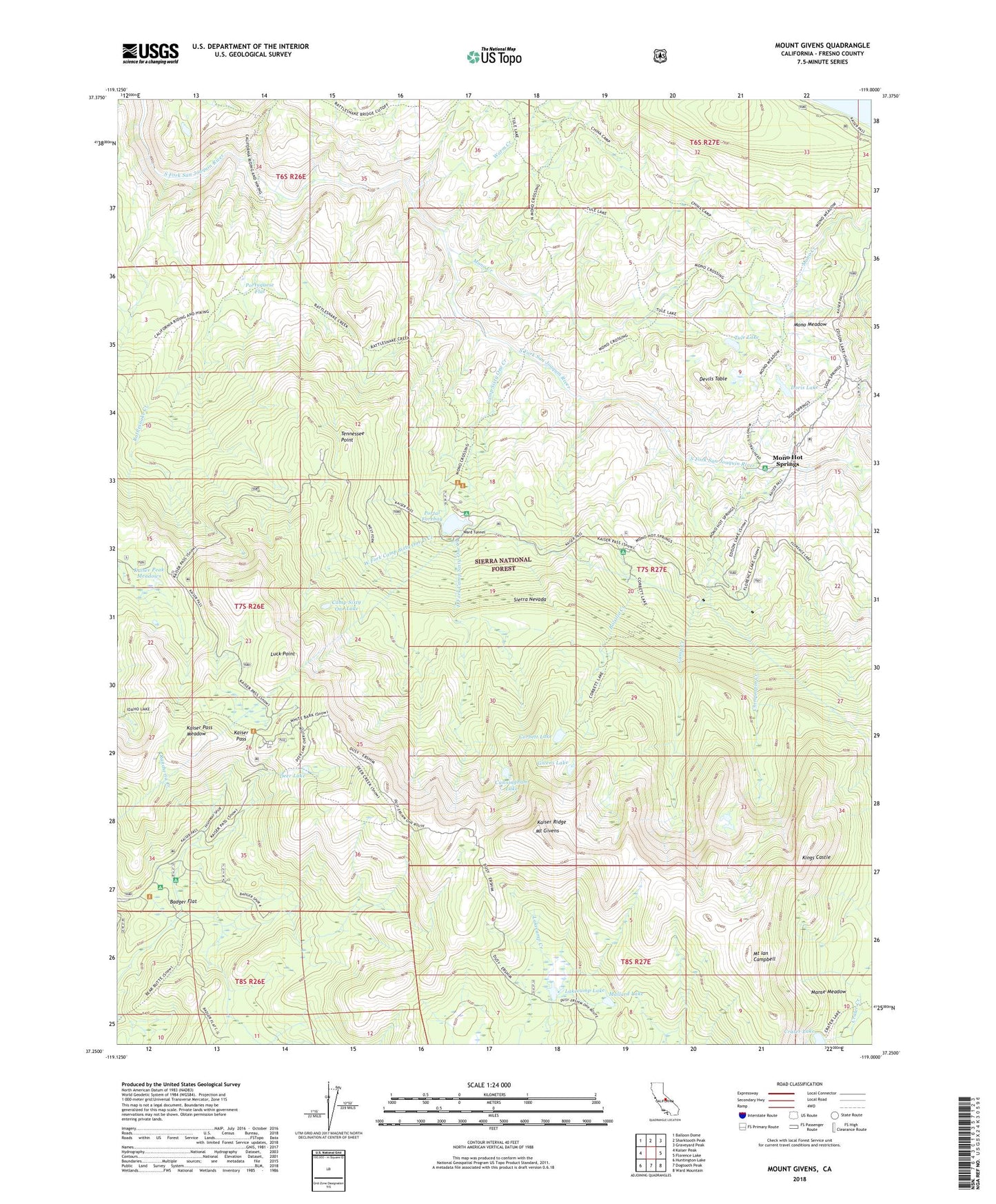
Mount Givens California US Topo Map
Couldn't load pickup availability
Also explore the Mount Givens Forest Service Topo of this same quad for updated USFS data
2021 topographic map quadrangle Mount Givens in the state of California. Scale: 1:24000. Based on the newly updated USGS 7.5' US Topo map series, this map is in the following counties: Fresno. The map contains contour data, water features, and other items you are used to seeing on USGS maps, but also has updated roads and other features. This is the next generation of topographic maps. Printed on high-quality waterproof paper with UV fade-resistant inks.
Quads adjacent to this one:
West: Kaiser Peak
Northwest: Balloon Dome
North: Sharktooth Peak
Northeast: Graveyard Peak
East: Florence Lake
Southeast: Ward Mountain
South: Dogtooth Peak
Southwest: Huntington Lake
This map covers the same area as the classic USGS quad with code o37119c1.
Contains the following named places: Badger Flat, Badger Flat Campground, Badger Flat Picnic Area, Bolsillo Campground, Bolsillo Creek, Camp Creek, Camp Sixty One Campground, Camp Sixty One Creek, Camp Sixty One D Campground, Camp Sixty One Lake, China Camp, Chinquapin Creek, Corbett Lake, Crater Lake, Cunningham Lake, Deer Lake, Devils Table, Doris Lake, East Fork Camp Sixty-One Creek, Givens Lake, High Sierra Ranger Station, Kaiser Pass, Kaiser Pass Meadow, Kaiser Peak Meadows, Kaiser Ridge, Kings Castle, Lakecamp Lake, Luck Point, Mallard Lake, Manse Meadow, Mono Creek, Mono Crossing, Mono Hot Springs, Mono Hot Springs Campgorund, Mono Hot Springs Post Office, Mono Hot Springs Resort, Mono Meadow, Mount Givens, Mount Ian Campbell, Portal Forebay, Portal Forebay Campground, Portal Powerhouse Forebay 104-024 Dam, Portuguese Flat, Rattlesnake Creek, Rattlesnake Crossing, Tennessee Point, Tule Lake, Ward Tunnel, Warm Creek, Weldons Camp, West Fork Camp Sixty One D Creek, White Bark Vista Point