MyTopo
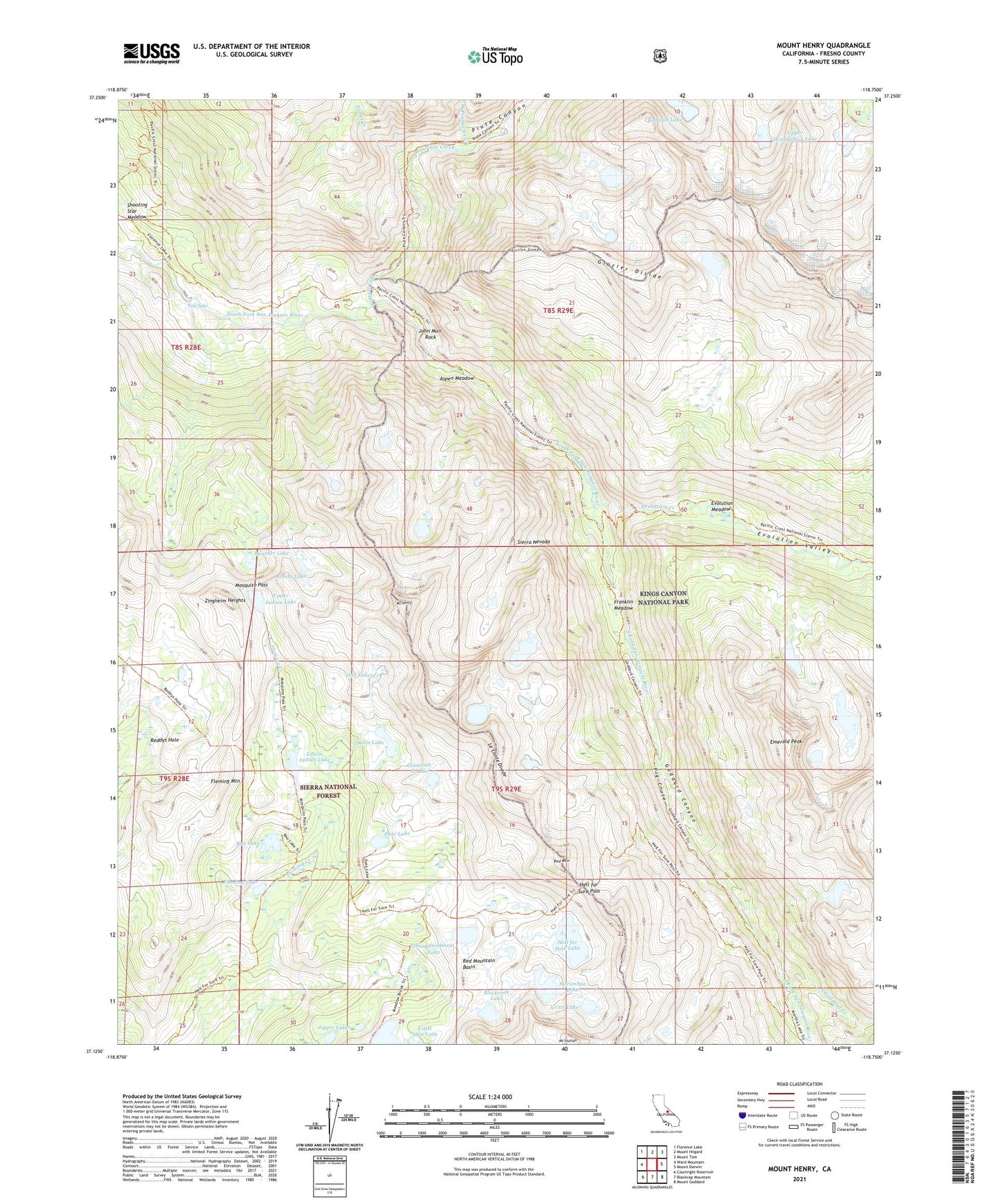
Mount Henry California US Topo Map
Couldn't load pickup availability
Also explore the Mount Henry Forest Service Topo of this same quad for updated USFS data
2021 topographic map quadrangle Mount Henry in the state of California. Scale: 1:24000. Based on the newly updated USGS 7.5' US Topo map series, this map is in the following counties: Fresno. The map contains contour data, water features, and other items you are used to seeing on USGS maps, but also has updated roads and other features. This is the next generation of topographic maps. Printed on high-quality waterproof paper with UV fade-resistant inks.
Quads adjacent to this one:
West: Ward Mountain
Northwest: Florence Lake
North: Mount Hilgard
Northeast: Mount Tom
East: Mount Darwin
Southeast: Mount Goddard
South: Blackcap Mountain
Southwest: Courtright Reservoir
This map covers the same area as the classic USGS quad with code o37118b7.
Contains the following named places: Arctic Lake, Aspen Meadow, Blackrock Lake, Bonita Lake, Dale Lake, Davis Lake, Devils Punchbowl, Diamond-X Lake, Disappointment Lake, Emerald Peak, Evolution Creek, Evolution Meadow, Evolution Valley, Fleming Lake, Fleming Mountain, Franklin Meadow, Goddard Canyon, Heather Lake, Hell for Sure Lake, Hell for Sure Pass, Horseshoe Lake, Jigger Lakes, John Muir Rock, John Muir Trail Cabin, John Muir Wilderness, Little Shot Lake, Lobe Lakes, Lower Indian Lake, Matthes Glaciers, Mosquito Pass, Mount Henry, Mount Hutton, North Goddard Creek, Pavilion Dome, Pig Chute, Piute Canyon, Piute Creek, Potholes, Rae Lake, Ramona Lake, Red Mountain, Red Mountain Basin, Reddys Hole, Tule Lake, Turf Lakes, Turret Creek, Upper Honeymoon Lake, Upper Indian Lake, West Pinnacles Creek, Zingheim Heights