MyTopo
Greenough Ridge California US Topo Map
Couldn't load pickup availability
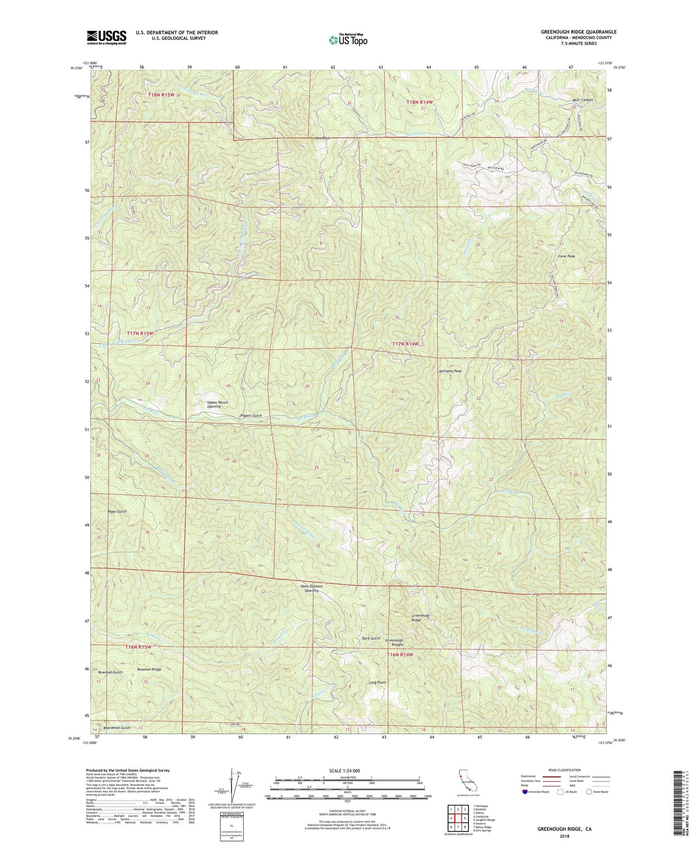
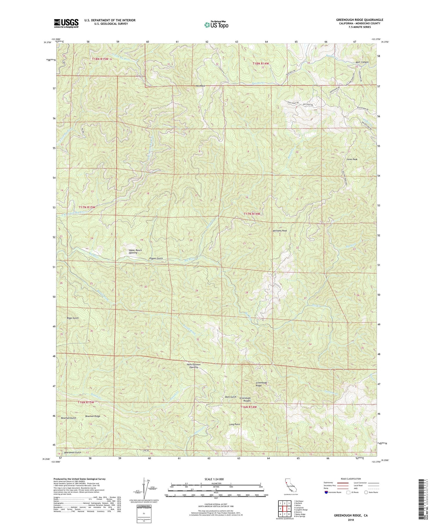
2021 topographic map quadrangle Greenough Ridge in the state of California. Scale: 1:24000. Based on the newly updated USGS 7.5' US Topo map series, this map is in the following counties: Mendocino. The map contains contour data, water features, and other items you are used to seeing on USGS maps, but also has updated roads and other features. This is the next generation of topographic maps. Printed on high-quality waterproof paper with UV fade-resistant inks.
Quads adjacent to this one:
West: Comptche
Northwest: Northspur
North: Burbeck
Northeast: Willits
East: Laughlin Range
Southeast: Orrs Springs
South: Bailey Ridge
Southwest: Navarro
This map covers the same area as the classic USGS quad with code o39123c4.
Contains the following named places: Boardman Gulch, Bowman Ridge, Fordice Ranch, Greenough Ridge, Greenough Roughs, Hans Ottoson Opening, Irene Peak, Johnson Dam, Long Point, Martin Creek, Pigpen Gulch, Rice Creek, Two Rock, Upper Ranch Opening, Valentine Creek, Williams Peak, Williams Ranch