MyTopo
Wawona California US Topo Map
Couldn't load pickup availability
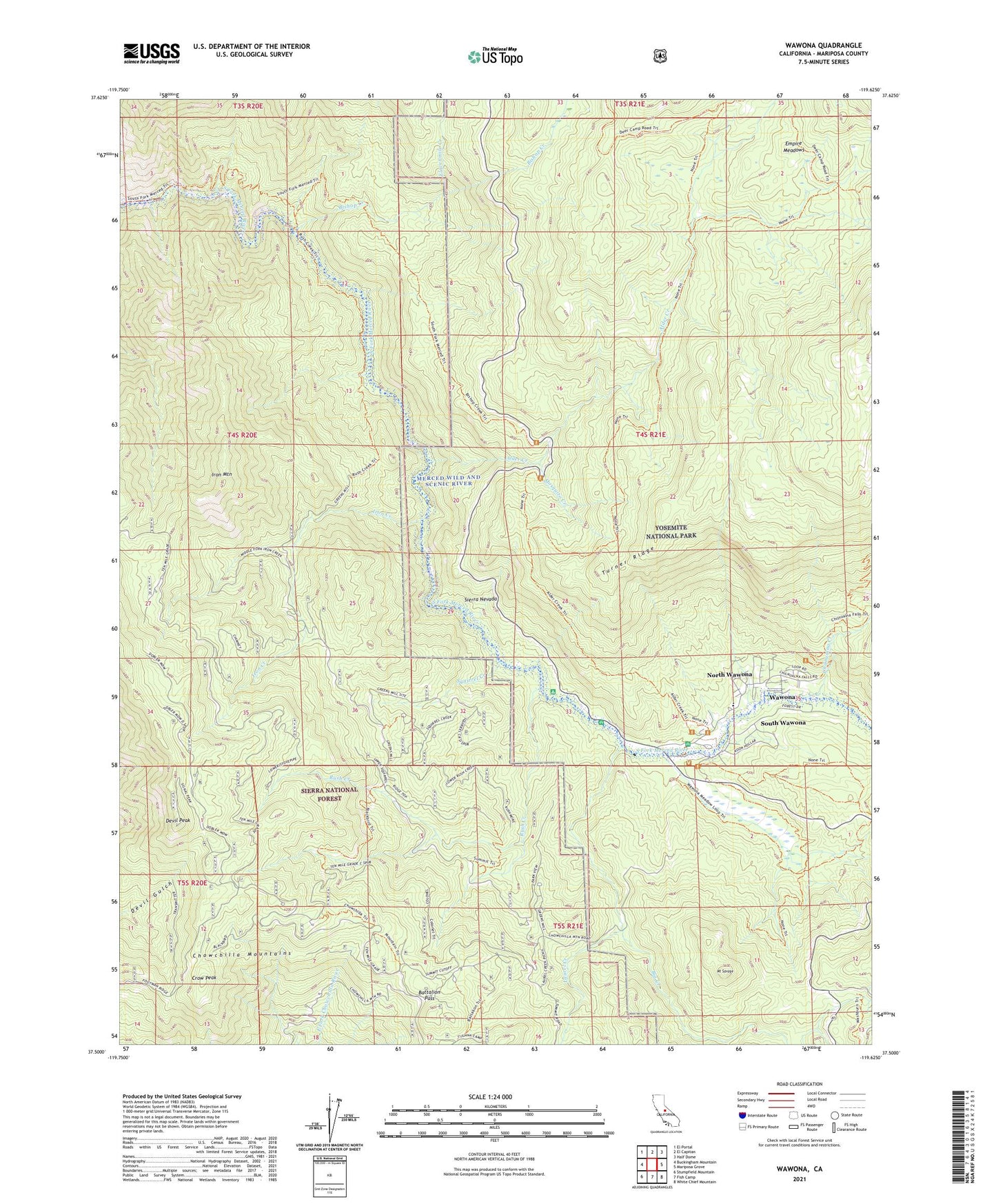
2021 topographic map quadrangle Wawona in the state of California. Scale: 1:24000. Based on the newly updated USGS 7.5' US Topo map series, this map is in the following counties: Mariposa. The map contains contour data, water features, and other items you are used to seeing on USGS maps, but also has updated roads and other features. This is the next generation of topographic maps. Printed on high-quality waterproof paper with UV fade-resistant inks.
Quads adjacent to this one:
West: Buckingham Mountain
Northwest: El Portal
North: El Capitan
Northeast: Half Dome
East: Mariposa Grove
Southeast: White Chief Mountain
South: Fish Camp
Southwest: Stumpfield Mountain
This map covers the same area as the classic USGS quad with code o37119e6.
Contains the following named places: Alder Creek, Battalion Pass, Bear Wallow Spur, Big Creek, Bishop Creek, Chilnualna Creek, Chilnualna Fall Trail, Chowchilla Mountains, Crow Peak, Crowsfoot Campground, Deer Camp, Devil Peak, Elevenmile Creek, Empire Meadows, Iron Creek, Iron Mountain, Laurel Creek, Mosquito Creek, Mount Savage, North Wawona, Pioneer Yosemite History Center, Rush Creek, Signal Group Campground, Signal Peak Lookout, South Wawona, Squirrel Creek, Stovepipe, Stovepipe Campsite, Summit Campground, Turner Ridge, Wawohna Campground, Wawona, Wawona Campground, Wawona Census Designated Place, Wawona Elementary School, Wawona Golf Course