MyTopo
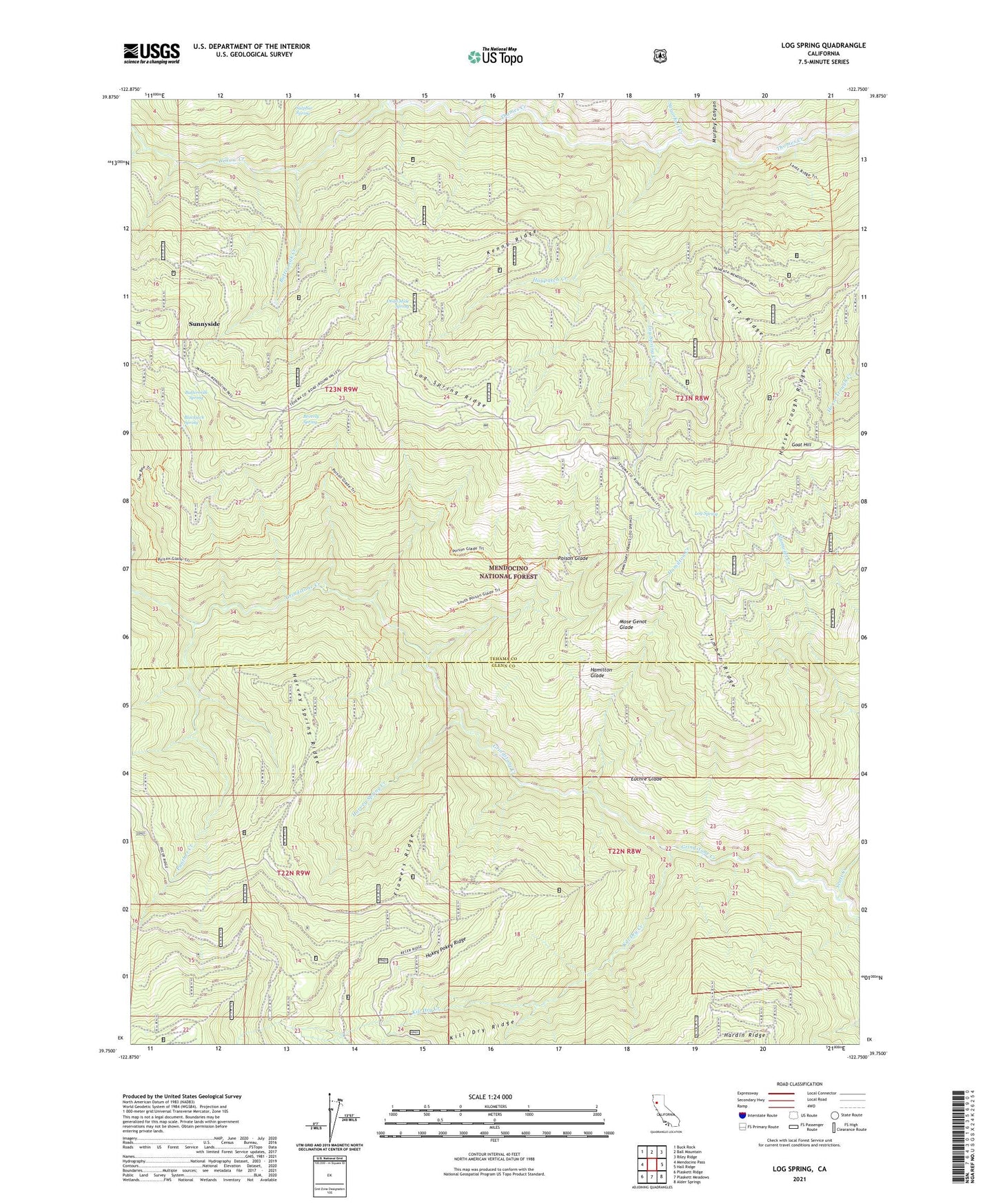
Log Spring California US Topo Map
Couldn't load pickup availability
Also explore the Log Spring Forest Service Topo of this same quad for updated USFS data
2021 topographic map quadrangle Log Spring in the state of California. Scale: 1:24000. Based on the newly updated USGS 7.5' US Topo map series, this map is in the following counties: Tehama, Glenn. The map contains contour data, water features, and other items you are used to seeing on USGS maps, but also has updated roads and other features. This is the next generation of topographic maps. Printed on high-quality waterproof paper with UV fade-resistant inks.
Quads adjacent to this one:
West: Mendocino Pass
Northwest: Buck Rock
North: Ball Mountain
Northeast: Riley Ridge
East: Hall Ridge
Southeast: Alder Springs
South: Plaskett Meadows
Southwest: Plaskett Ridge
This map covers the same area as the classic USGS quad with code o39122g7.
Contains the following named places: Beverly Spring, Blackjack Recreation Site, Blackjack Spring, Board Creek, Bodkin Cabin, Buttermilk Creek, Buttermilk Spring, Cary Pasture Creek, Dead Mule Camp, Dead Mule Spring, Euchre Glade, Flowers Ridge, Goat Hill, Hamilton Creek, Hamilton Glade, Harvey Spring Creek, Harvey Spring Ridge, Haypatch Creek, Hokey Pokey Ridge, Horse Trough Ridge, Kenny Ridge, Kill Dry Creek, Lantz Cabin, Lantz Ridge, Log Spring, Log Spring Creek, Log Spring Ridge, Log Spring Station, Mose Genot Glade, Murphy Canyon, One Bee Camp, Panther Creek, Poison Glade, Poison Glade Recreation Site, Powell Cabin, Saturday Camp, Scott Creek, Side Rod Camp, Sugarfoot Creek, Sulphur Spring, Sunnyside, Timber Ridge, Willow Creek