
MyTopo
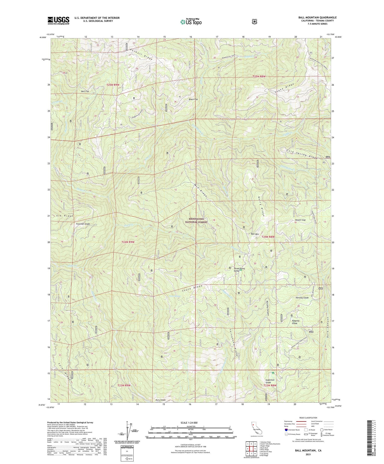
Ball Mountain California US Topo Map
Couldn't load pickup availability
Also explore the Ball Mountain Forest Service Topo of this same quad for updated USFS data
2021 topographic map quadrangle Ball Mountain in the state of California. Scale: 1:24000. Based on the newly updated USGS 7.5' US Topo map series, this map is in the following counties: Tehama. The map contains contour data, water features, and other items you are used to seeing on USGS maps, but also has updated roads and other features. This is the next generation of topographic maps. Printed on high-quality waterproof paper with UV fade-resistant inks.
Quads adjacent to this one:
West: Buck Rock
Northwest: Solomon Peak
North: South Yolla Bolly Mountains
Northeast: Raglin Ridge
East: Riley Ridge
Southeast: Hall Ridge
South: Log Spring
Southwest: Mendocino Pass
This map covers the same area as the classic USGS quad with code o39122h7.
Contains the following named places: Auger Creek, Ball Mountain, Berry Creek, Berry Ridge, Big Stump Camp, Black Flat, Bull Flat, Cold Spring Creek, Cold Spring Ridge, Cold Springs Forest Service Facility, Croney Creek, Eury Glade, Fish Creek, Flood Creek, Foreman Glade, Griffin Creek, Griffin Place, Hensley Glade, Howell Camp, Howell Gap, Johnson Cabin, Kingsley Glade, Mason Camp, Maxim Cabin, McClure Creek, Middle Ridge, Onion Springs, Peterson Place, Pollard Corral, Russell Cabin, Snake Creek, Snake Ridge, South Ridge, Stockton Cabin, Straight Arrow Camp, Sugarfoot Glade, Sugarfoot Recreation Site, Telephone Camp, Telephone Ridge, Three Prong Campground, Three Prong Valley


