MyTopo
Plaskett Meadows California US Topo Map
Couldn't load pickup availability
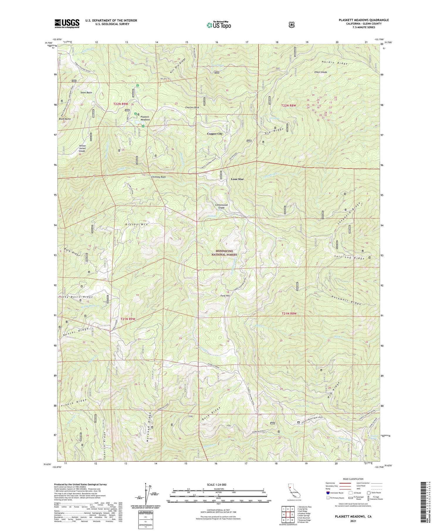
Also explore the Plaskett Meadows Forest Service Topo of this same quad for updated USFS data
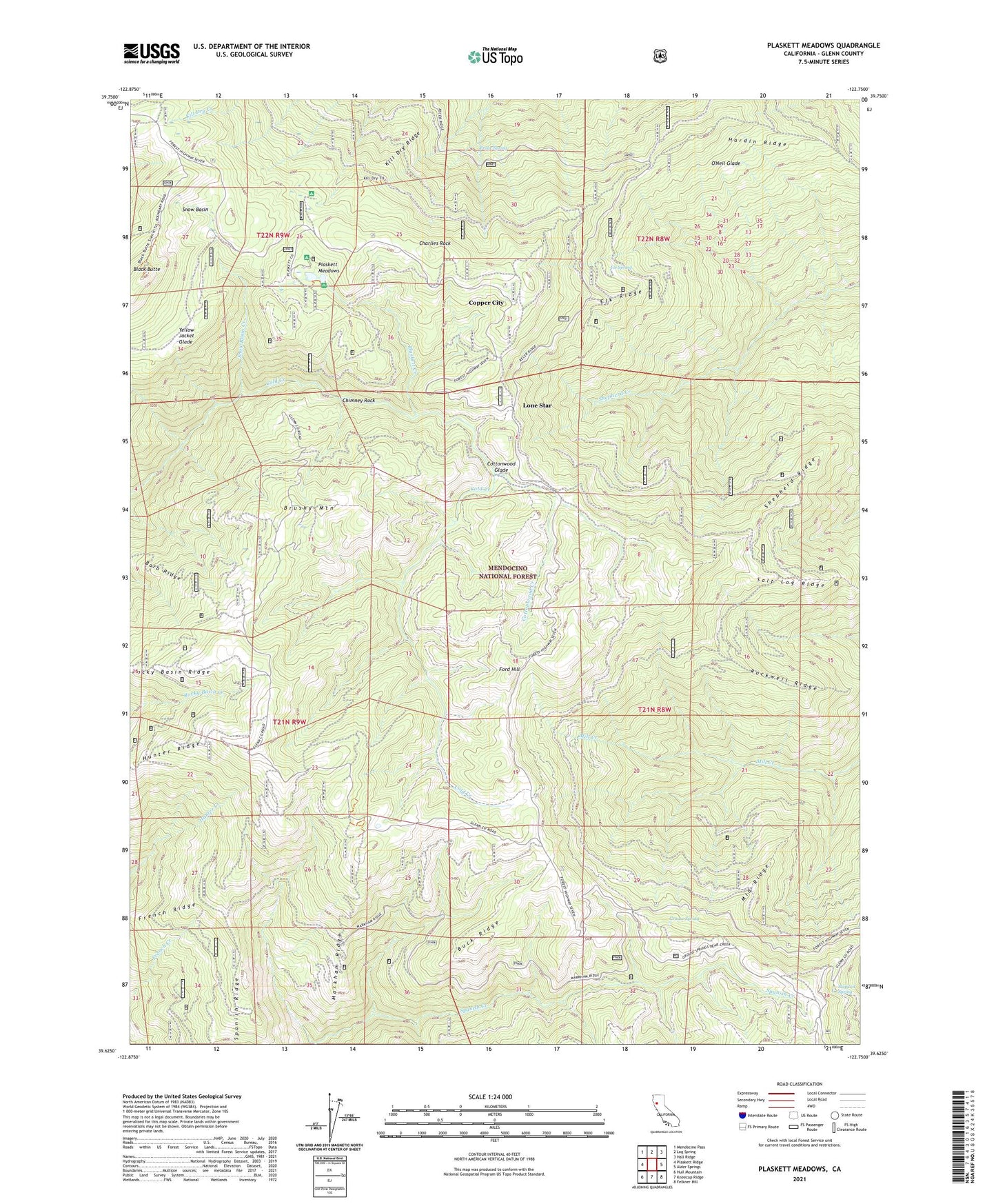
2021 topographic map quadrangle Plaskett Meadows in the state of California. Scale: 1:24000. Based on the newly updated USGS 7.5' US Topo map series, this map is in the following counties: Glenn. The map contains contour data, water features, and other items you are used to seeing on USGS maps, but also has updated roads and other features. This is the next generation of topographic maps. Printed on high-quality waterproof paper with UV fade-resistant inks.
Quads adjacent to this one:
West: Plaskett Ridge
Northwest: Mendocino Pass
North: Log Spring
Northeast: Hall Ridge
East: Alder Springs
Southeast: Felkner Hill
South: Kneecap Ridge
Southwest: Hull Mountain
This map covers the same area as the classic USGS quad with code o39122f7.
Contains the following named places: Barb Ridge, Black Butte, Board Tree Campground, Brownell Camp, Brushy Mountain, Buck Ridge, Charlies Rock, Chimney Rock, Copper City, Copper City Campground, Cottonwood Creek, Cottonwood Glade, Cottonwood Glade Campground, Elk Ridge, Ford Hill, French Ridge, Frolic Spring, Garnett Camp, Grouse Spring, Hardin Ridge, Hunter Ridge, Ice Spring, Jenks Place, Keeran Camp, Kill Dry Ridge, Lone Star, Lone Star Campground, Markham Ridge, Masterson Campground, Mendocino National Forest, Middle Ridge, Ocean View, O'Neil Glade, Plaskett Creek, Plaskett Meadows, Plaskett Recreation Site, Plaskett Station, Rockwell Ridge, Rocky Basin Ridge, Salt Log Ridge, Shepherd Ridge, Slapjack Spring, Snow Basin, Snow Basin Creek, Spanish Ridge, Squaw Camp, Walker Cabin, Yellow Jacket Glade