MyTopo
Paulsell California US Topo Map
Couldn't load pickup availability
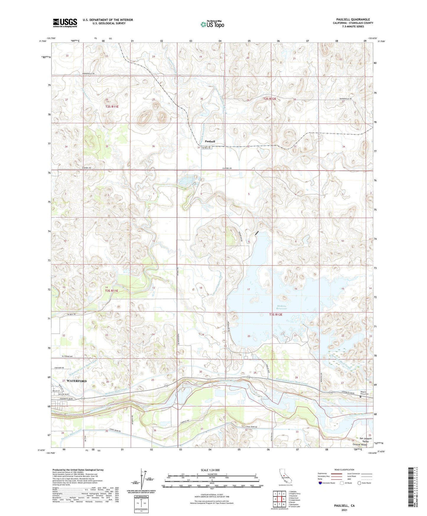
2021 topographic map quadrangle Paulsell in the state of California. Scale: 1:24000. Based on the newly updated USGS 7.5' US Topo map series, this map is in the following counties: Stanislaus. The map contains contour data, water features, and other items you are used to seeing on USGS maps, but also has updated roads and other features. This is the next generation of topographic maps. Printed on high-quality waterproof paper with UV fade-resistant inks.
Quads adjacent to this one:
West: Waterford
Northwest: Oakdale
North: Knights Ferry
Northeast: Keystone
East: Cooperstown
Southeast: Turlock Lake
South: Montpelier
Southwest: Denair
This map covers the same area as the classic USGS quad with code o37120f6.
Contains the following named places: Big Bear Park, Cashman Creek, Dan Casey Slough, Horrs School, J and B Farms, Ketcham Slough, KTRB-AM (Modesto), Lateral Number Eight, Lateral Number Three, Lateral Number Three-B, Lateral Number Two, Modesto Main Canal, Modesto Reservoir, Modesto Reservoir 59-000 Dam, Paulsell, Paulsell Extension, Paulsell Lateral, Roberts Ferry Cemetery, Turlock Main Canal, Waterford Division, Waterford Lower Main Canal, Waterford Pit, ZIP Code: 95386