MyTopo
Mount Goddard California US Topo Map
Couldn't load pickup availability
Also explore the Mount Goddard Forest Service Topo of this same quad for updated USFS data
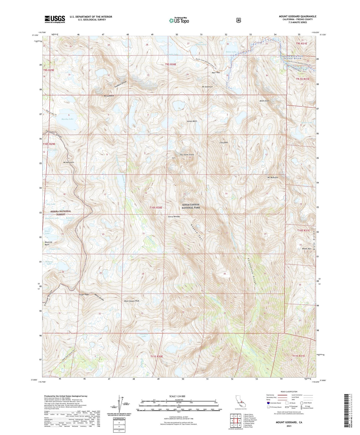
2021 topographic map quadrangle Mount Goddard in the state of California. Scale: 1:24000. Based on the newly updated USGS 7.5' US Topo map series, this map is in the following counties: Fresno. The map contains contour data, water features, and other items you are used to seeing on USGS maps, but also has updated roads and other features. This is the next generation of topographic maps. Printed on high-quality waterproof paper with UV fade-resistant inks.
Quads adjacent to this one:
West: Blackcap Mountain
Northwest: Mount Henry
North: Mount Darwin
Northeast: Mount Thompson
East: North Palisade
Southeast: Marion Peak
South: Slide Bluffs
Southwest: Tehipite Dome
This map covers the same area as the classic USGS quad with code o37118a6.
Contains the following named places: Battalion Lake, Black Divide, Black Giant, Blue Canyon Peak, Cathedral Lake, Chapel Lake, Charybdis, Disappearing Creek, Enchanted Gorge, Ewe Lake, Finger Peak, Goddard Divide, Helen Lake, Ionian Basin, Kettle Ridge, Lake McDermand, Le Conte Divide, Martha Lake, Mount Goddard, Mount Hansen, Mount McDuffie, Mount Reinstein, Mount Solomons, Muir Pass, Pearl Lake, Ragged Spur, Regiment Lake, Scylla, The Three Sirens, Tunemah Lake, Valor Lake, Wanda Lake, Wheel Mountain, White Divide