MyTopo
Blackcap Mountain California US Topo Map
Couldn't load pickup availability
Also explore the Blackcap Mountain Forest Service Topo of this same quad for updated USFS data
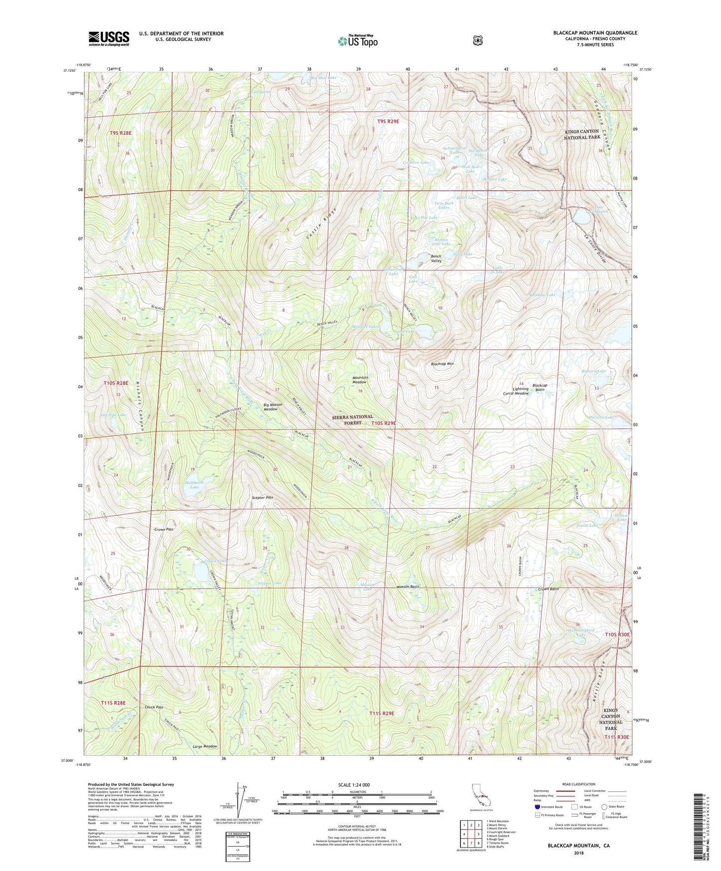
2021 topographic map quadrangle Blackcap Mountain in the state of California. Scale: 1:24000. Based on the newly updated USGS 7.5' US Topo map series, this map is in the following counties: Fresno. The map contains contour data, water features, and other items you are used to seeing on USGS maps, but also has updated roads and other features. This is the next generation of topographic maps. Printed on high-quality waterproof paper with UV fade-resistant inks.
Quads adjacent to this one:
West: Courtright Reservoir
Northwest: Ward Mountain
North: Mount Henry
Northeast: Mount Darwin
East: Mount Goddard
Southeast: Slide Bluffs
South: Tehipite Dome
Southwest: Rough Spur
This map covers the same area as the classic USGS quad with code o37118a7.
Contains the following named places: Ambition Lake, Bench Valley, Big Maxson Meadow, Big Shot Lake, Bighorn Lake, Blackcap Basin, Blackcap Mountain, Bullet Lake, Castle Ridge, Chuck Pass, Cold Springs, Colt Lake, Crabtree Lake, Crown Basin, Crown Lake, Crown Pass, Division Lake, Fall Creek, Filly Lake, Fleming Creek, Guest Lake, Halfmoon Lake, Hockey Lakes, Holster Lake, Horseshoe Lake, Hummingbird Lake, Lake Confusion, Lightning Corral Meadow, Little Jo Lake, Lone Doe Lake, Maxson Basin, Maxson Lake, McGuire Lakes, Meadow Brook, Meadow Brook Cabin, Midway Lake, Mountain Meadow, Nichols Canyon, Old Pipe Lake, Portal Lake, Rainbow Lake, Ram Lake, Roman Four Lake, Scepter Lake, Scepter Pass, Schoolmarm Lake, Six Shooter Lake, Twin Buck Lakes, Wah Hoo Lake