MyTopo
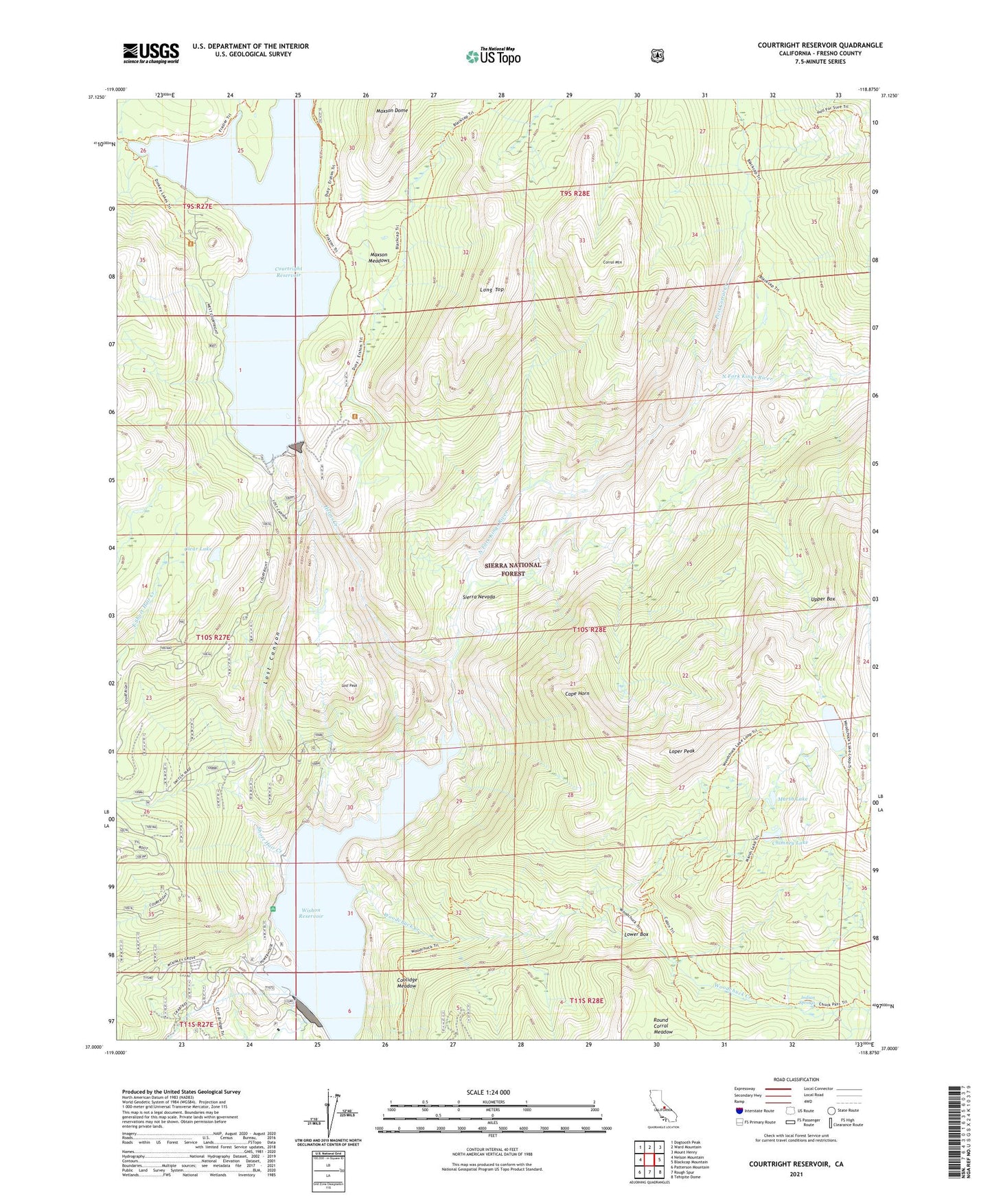
Courtright Reservoir California US Topo Map
Couldn't load pickup availability
Also explore the Courtright Reservoir Forest Service Topo of this same quad for updated USFS data
2021 topographic map quadrangle Courtright Reservoir in the state of California. Scale: 1:24000. Based on the newly updated USGS 7.5' US Topo map series, this map is in the following counties: Fresno. The map contains contour data, water features, and other items you are used to seeing on USGS maps, but also has updated roads and other features. This is the next generation of topographic maps. Printed on high-quality waterproof paper with UV fade-resistant inks.
Quads adjacent to this one:
West: Nelson Mountain
Northwest: Dogtooth Peak
North: Ward Mountain
Northeast: Mount Henry
East: Blackcap Mountain
Southeast: Tehipite Dome
South: Rough Spur
Southwest: Patterson Mountain
This map covers the same area as the classic USGS quad with code o37118a8.
Contains the following named places: Blizzard Camp, Cape Horn, Chamberlains Camp, Chimney Lake, China Camp, Clear Lake, Coolidge Meadow, Corral Mountain, Courtright Dam, Courtright Intrusive Contact Zone Geological Area, Courtright Reservoir, Courtwright 97-119 Dam, Dusy Creek, Helms Creek, Indian Springs, Lacy Camp, Lily Pad Campground, Long Top, Loper Peak, Lost Canyon, Lost Peak, Lower Box, Marmot Rock Campground, Marsh Lake, Maxson Dome, Maxson Meadows, Moore Boys Camp, Post Corral Creek, Sharp Creek, Short Hair Creek, Trapper Springs Campground, Upper Box, Voyager Rock Campground, Wishon 97-118 Dam, Wishon Dam, Wishon Reservoir, Woodchuck Country, Woodchuck Creek, Woodchuck Lake