MyTopo
Philo California US Topo Map
Couldn't load pickup availability
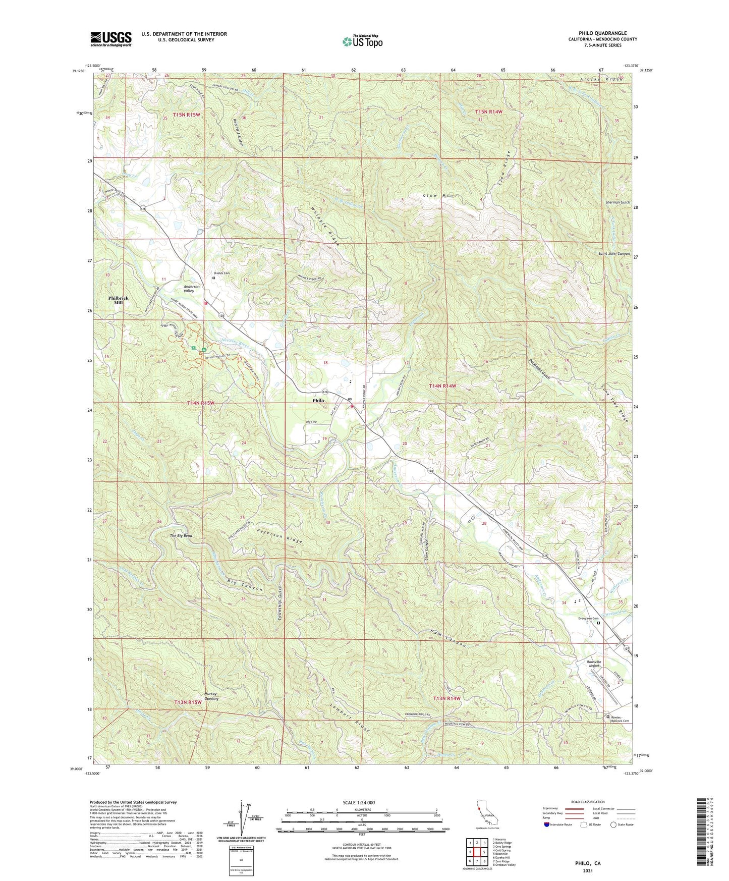
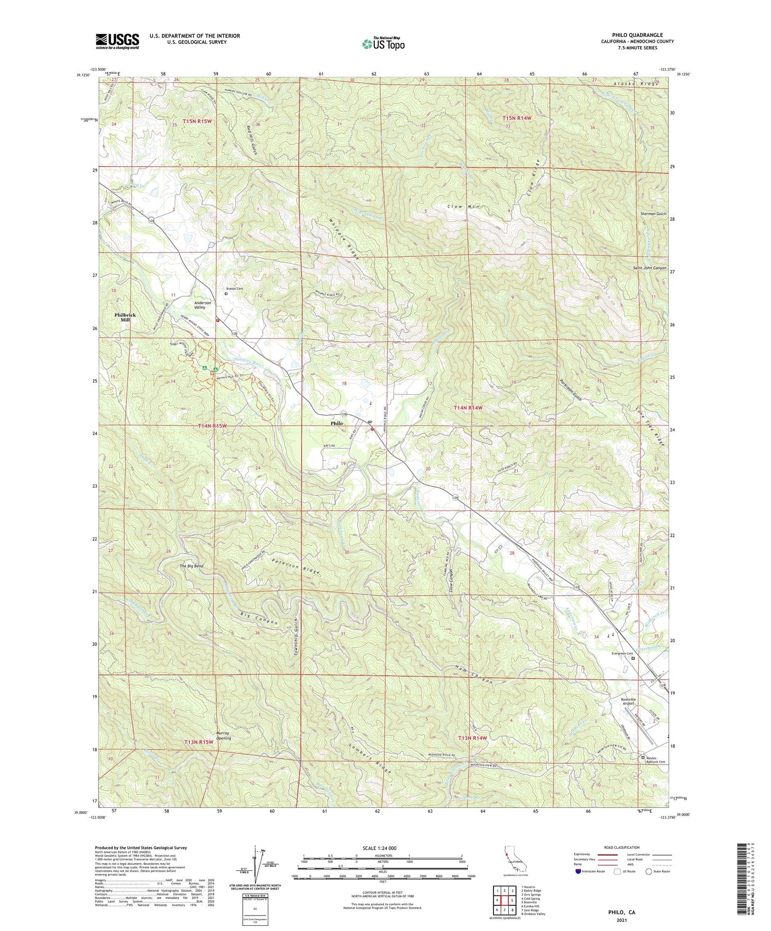
2021 topographic map quadrangle Philo in the state of California. Scale: 1:24000. Based on the newly updated USGS 7.5' US Topo map series, this map is in the following counties: Mendocino. The map contains contour data, water features, and other items you are used to seeing on USGS maps, but also has updated roads and other features. This is the next generation of topographic maps. Printed on high-quality waterproof paper with UV fade-resistant inks.
Quads adjacent to this one:
West: Cold Spring
Northwest: Navarro
North: Bailey Ridge
Northeast: Orrs Springs
East: Boonville
Southeast: Ornbaun Valley
South: Zeni Ridge
Southwest: Eureka Hill
This map covers the same area as the classic USGS quad with code o39123a4.
Contains the following named places: Anderson Creek, Anderson Valley, Anderson Valley Elementary School, Anderson Valley Historical Museum, Anderson Valley Junior - Senior High School, Anderson Valley Volunteer Fire Department Station 742, Anderson Valley Volunteer Fire Station, Big Canyon, Big Hendy Grove, Boonville Airport, Bullock Creek, Christine Junction, Clow Canyon, Clow Mountain, Clow Ridge, Cold Springs Creek, Con Creek, Con Creek School, Creek Italian, Dago Creek, Evergreen Cemetery, Faulkner County Park, Gowan Creek, Graveyard Creek, Gschwend Creek, Hagemann Ranch, Ham Canyon, Hendy Grove, Hendy Woods State Park, Highland Ranch, Honey Creek, Horse Creek, Indian Creek, Indian Creek County Park, Lambert Ridge, Little Hendy Grove, Mendocino County Community School, Murray Opening, Ornbaun Creek, Parkinson Gulch, Peterson Ridge, Philbrick Mill, Philo, Philo Census Designated Place, Philo Post Office, Rancheria Continuation High School, Rancheria Creek, Rawles - Babcock Cemetery, Rays Resort, Red Hill Gulch, Saint John Canyon, Sherman Gulch, Shields Cemetery, The Big Bend, Township Gulch, Tumbling Mc'D' Ranch, Unicorn School, Van Zandts Resort, West Branch Indian Creek, West Branch North Fork Indian Creek, Whipple Ranch, Whipple Ridge, Witherell Creek