MyTopo
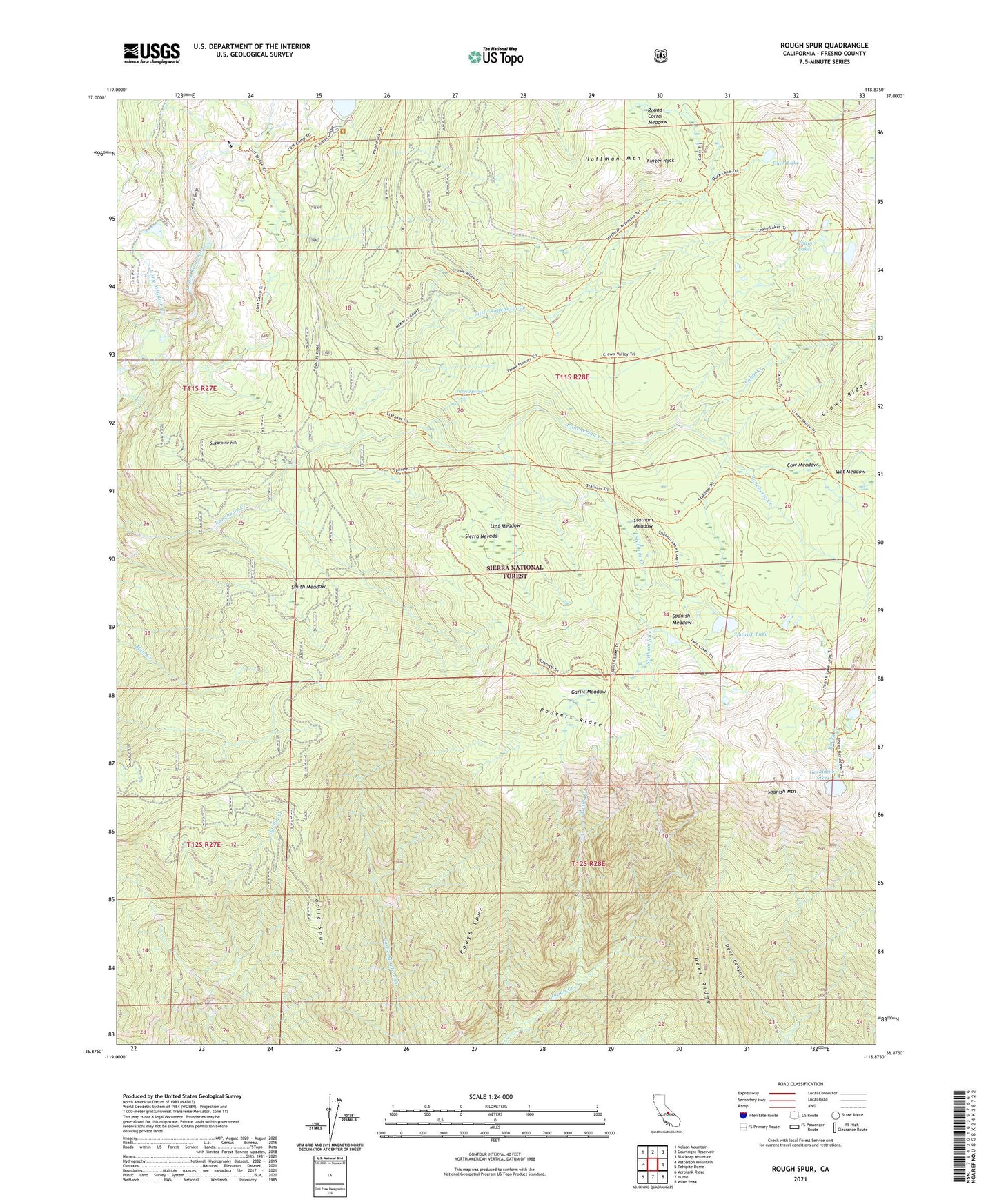
Rough Spur California US Topo Map
Couldn't load pickup availability
Also explore the Rough Spur Forest Service Topo of this same quad for updated USFS data
2021 topographic map quadrangle Rough Spur in the state of California. Scale: 1:24000. Based on the newly updated USGS 7.5' US Topo map series, this map is in the following counties: Fresno. The map contains contour data, water features, and other items you are used to seeing on USGS maps, but also has updated roads and other features. This is the next generation of topographic maps. Printed on high-quality waterproof paper with UV fade-resistant inks.
Quads adjacent to this one:
West: Patterson Mountain
Northwest: Nelson Mountain
North: Courtright Reservoir
Northeast: Blackcap Mountain
East: Tehipite Dome
Southeast: Wren Peak
South: Hume
Southwest: Verplank Ridge
This map covers the same area as the classic USGS quad with code o36118h8.
Contains the following named places: Cabin Creek, Chain Lakes, Cliff Bridge, Cliff Camp, Cow Meadow, Deer Ridge, Duck Lake, Finger Rock, Garlic Meadow, Garlic Spur, Geraldine Lakes, Granite Gorge, Hoffman Mountain, Kings Cavern Geological Area, Little Rancheria Creek, Little Spanish Lake, Long Meadow Creek, Lost Meadow, Rodgers Ridge, Rough Spur, Round Corral Meadow, Smith Meadow, Spanish Lake, Spanish Meadow, Spanish Mountain, Statham Creek, Statham Meadow, Statham River, Sugarpine Hill, Three Springs, Twin Lakes, Wet Meadow