MyTopo
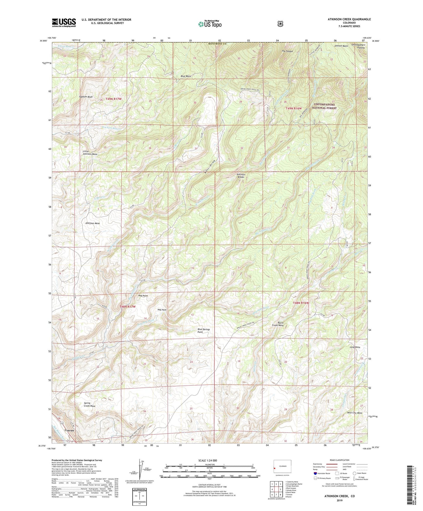
Atkinson Creek Colorado US Topo Map
Couldn't load pickup availability
Also explore the Atkinson Creek Forest Service Topo of this same quad for updated USFS data
2022 topographic map quadrangle Atkinson Creek in the state of Colorado. Scale: 1:24000. Based on the newly updated USGS 7.5' US Topo map series, this map is in the following counties: Montrose, Mesa. The map contains contour data, water features, and other items you are used to seeing on USGS maps, but also has updated roads and other features. This is the next generation of topographic maps. Printed on high-quality waterproof paper with UV fade-resistant inks.
Quads adjacent to this one:
West: Red Canyon
Northwest: Calamity Mesa
North: Uncompahgre Butte
Northeast: Snipe Mountain
East: Windy Point
Southeast: Nucla
South: Uravan
Southwest: Davis Mesa
This map covers the same area as the classic USGS quad with code o38108d6.
Contains the following named places: All Stars Mine, Atkinson Breaks, Atkinson Mesa, Big Atkinson Creek, Big Johnson Creek, Blue Basin, Blue Springs Point, Bull Draw, Burro Creek, Burro Creek Mesa, Gypsum Bluff, Hog Park, Hog Park Wash, Hog Point, Little Atkinson Mesa, Little Johnson Creek, Long Mesa, Movie Star Mine, Spring Creek Mesa, Spring Creek Ranch, Vanablend Forty-seven Mine, West Atkinson Creek, West Campbell Creek, Wright Mines