MyTopo
Uravan Colorado US Topo Map
Couldn't load pickup availability
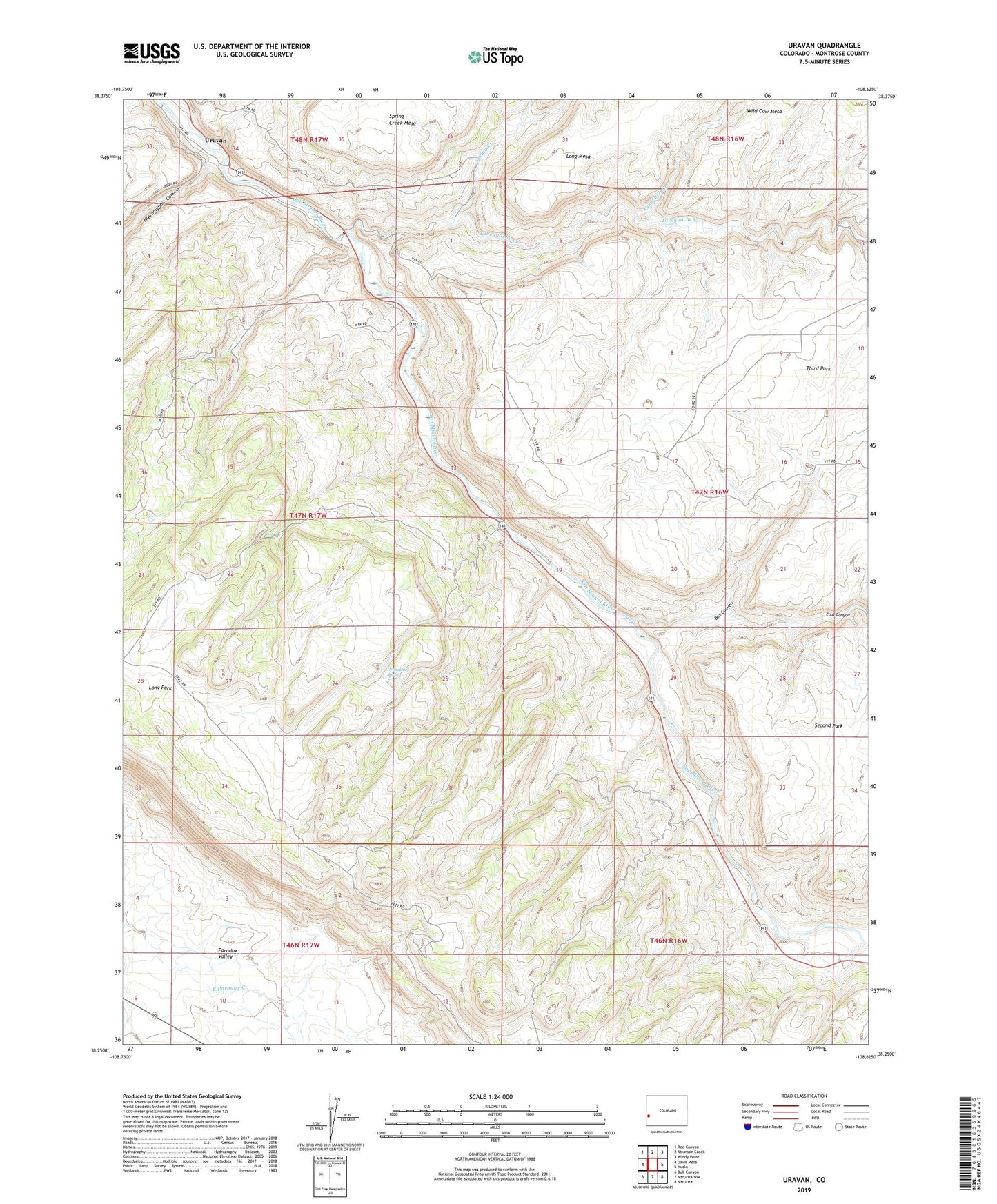
2022 topographic map quadrangle Uravan in the state of Colorado. Scale: 1:24000. Based on the newly updated USGS 7.5' US Topo map series, this map is in the following counties: Montrose. The map contains contour data, water features, and other items you are used to seeing on USGS maps, but also has updated roads and other features. This is the next generation of topographic maps. Printed on high-quality waterproof paper with UV fade-resistant inks.
Quads adjacent to this one:
West: Davis Mesa
Northwest: Red Canyon
North: Atkinson Creek
Northeast: Windy Point
East: Nucla
Southeast: Naturita
South: Naturita NW
Southwest: Bull Canyon
This map covers the same area as the classic USGS quad with code o38108c6.
Contains the following named places: Bench Claim, Bitter Creek Mines, Black Dinah Dump Mine, Black Dinah Mine, Blitz Mine, Bogus Mine, Box Canyon, Butterfly Mine, Campbell Creek, Club Mines, Coal Canyon, Coloradian Mine, Dakota Mine, Dog Tail Mine, Donald D Mine, Donna K Mine, Eagle Mine, Effie F Mine, Emma May Mine, Fairy King Mine, Fall Creek Mine, Forty-five Ninety Mine, Golden Eagle Mine, Guadacanal Mine, Hardscrabble Mine, Hieroglyphic Canyon, Horsethief Spring, Julian Group Mine, Knaess and Young Placer, Long Park, Long Park Group Mine, Long Park Number 6 Mine, Long Park Number One Mine, Long Park Number Two Mine, Media Mine, Mineral Park Mine, New Good Hope Mine, New Hope Mine, Petrified Tree Mine, Red Fox Mine, Rex Thirty-eight Mine, Rock Raven Mine, Sawtooth Ridge, South Blackfoot Mine, Spring Creek, Sunbeam Mine, Tabeguache Creek, Third Park, Three Jacks Mine, Triangulation Mine, Uravan, Uravan Number Three Mine, Virgin Mine, Whitney Mine, Yellow Spot Mine, ZIP Code: 81422