MyTopo
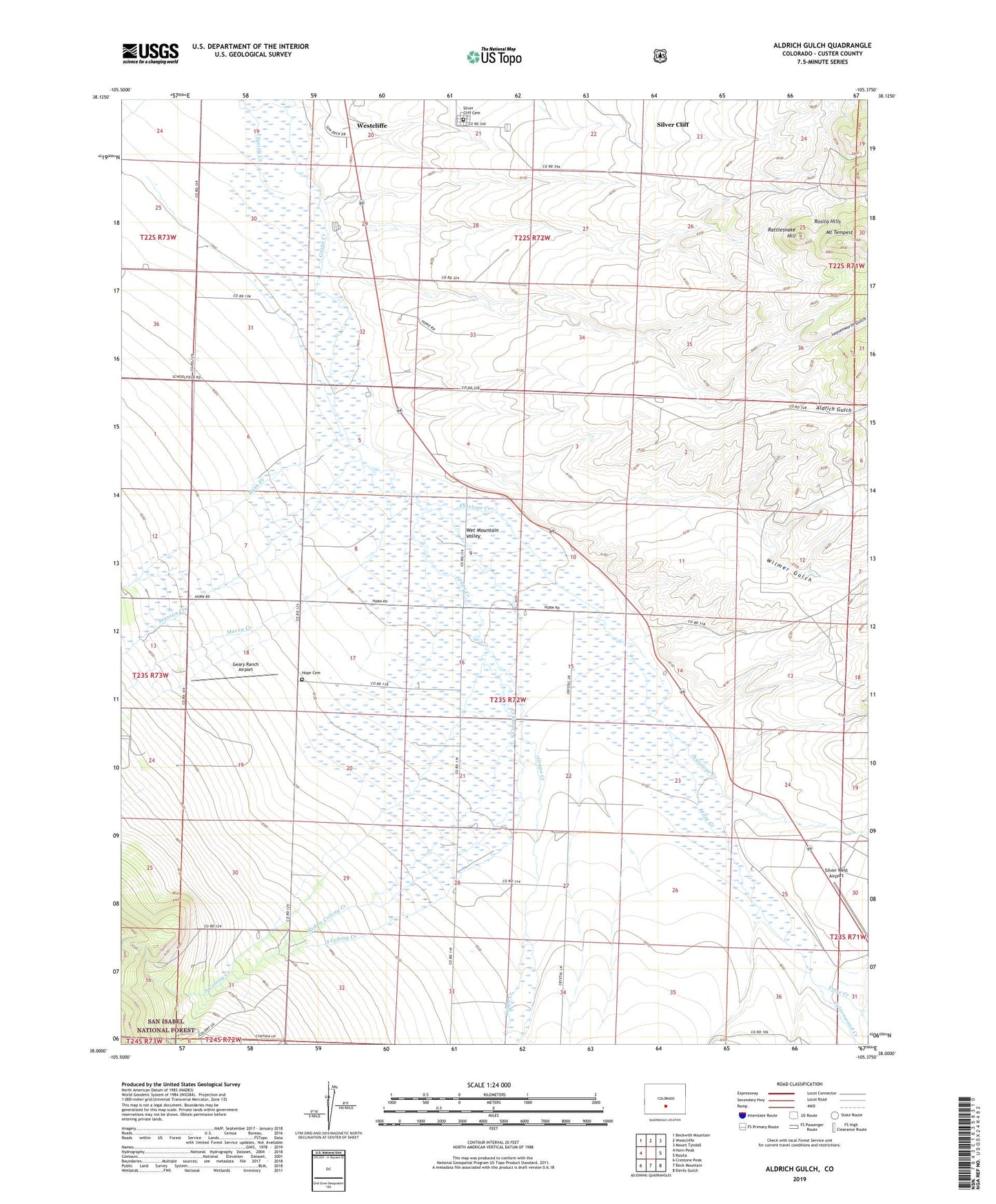
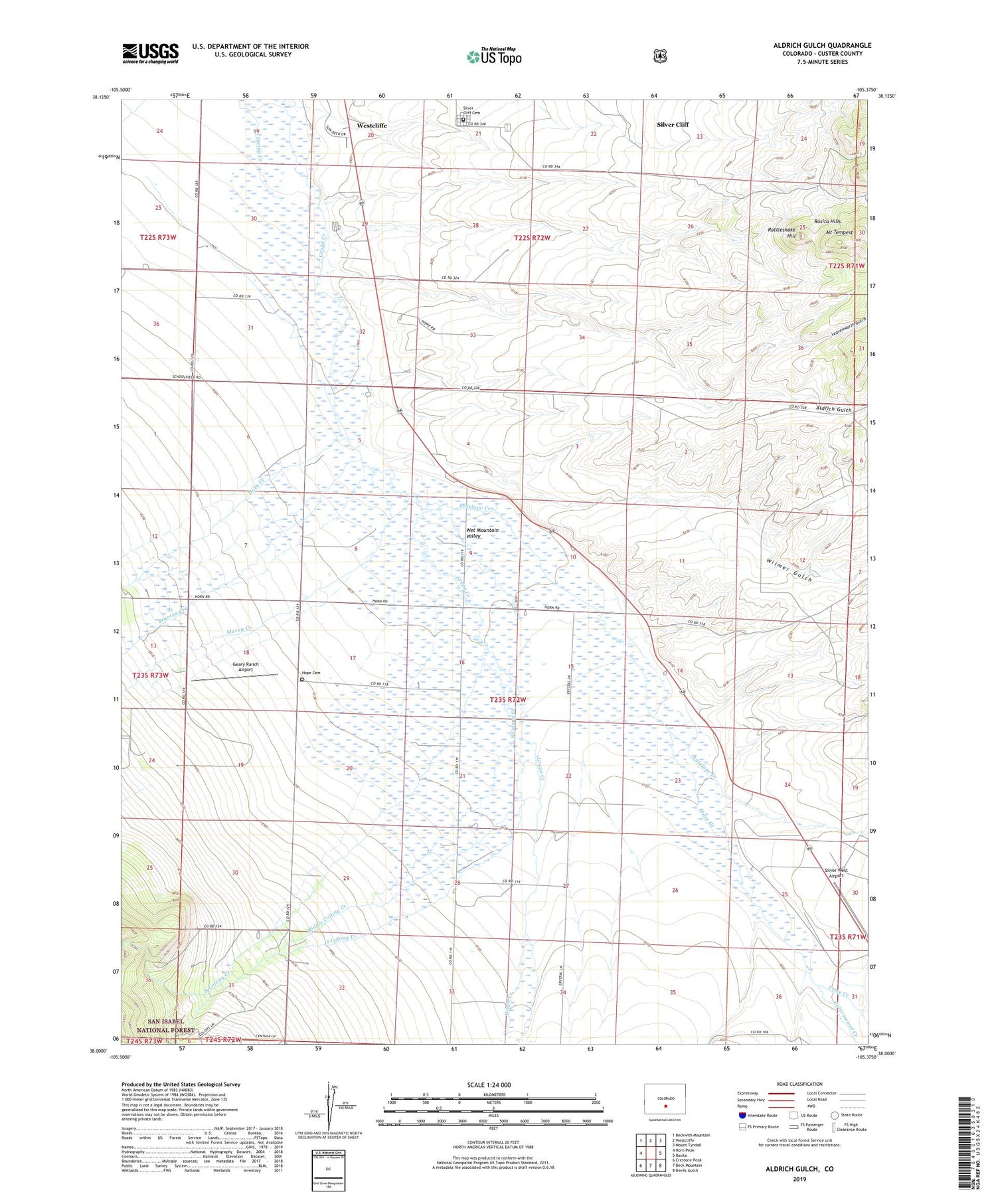
Aldrich Gulch Colorado US Topo Map
Couldn't load pickup availability
Also explore the Aldrich Gulch Forest Service Topo of this same quad for updated USFS data
2022 topographic map quadrangle Aldrich Gulch in the state of Colorado. Scale: 1:24000. Based on the newly updated USGS 7.5' US Topo map series, this map is in the following counties: Custer. The map contains contour data, water features, and other items you are used to seeing on USGS maps, but also has updated roads and other features. This is the next generation of topographic maps. Printed on high-quality waterproof paper with UV fade-resistant inks.
Quads adjacent to this one:
West: Horn Peak
Northwest: Beckwith Mountain
North: Westcliffe
Northeast: Mount Tyndall
East: Rosita
Southeast: Devils Gulch
South: Beck Mountain
Southwest: Crestone Peak
This map covers the same area as the classic USGS quad with code o38105a4.
Contains the following named places: Aldrich Gulch, Antelope Creek, Cottonwood Creek, Froze Creek, Geary Ranch Airport, Hardnack Creek, Hope Cemetery, Horn Creek, Leavenworth Gulch, Macey Creek, Middle Colony Creek, Mount Tempest, North Colony Creek, Rattlesnake Hill, Silver Cliff Cemetery, Silver West Airport, South Colony Creek, Stanton Creek, Town of Silver Cliff, Wet Mountain Valley, Wilmer Gulch, ZIP Code: 81252