MyTopo
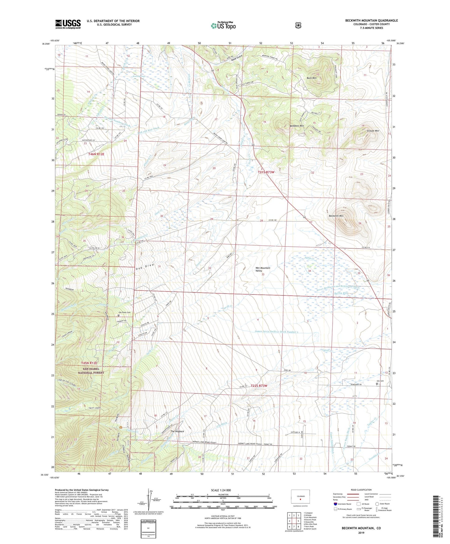
Beckwith Mountain Colorado US Topo Map
Couldn't load pickup availability
Also explore the Beckwith Mountain Forest Service Topo of this same quad for updated USFS data
2022 topographic map quadrangle Beckwith Mountain in the state of Colorado. Scale: 1:24000. Based on the newly updated USGS 7.5' US Topo map series, this map is in the following counties: Custer. The map contains contour data, water features, and other items you are used to seeing on USGS maps, but also has updated roads and other features. This is the next generation of topographic maps. Printed on high-quality waterproof paper with UV fade-resistant inks.
Quads adjacent to this one:
West: Electric Peak
Northwest: Cotopaxi
North: Hillside
Northeast: Iron Mountain
East: Westcliffe
Southeast: Aldrich Gulch
South: Horn Peak
Southwest: Rito Alto Peak
This map covers the same area as the classic USGS quad with code o38105b5.
Contains the following named places: Beckwith Mountain, Beddows Mountain, Buck Mountain, Buttermilk Creek, Cress Field, Freer-Beckwith and Kennicott Ditch, Gibson Creek, Gibson Creek Trailhead, Goat Creek, Goodwin Creek, Greenleaf Creek, Grouse Mountain, Hogback Ditch, Howard Number 1 Ditch, James Jarvis Swift Creek Ditch Number 3, Kick and Kint Ditch, Koch Springs, Lohstroh Highline Ditch, Lower Smith Ditch, North Brush Creek, North Greenleaf Creek, Oak Draw, O'Leary Creek, Phares and Allen Mine, Reed Ditch, Reed Gulch, San Isabel Ranch, Short Creek, South Brush Creek, South Greenleaf Creek, The Hogback, The Pines, The Pines Cemetery, Ula, Ula Cemetery, Ula Ditch, Ula Prairie, Upper Smith Ditch, Verde Creek