MyTopo
Westcliffe Colorado US Topo Map
Couldn't load pickup availability
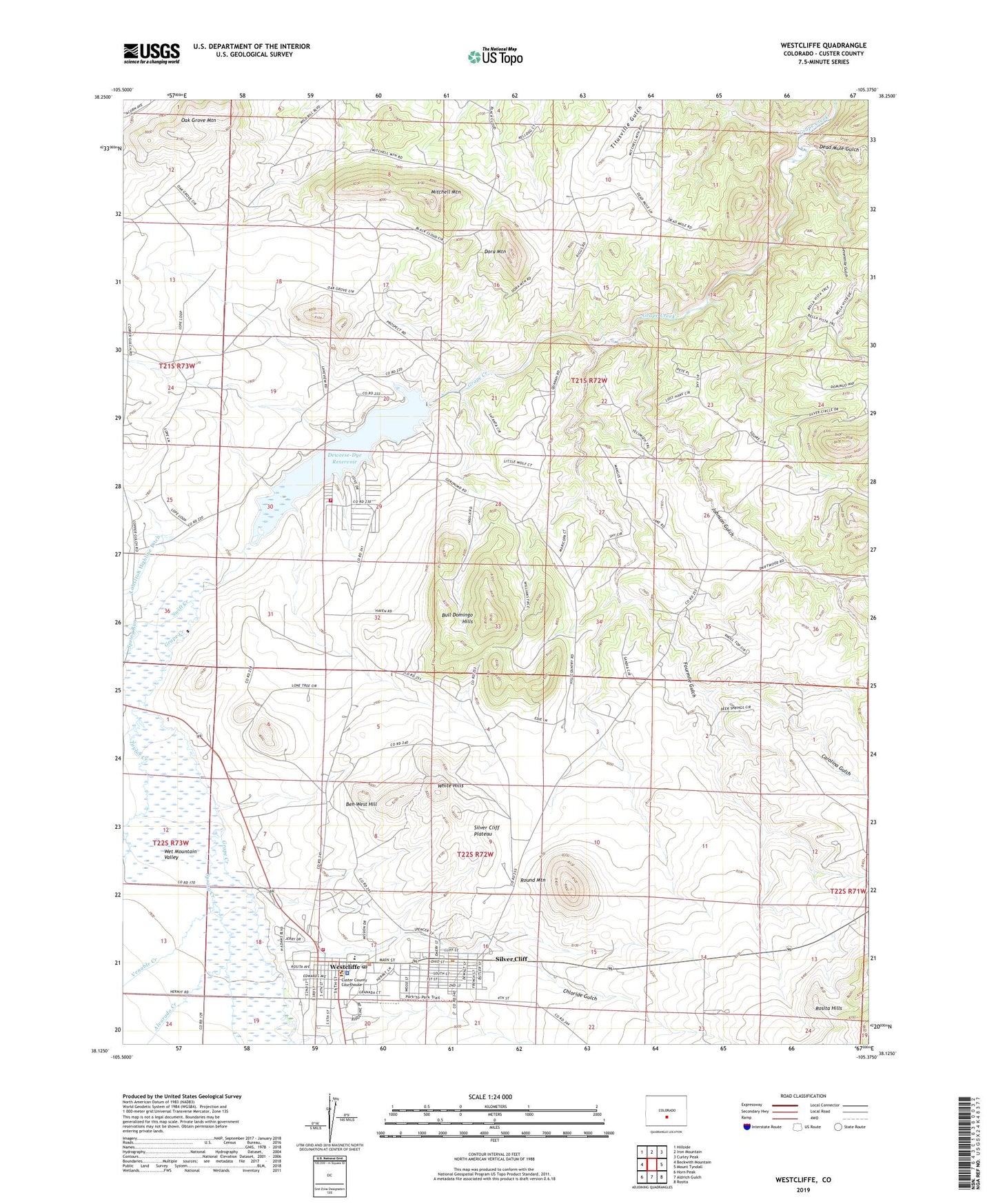
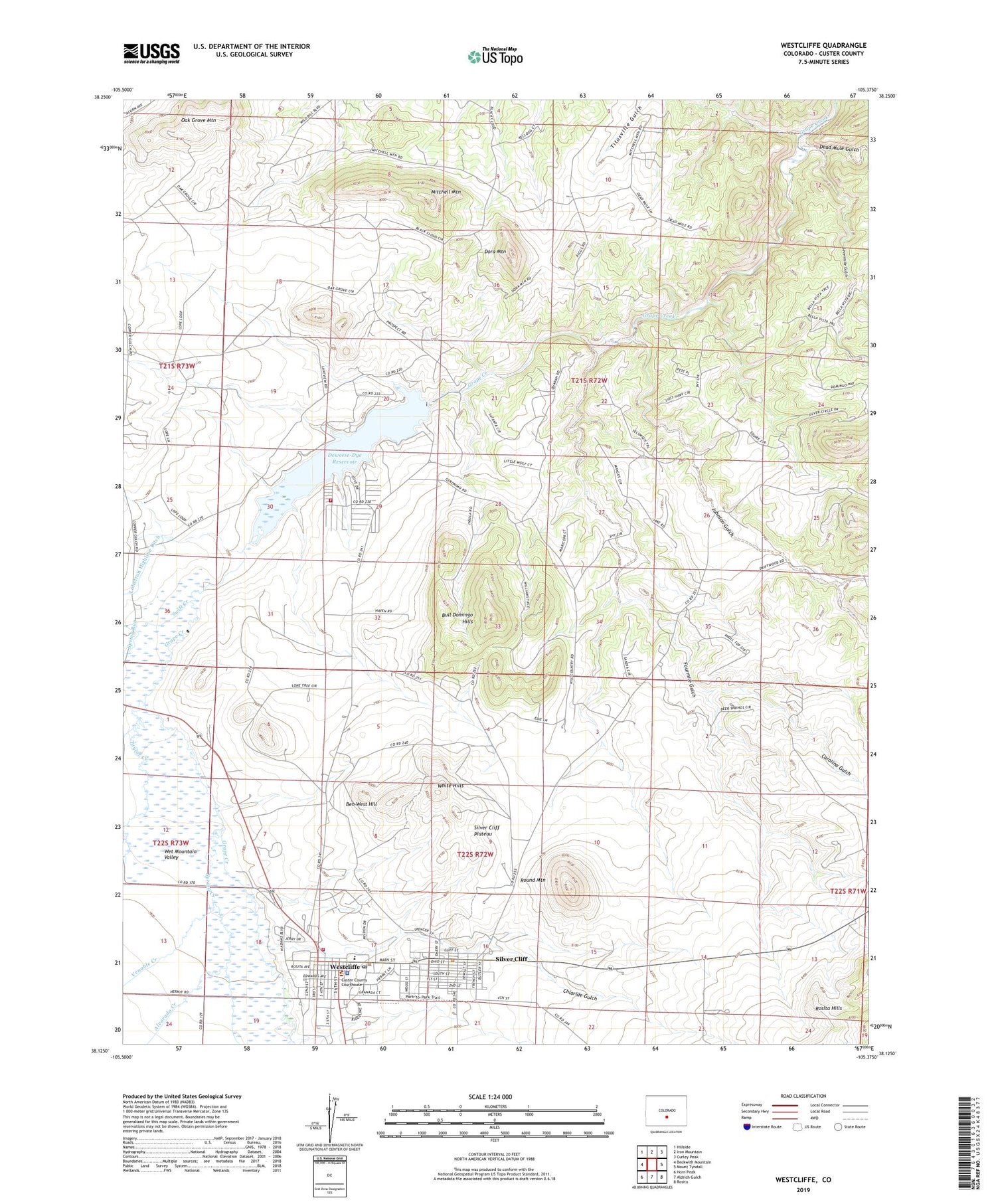
2022 topographic map quadrangle Westcliffe in the state of Colorado. Scale: 1:24000. Based on the newly updated USGS 7.5' US Topo map series, this map is in the following counties: Custer. The map contains contour data, water features, and other items you are used to seeing on USGS maps, but also has updated roads and other features. This is the next generation of topographic maps. Printed on high-quality waterproof paper with UV fade-resistant inks.
Quads adjacent to this one:
West: Beckwith Mountain
Northwest: Hillside
North: Iron Mountain
Northeast: Curley Peak
East: Mount Tyndall
Southeast: Rosita
South: Aldrich Gulch
Southwest: Horn Peak
This map covers the same area as the classic USGS quad with code o38105b4.
Contains the following named places: Alvarado Creek, Ben West Hill, Bull Domingo Hills, Bull Domingo Mine, C H Connor Mine, Carolina Gulch, Chloride Gulch, Custer County Ambulance Corps, Custer County Medical Center, Custer County Sheriff's Office, Dan Riggs Memorial Heliport, De Weese Dam, Dead Mule Gulch, Deceiver Mine, Defender Mine, Deweese-Dye Reservoir, Dora Mountain, Fourmile Gulch, Green Mountain Mine, Herman Passiflora Mine, Johnson Gulch, Keystone Mine, Lady Franklin Mine, Lake DeWeese Lodge, Lakeview Mine, Luton Creek, Mitchell Mountain, New Hope Mine, Nutter Prospect, Oak Grove Mountain, Quist Voss Land Mine, Round Mountain, Sevenmile Gulch, Silver Cliff, Silver Cliff Plateau, Spring Creek, Spring Run, Stroelhke Mine, Swift Creek, Taylor Creek, Town of Westcliffe, Venable Creek, Wahl Mine, Westcliffe, Westcliffe Post Office, Wet Mountain Fire Protection District - Lake Deweese Station, Wet Mountain Fire Protection District Main Station, White Hills