MyTopo
Delagua Colorado US Topo Map
Couldn't load pickup availability
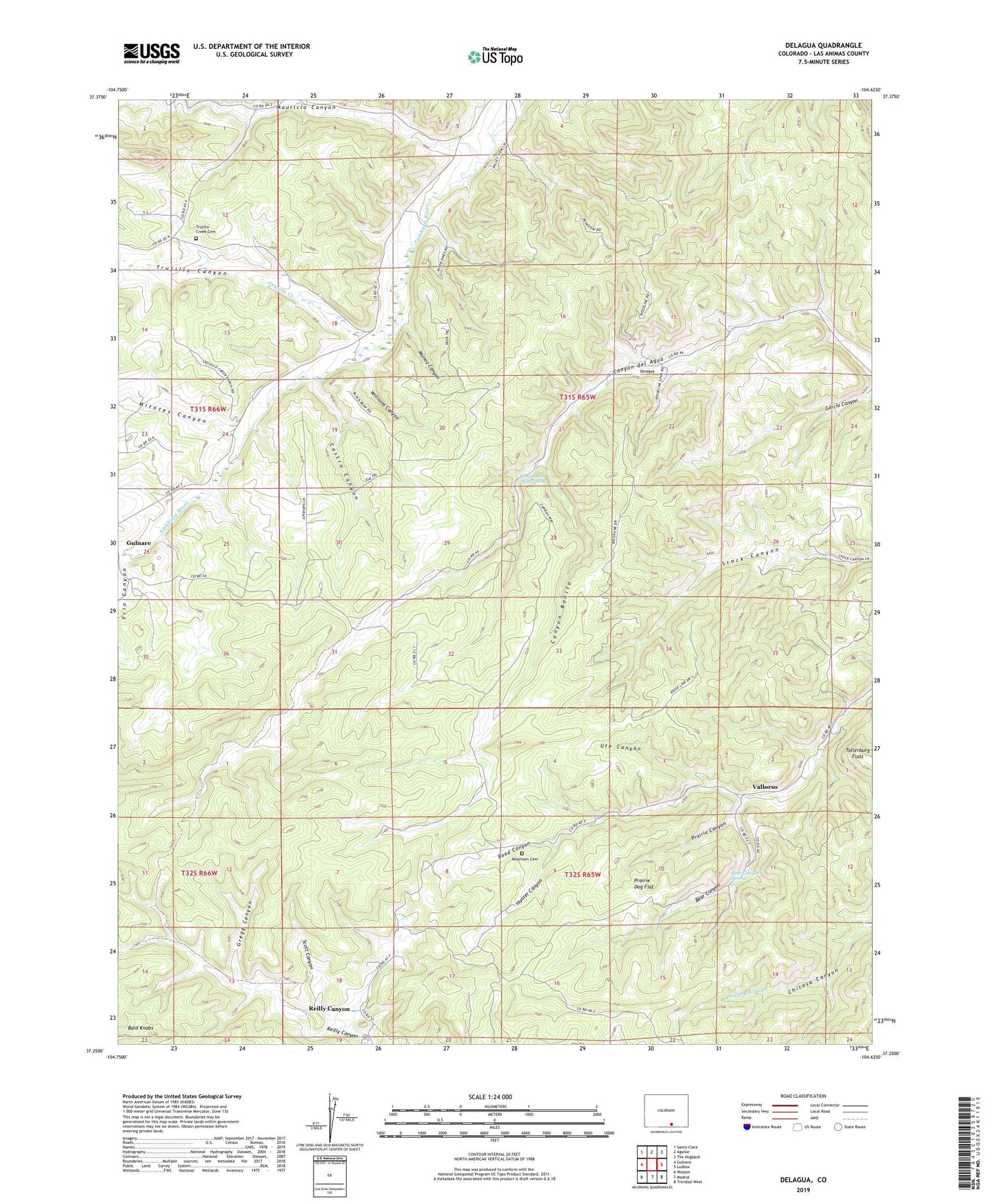
2022 topographic map quadrangle Delagua in the state of Colorado. Scale: 1:24000. Based on the newly updated USGS 7.5' US Topo map series, this map is in the following counties: Las Animas. The map contains contour data, water features, and other items you are used to seeing on USGS maps, but also has updated roads and other features. This is the next generation of topographic maps. Printed on high-quality waterproof paper with UV fade-resistant inks.
Quads adjacent to this one:
West: Gulnare
Northwest: Santa Clara
North: Aguilar
Northeast: The Hogback
East: Ludlow
Southeast: Trinidad West
South: Madrid
Southwest: Weston
This map covers the same area as the classic USGS quad with code o37104c6.
Contains the following named places: Albertson Cemetery, Bald Knobs, Bear Canon Mines, Bear Canyon, Bear Canyon Mine, Bear Canyon Spring, Canyon Bonito, Canyon Del Agua Spring, Castro Canyon, Delagua, Delagua and Delagua Mines, Frio Canyon, Gregg Canyon, Hunter Canyon, Mauricio Canyon, Mitotes Canyon, Munoz Canyon, Prairie Canon Mines, Prairie Canyon, Prairie Canyon Mine, Prairie Dog Flat, Reilly Canyon, Scott Canyon, Three Pines Number One Mine, Toller Mine, Trinidad Basin Strip Mine, Trujillo Canyon, Trujillo Creek, Trujillo Creek Cemetery, Ute Canyon, Vallorso, Wheeler Canyon, Williams Canyon