MyTopo
Madrid Colorado US Topo Map
Couldn't load pickup availability
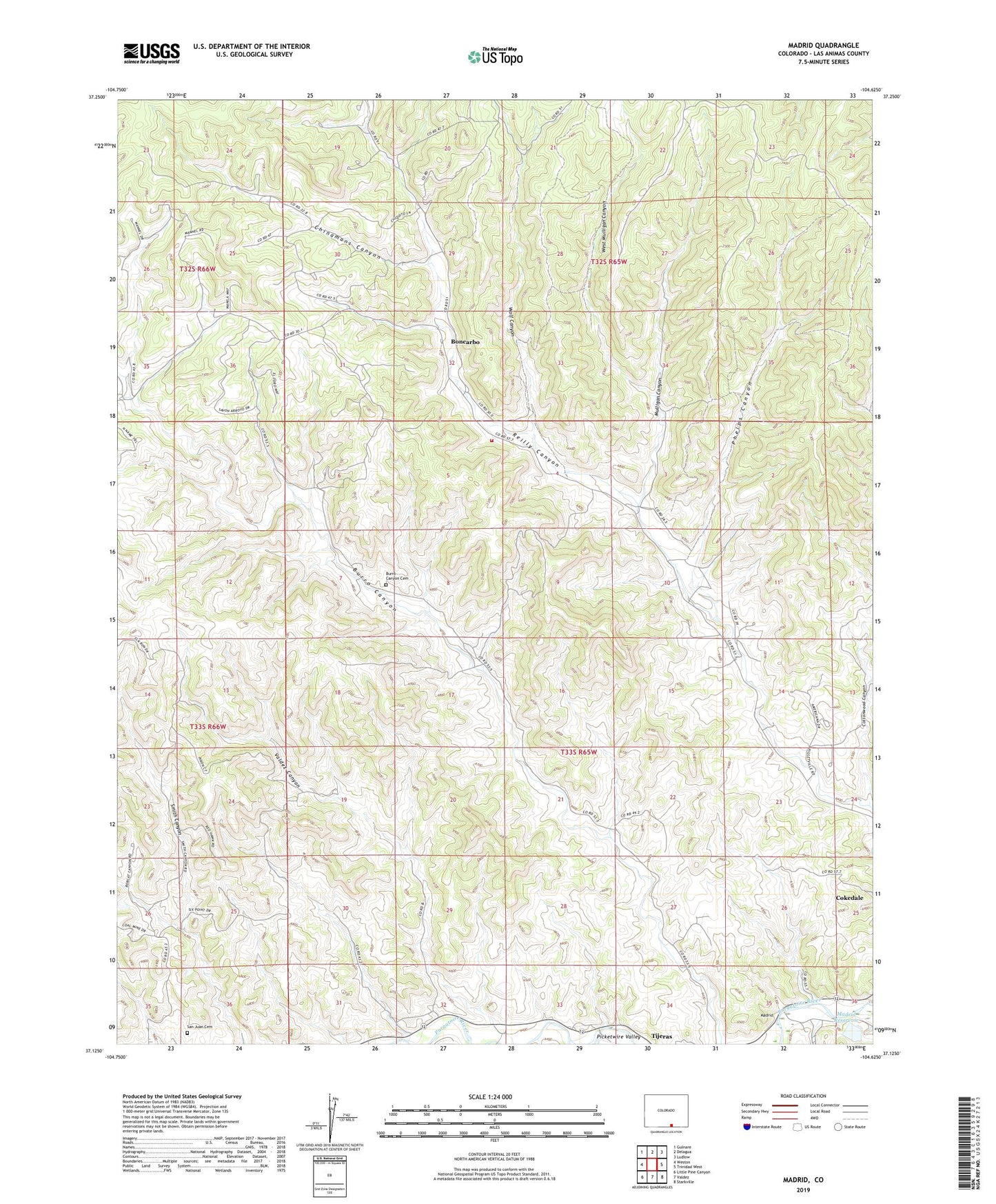
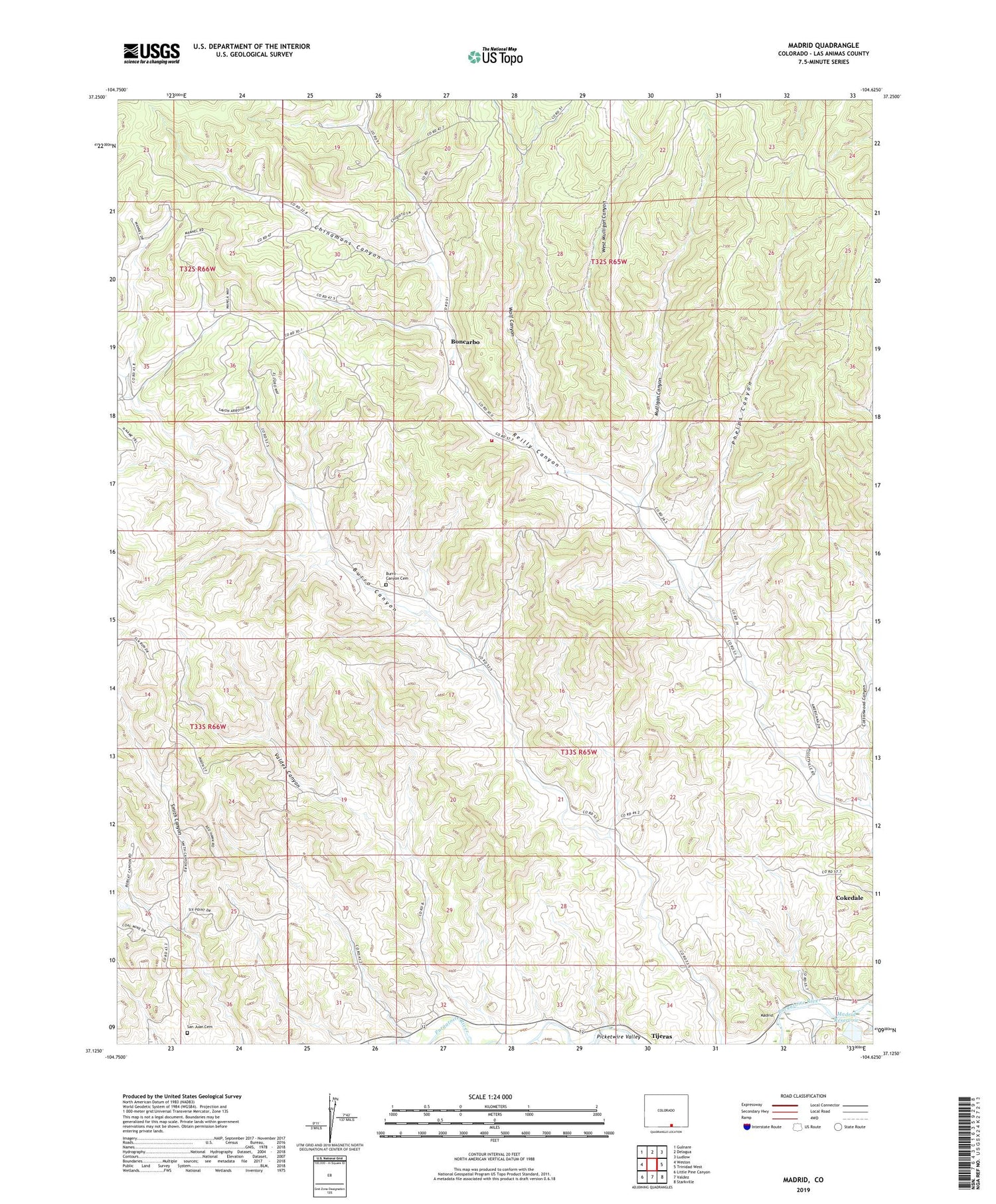
2022 topographic map quadrangle Madrid in the state of Colorado. Scale: 1:24000. Based on the newly updated USGS 7.5' US Topo map series, this map is in the following counties: Las Animas. The map contains contour data, water features, and other items you are used to seeing on USGS maps, but also has updated roads and other features. This is the next generation of topographic maps. Printed on high-quality waterproof paper with UV fade-resistant inks.
Quads adjacent to this one:
West: Weston
Northwest: Gulnare
North: Delagua
Northeast: Ludlow
East: Trinidad West
Southeast: Starkville
South: Valdez
Southwest: Little Pine Canyon
This map covers the same area as the classic USGS quad with code o37104b6.
Contains the following named places: Boncarbo, Boncarbo Mine, Boncarbo Volunteer Fire Department, Burro Canyon Cemetery, Chinamans Canyon, Colorado Standard School, Cottonwood Canyon, Crystal Mine, Deer Canyon Mine, Dick, Dick Coal Mine, Dicks Mine, Eureka Mine, Jacks Mine, Joger Mine, Madrid, Madrid Canyon, Madrid Dam, Madrid Reservoir, Martinez Mine, Middle Burro Canyon School, Midway School, Mulligan Canyon, Phelps Canyon, Pricco Mine, Primero, Primero Mine North, Primero Mine South, Primero Mine West, Primero Reservoir, San Juan Cemetery, Sanchez Mine, Stanley Mine, Tijeras, Valdez Canyon, Viola Mine, West Mulligan Canyon, Wolf Canyon, ZIP Code: 81024