MyTopo
Weston Colorado US Topo Map
Couldn't load pickup availability
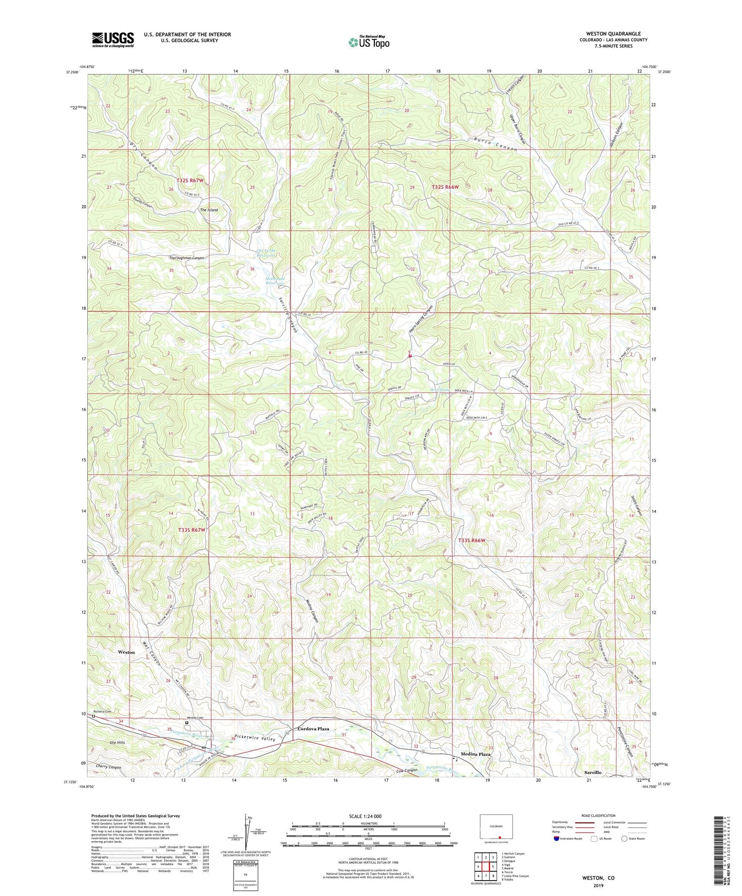
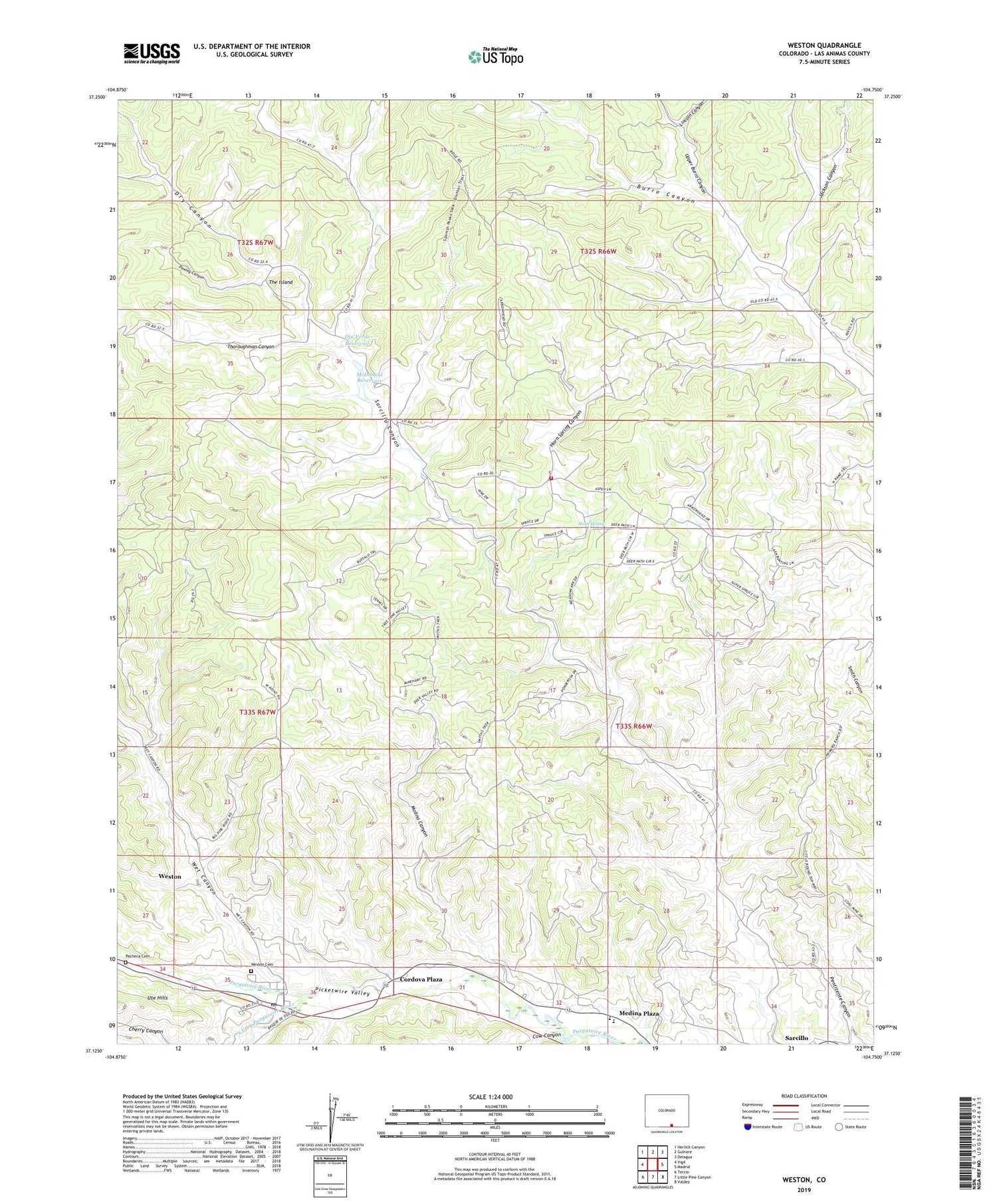
2022 topographic map quadrangle Weston in the state of Colorado. Scale: 1:24000. Based on the newly updated USGS 7.5' US Topo map series, this map is in the following counties: Las Animas. The map contains contour data, water features, and other items you are used to seeing on USGS maps, but also has updated roads and other features. This is the next generation of topographic maps. Printed on high-quality waterproof paper with UV fade-resistant inks.
Quads adjacent to this one:
West: Vigil
Northwest: Herlick Canyon
North: Gulnare
Northeast: Delagua
East: Madrid
Southeast: Valdez
South: Little Pine Canyon
Southwest: Tercio
This map covers the same area as the classic USGS quad with code o37104b7.
Contains the following named places: Cordova Plaza, Cow Canyon, Dry Canyon, Esquipula Church, Horn Spring, Horn Spring Canyon, Jackson Canyon, Lincoln Canyon, Maxwell Mine, McDonald Reservoir, Medina Plaza, Molino Canyon, Ojo Verde Reservoir, Pacheca Cemetery, Pawley Canyon, Primero High School, Sarcillo, Segundo, South Fork Purgatoire River, Spanish Peaks State Wildlife Area, Stonewall Fire Protection District La Garita Station, The Island, Thoroughman Canyon, Upper Burro Canyon, Upper Burro Canyon School, Weston, Weston Cemetery, Weston Census Designated Place, Weston Post Office, Wet Canyon