
MyTopo
Dinosaur Colorado US Topo Map
Couldn't load pickup availability
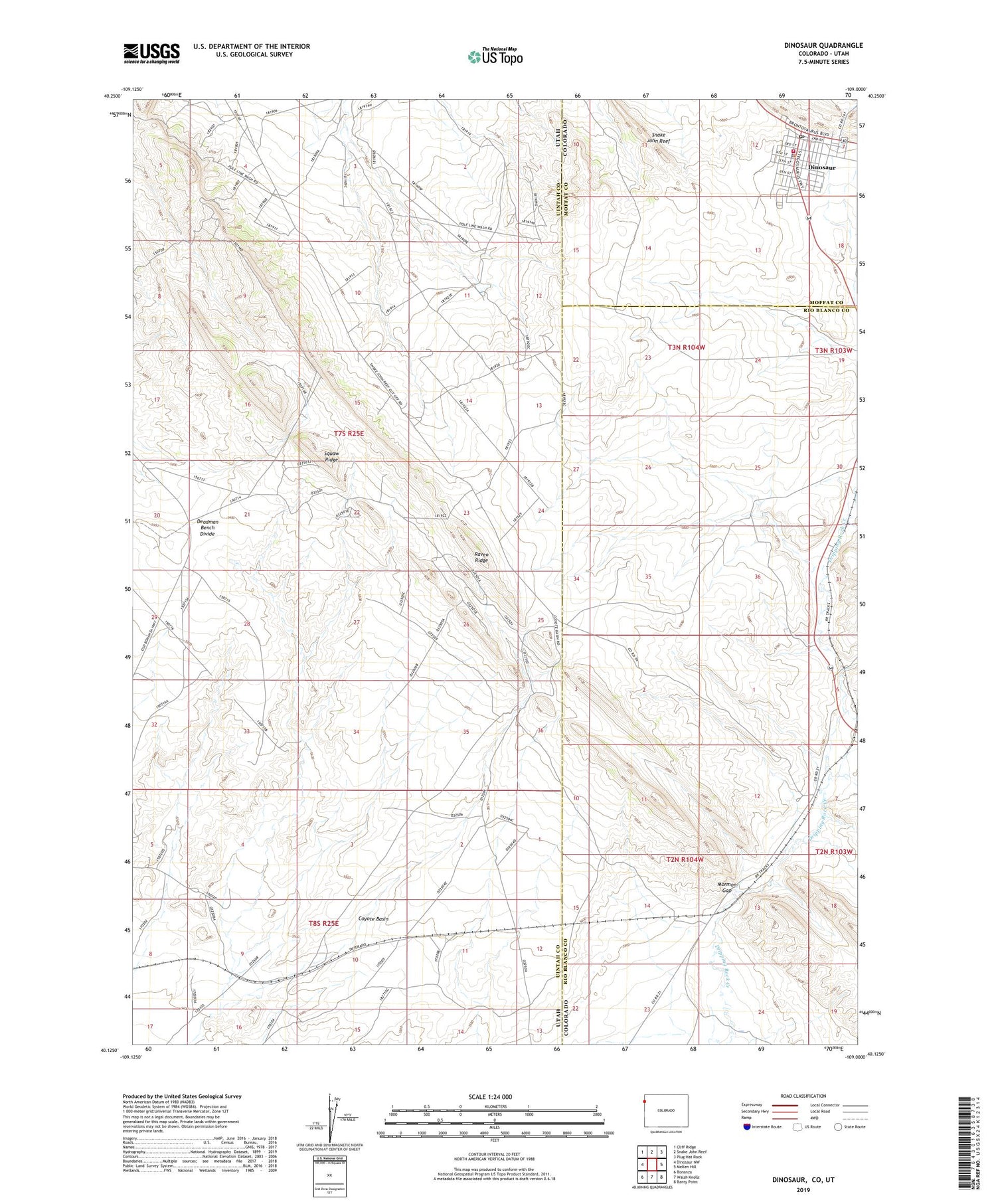
2023 topographic map quadrangle Dinosaur in the states of Utah, Colorado. Scale: 1:24000. Based on the newly updated USGS 7.5' US Topo map series, this map is in the following counties: Moffat, Uintah, Rio Blanco. The map contains contour data, water features, and other items you are used to seeing on USGS maps, but also has updated roads and other features. This is the next generation of topographic maps. Printed on high-quality waterproof paper with UV fade-resistant inks.
Quads adjacent to this one:
West: Dinosaur NW
Northwest: Cliff Ridge
North: Snake John Reef
Northeast: Plug Hat Rock
East: Mellen Hill
Southeast: Banty Point
South: Walsh Knolls
Southwest: Bonanza
Contains the following named places: Artisea Fire Protection District, Coyote Basin, Deadman Bench Divide, Dinosaur, Dinosaur Police Department, Dinosaur Post Office, Mormon Gap, Raven Ridge, Rich Mine, Snake John Reef, Squaw Ridge, Town of Dinosaur


