MyTopo
Mile High Lakes Colorado US Topo Map
Couldn't load pickup availability
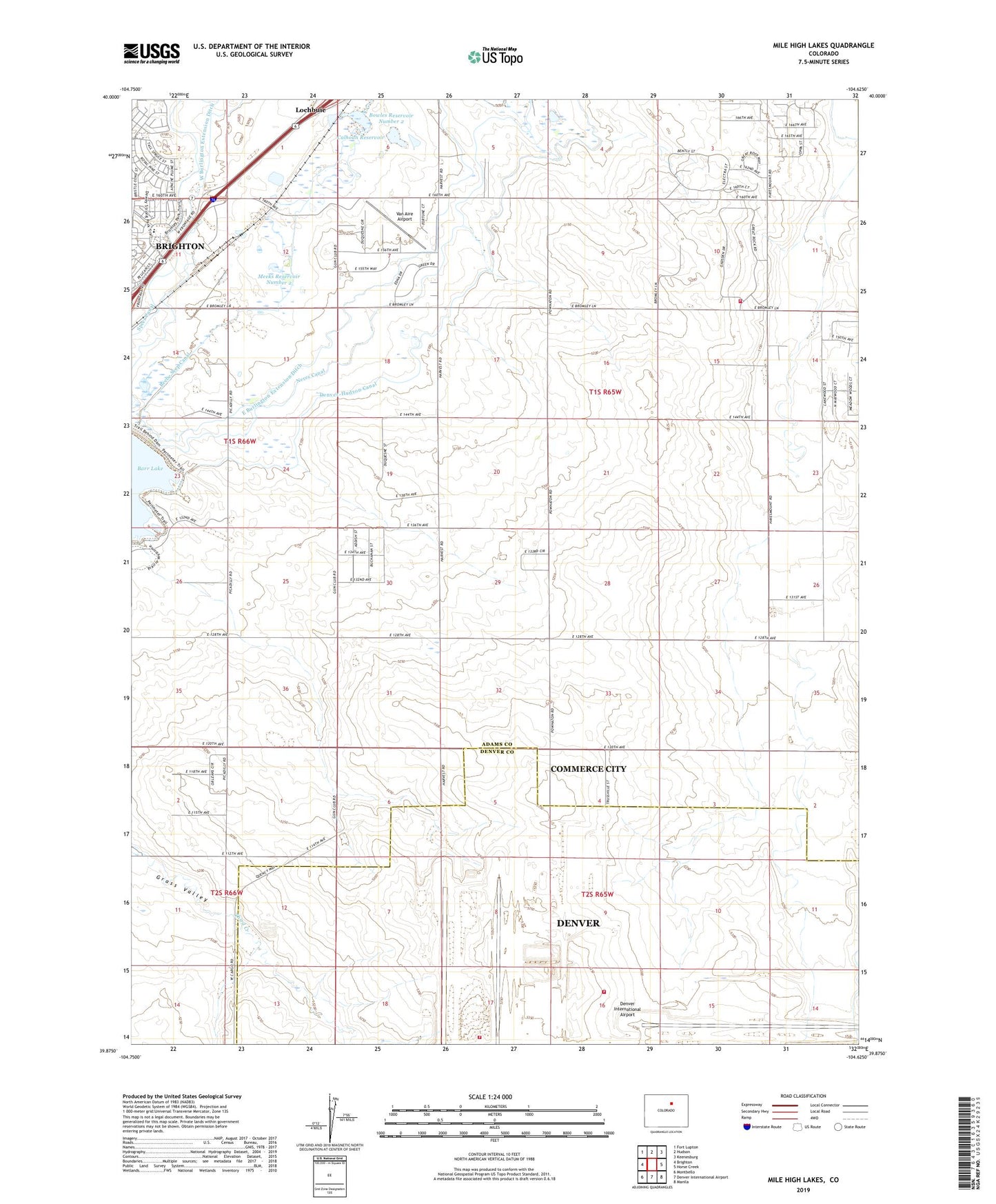
2022 topographic map quadrangle Mile High Lakes in the state of Colorado. Scale: 1:24000. Based on the newly updated USGS 7.5' US Topo map series, this map is in the following counties: Adams, Denver. The map contains contour data, water features, and other items you are used to seeing on USGS maps, but also has updated roads and other features. This is the next generation of topographic maps. Printed on high-quality waterproof paper with UV fade-resistant inks.
Quads adjacent to this one:
West: Brighton
Northwest: Fort Lupton
North: Hudson
Northeast: Keenesburg
East: Horse Creek
Southeast: Manila
South: Denver International Airport
Southwest: Montbello
This map covers the same area as the classic USGS quad with code o39104h6.
Contains the following named places: Bowles Number 2 Dam, Bowles Reservoir Number 2, Calhoun Reservoir, Denver Fire Department Station 32 DIA Station 2, Denver Fire Department Station 34 DIA Station 4, East Burlington Extension Ditch, Grass Valley, Greater Brighton Fire Protection District Station 54, Green Valley Grange Hall, Heckendorf Ranches Airport, KMVP-AM (Commerce City), Meeks Reservoir Number 1, Meeks Reservoir Number 2, Mile High Lakes, Patton Ranch, Stevens Airport, Van Aire Airport, ZIP Code: 80603