MyTopo
Fort Lupton Colorado US Topo Map
Couldn't load pickup availability
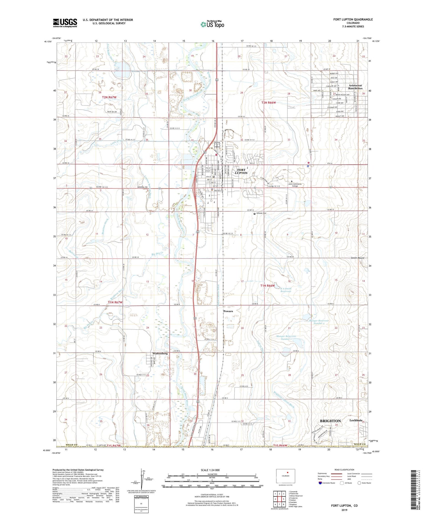
2022 topographic map quadrangle Fort Lupton in the state of Colorado. Scale: 1:24000. Based on the newly updated USGS 7.5' US Topo map series, this map is in the following counties: Weld, Adams. The map contains contour data, water features, and other items you are used to seeing on USGS maps, but also has updated roads and other features. This is the next generation of topographic maps. Printed on high-quality waterproof paper with UV fade-resistant inks.
Quads adjacent to this one:
West: Frederick
Northwest: Gowanda
North: Platteville
Northeast: Milton Reservoir
East: Hudson
Southeast: Mile High Lakes
South: Brighton
Southwest: Eastlake
This map covers the same area as the classic USGS quad with code o40104a7.
Contains the following named places: Alpha Mine, Aristocrat Ranchettes, Aristocrat Ranchettes Census Designated Place, Big Dry Creek, Brantner Ditch, Brighton Ditch, Brighton Lateral Ditch, Butler Elementary School, City of Fort Lupton, Coal Ridge Waste Dam, Coal Ridge Waste Reservoir, Delventhal Farm Airport, Fort Lupton, Fort Lupton Division, Fort Lupton Fire Department Station 1, Fort Lupton Fire Department Station 2, Fort Lupton High School, Fort Lupton Middle School, Fort Lupton Police Department, Fort Lupton Post Office, Fulton Lateral Ditch, H A Smith Dam, H A Smith Reservoir, Hillside Cemetery, Independence School, KLTT-AM (Brighton), Little Dry Creek, Lupton Bottoms Ditch, Munger Number 1 Dam, Munger Number 2 Dam, Munger Reservoir Number 1, Munger Reservoir Number 2, Porter School, Powars, Smith Mound, Twombly Elementary School, Wattenberg, Wattenberg School, Weld County Paramedic Services Station 3, Weld County Sheriff's Office, ZIP Code: 80621