MyTopo
Hudson Colorado US Topo Map
Couldn't load pickup availability
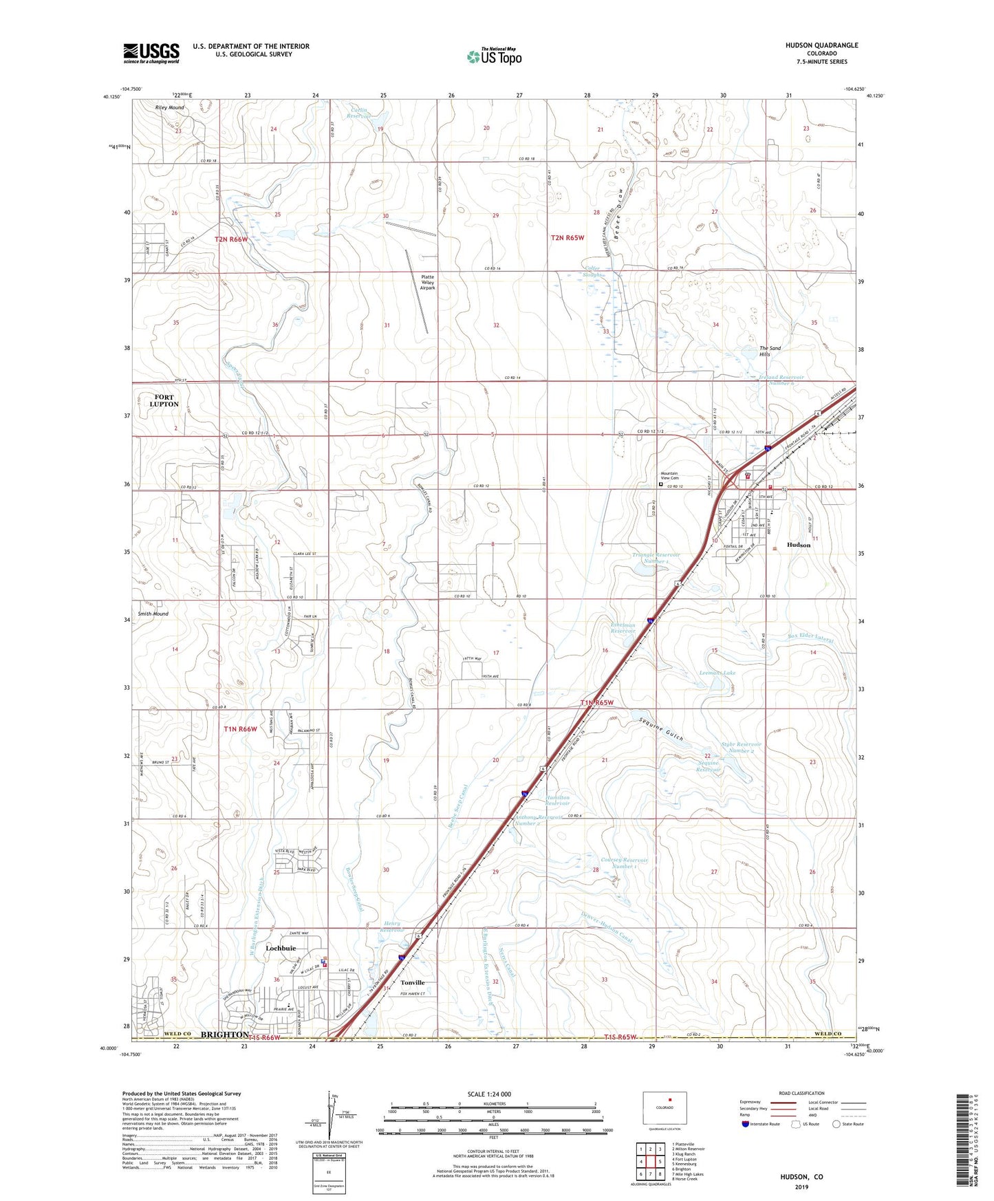
2022 topographic map quadrangle Hudson in the state of Colorado. Scale: 1:24000. Based on the newly updated USGS 7.5' US Topo map series, this map is in the following counties: Weld, Adams. The map contains contour data, water features, and other items you are used to seeing on USGS maps, but also has updated roads and other features. This is the next generation of topographic maps. Printed on high-quality waterproof paper with UV fade-resistant inks.
Quads adjacent to this one:
West: Fort Lupton
Northwest: Platteville
North: Milton Reservoir
Northeast: Klug Ranch
East: Keenesburg
Southeast: Horse Creek
South: Mile High Lakes
Southwest: Brighton
This map covers the same area as the classic USGS quad with code o40104a6.
Contains the following named places: Anthony Reservoir Number 2, Bowles Seep Canal, Carlin Dam, Carlin Reservoir, Colfer Sloughs, Coursey Reservoir Number 1, Dougan Reservoir, Eshelman Reservoir, Hamilton Reservoir, Henry Dam, Henry Lake Reservoir, Hudson, Hudson Elementary School, Hudson Fire Protection District, Hudson Fire Protection District Station 1, Hudson Fire Protection District Station 2, Hudson Fire Protection District Station 3, Hudson Post Office, Hudson Pullett Farm, Ireland Reservoir Number 6, Leemans Lake, Leemans Lake Dam, Lochbuie, Lochbuie Police Department, Morwai Dairy, Mountain View Cemetery, Platte Valley Airpark, Riley Mound, Sequine Gulch, Sequine Reservoir, Speer Canal, Stybr Reservoir Number 2, The Sand Hills, Tonville, Town of Lochbuie, Triangle Reservoir Number 1, West Burlington Extension Ditch