
MyTopo
Wacissa Florida US Topo Map
Couldn't load pickup availability
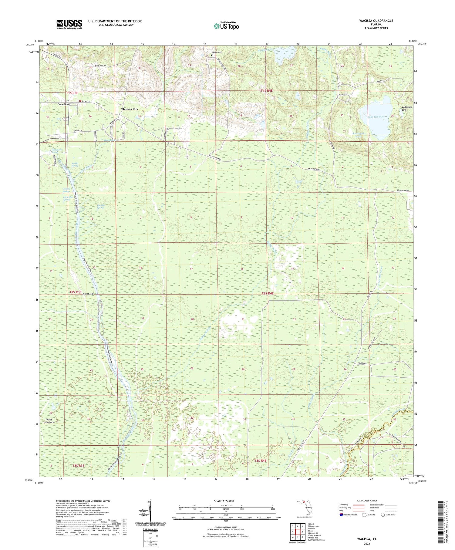
2024 topographic map quadrangle Wacissa in the state of Florida. Scale: 1:24000. Based on the newly updated USGS 7.5' US Topo map series, this map is in the following counties: Jefferson, Taylor. The map contains contour data, water features, and other items you are used to seeing on USGS maps, but also has updated roads and other features. This is the next generation of topographic maps. Printed on high-quality waterproof paper with UV fade-resistant inks.
Quads adjacent to this one:
West: Cody
Northwest: Lloyd
North: Waukeenah
Northeast: Lamont
East: Lamont SE
Southeast: Johnson Hammock
South: Nutall Rise
Southwest: Saint Marks NE
This map covers the same area as the classic USGS quad with code o30083c8.
Contains the following named places: Allen Spring, Aucilla Spring, Bailey Mill Creek, Beth Page Missionary Baptist Church, Bethphage Church, Big Blue Spring, Calico Hill, Cassidy Spring, Hamaste, Horsehead Run, Horsehead Spring, Jones Mill Creek, Lake Iamonia, Little Blue Spring, Little River, Mulloy Landing, San Luis Apalache, Scurrycut Pond, Thomas City, Tooles Hammock, Wacissa, Wacissa Census Designated Place, Wacissa Division, Wacissa Lookout Tower, Wacissa Post Office, Wacissa Springs Volunteer Fire and Rescue, Walker Cemetery, Welaunee Church, Welaunee Creek, Welaunee Plantation, Welaunee School, Welaunee Sink, Willanocha, ZIP Code: 32361


