
MyTopo
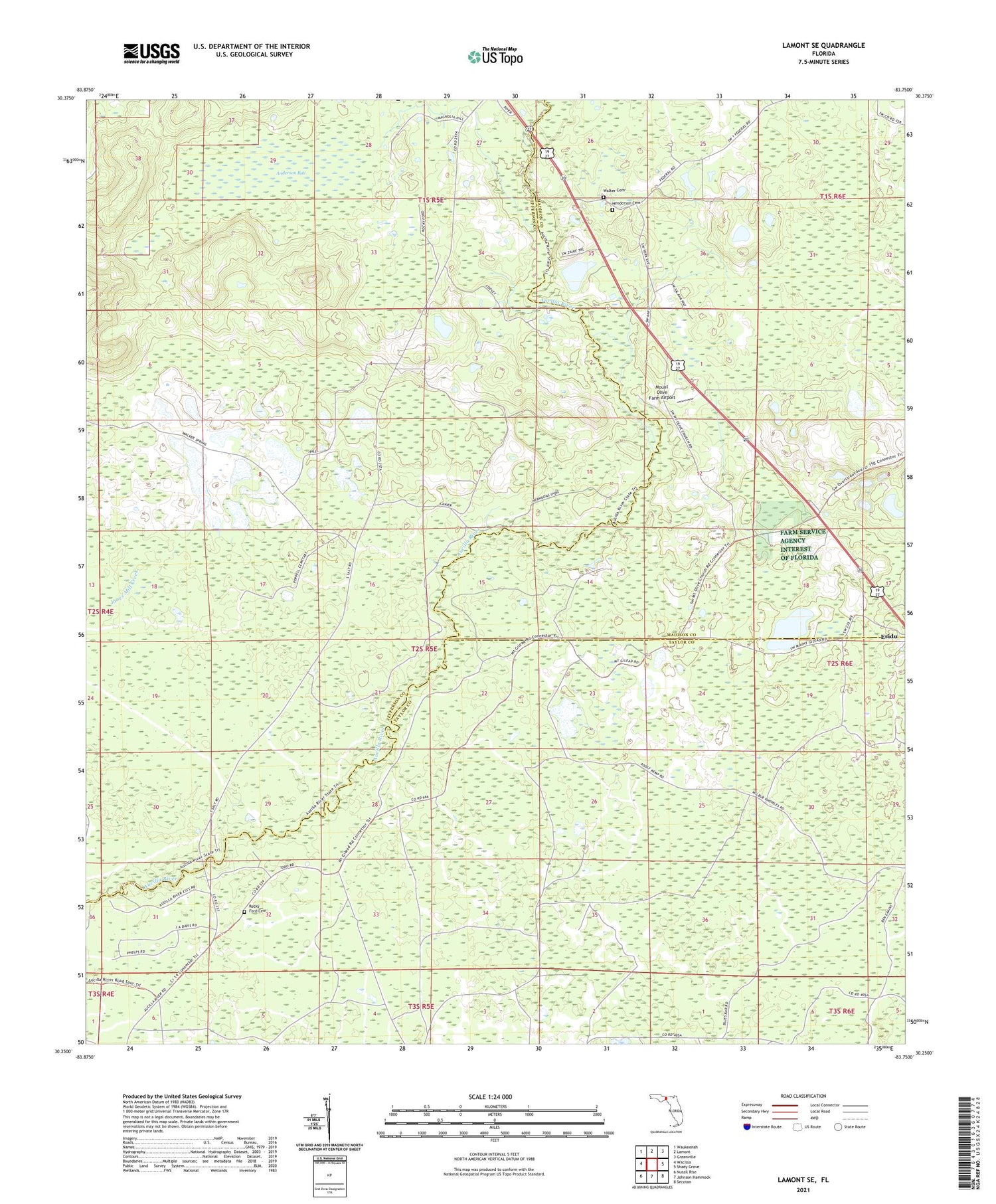
Lamont SE Florida US Topo Map
Couldn't load pickup availability
2024 topographic map quadrangle Lamont SE in the state of Florida. Scale: 1:24000. Based on the newly updated USGS 7.5' US Topo map series, this map is in the following counties: Jefferson, Taylor, Madison. The map contains contour data, water features, and other items you are used to seeing on USGS maps, but also has updated roads and other features. This is the next generation of topographic maps. Printed on high-quality waterproof paper with UV fade-resistant inks.
Quads adjacent to this one:
West: Wacissa
Northwest: Waukeenah
North: Lamont
Northeast: Greenville
East: Shady Grove
Southeast: Secotan
South: Johnson Hammock
Southwest: Nutall Rise
This map covers the same area as the classic USGS quad with code o30083c7.
Contains the following named places: Allison School, Anderson Bay, Covington, Green Grove School, Henderson Cemetery, Mount Gilead Church, Mount Olive Church, Mount Olive Farm Airport, Rocky Ford Cemetery, San Lorenzo Ibitachuco, Walker Cemetery, William Hambley Grant, ZIP Code: 32336


