MyTopo
Berlin East Georgia US Topo Map
Couldn't load pickup availability
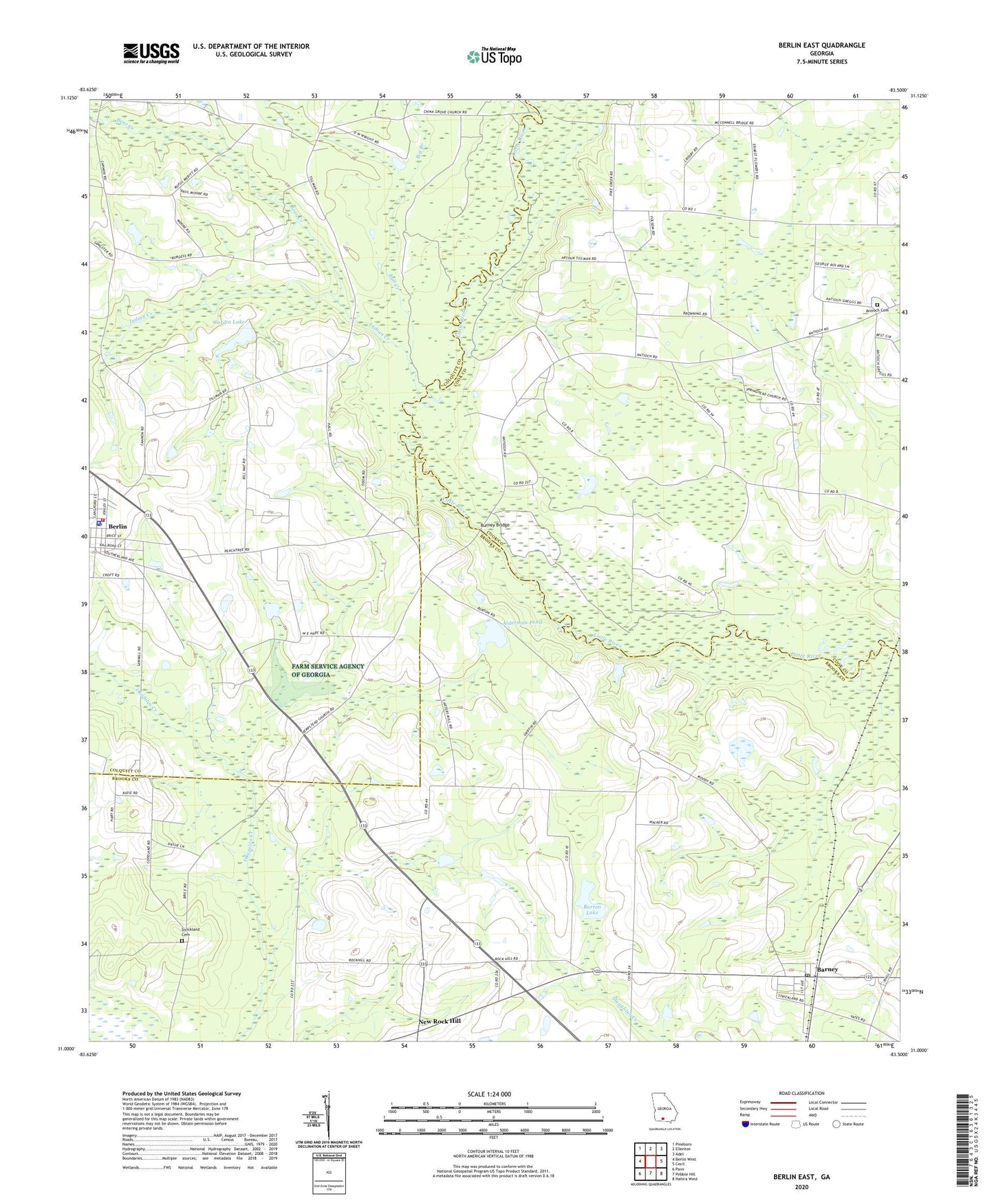
2024 topographic map quadrangle Berlin East in the state of Georgia. Scale: 1:24000. Based on the newly updated USGS 7.5' US Topo map series, this map is in the following counties: Brooks, Colquitt, Cook. The map contains contour data, water features, and other items you are used to seeing on USGS maps, but also has updated roads and other features. This is the next generation of topographic maps. Printed on high-quality waterproof paper with UV fade-resistant inks.
Quads adjacent to this one:
West: Berlin West
Northwest: Pineboro
North: Ellenton
Northeast: Adel
East: Cecil
Southeast: Hahira West
South: Pebble Hill
Southwest: Pavo
This map covers the same area as the classic USGS quad with code o31083a5.
Contains the following named places: Alderman Pond, Antioch Cemetery, Antioch Church, Barney, Barney Division, Barney Post Office, Bear Creek, Berlin, Berlin Elementary School, Berlin Police Department, Berlin Post Office, Big Branch, Bull Creek, Burney Bridge, Burton Lake, Burton Lake Dam, Cardin Lake, Cardin Lake Dam, China Grove Church, City of Berlin, Coloquitt County Volunteer Firefighters Association Fire Station 31 Berlin, County Line School, Hempstead Church, Hempstead Church Cemetery, Indian Creek, McConnell Bridge, New Rock Hill, Old Rock Hill, Pikes Creek, Pine Grove Church, Rock Hill School, Ryall Pond, Springhead Church, Strickland Cemetery, Trinity Church, Welcome Hope Church, ZIP Code: 31722