MyTopo
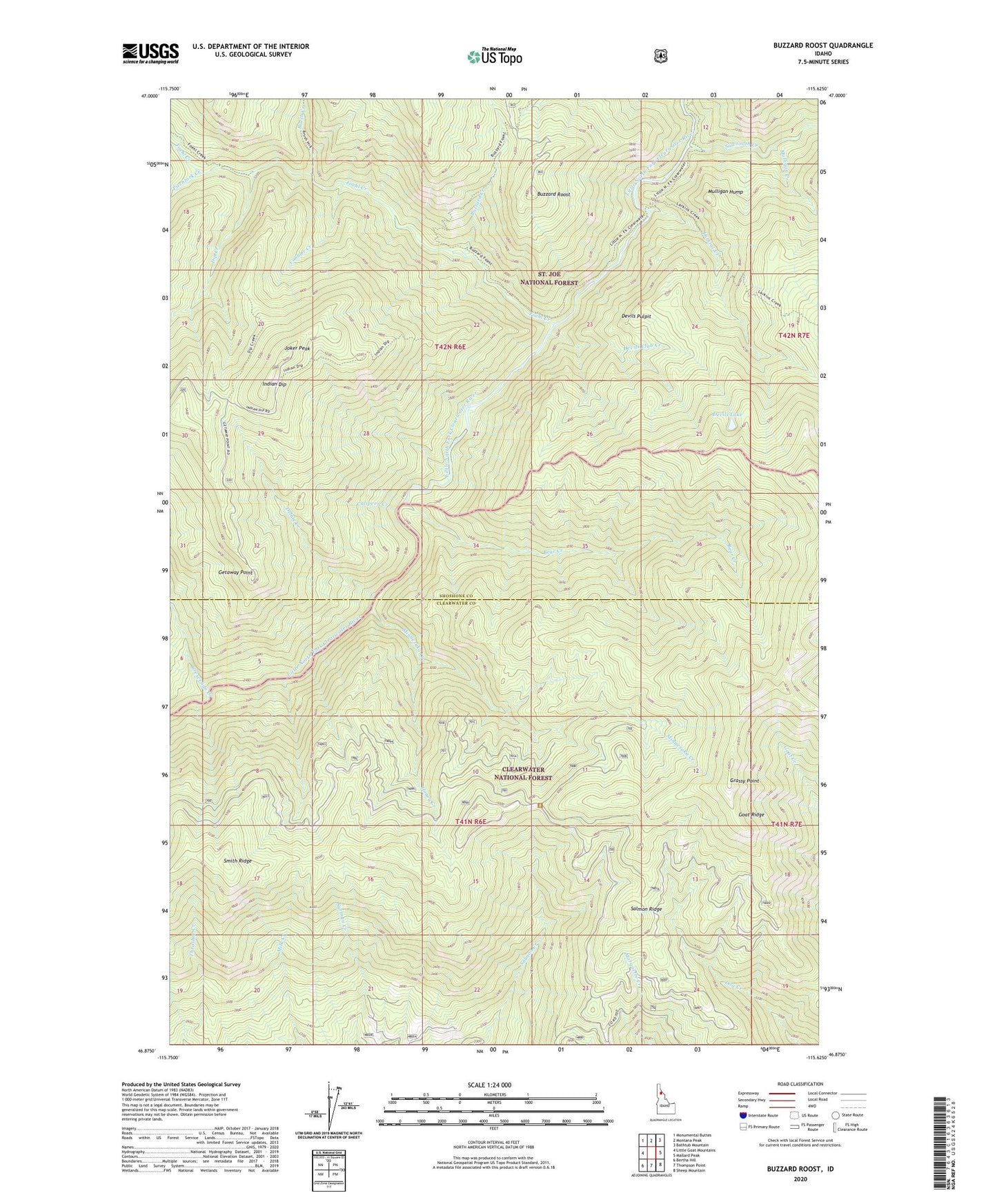
Buzzard Roost Idaho US Topo Map
Couldn't load pickup availability
Also explore the Buzzard Roost Forest Service Topo of this same quad for updated USFS data
2024 topographic map quadrangle Buzzard Roost in the state of Idaho. Scale: 1:24000. Based on the newly updated USGS 7.5' US Topo map series, this map is in the following counties: Shoshone, Clearwater. The map contains contour data, water features, and other items you are used to seeing on USGS maps, but also has updated roads and other features. This is the next generation of topographic maps. Printed on high-quality waterproof paper with UV fade-resistant inks.
Quads adjacent to this one:
West: Little Goat Mountains
Northwest: Monumental Buttes
North: Montana Peak
Northeast: Bathtub Mountain
East: Mallard Peak
Southeast: Sheep Mountain
South: Thompson Point
Southwest: Bertha Hill
This map covers the same area as the classic USGS quad with code o46115h6.
Contains the following named places: Bear Creek, Brush Creek, Buzzard Creek, Buzzard Roost, Calipeen Creek, Chicadee Cabin, Cobbler Creek, Crescendo Creek, Delate Creek, Devils Club Creek, Devils Lake, Devils Pulpit, Dip Creek, Foehl Creek, Getaway Point, Grassy Point, Grizzley Lake, Honey Creek, Indian Dip, Joker Peak, Larkins Creek, Minnesaka Creek, Mulligan Creek, Mulligan Hump, Pitchfork Creek, Salmon Ridge, Sawtooth Creek, Trappers Cabin