MyTopo
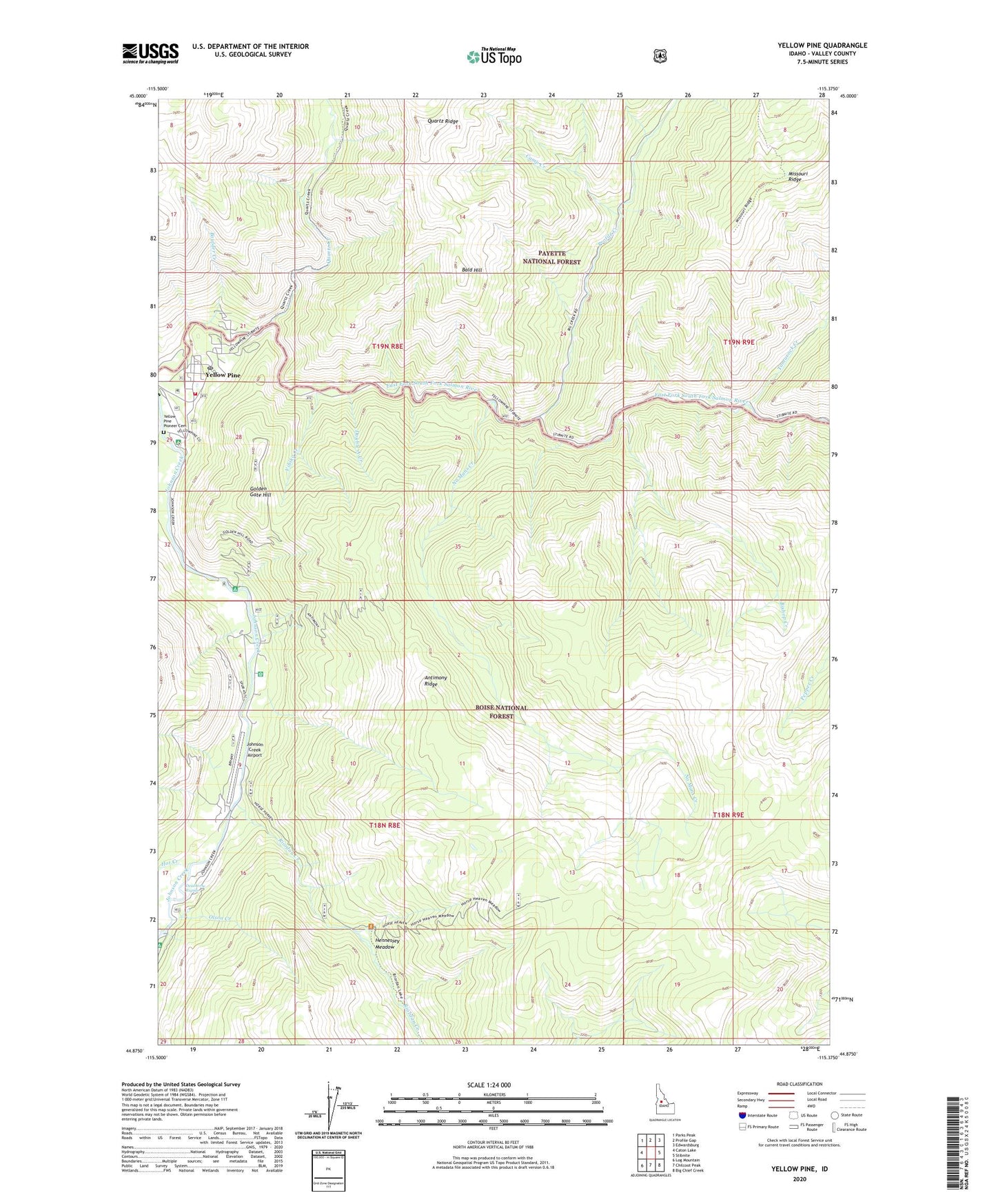
Yellow Pine Idaho US Topo Map
Couldn't load pickup availability
Also explore the Yellow Pine Forest Service Topo of this same quad for updated USFS data
2024 topographic map quadrangle Yellow Pine in the state of Idaho. Scale: 1:24000. Based on the newly updated USGS 7.5' US Topo map series, this map is in the following counties: Valley. The map contains contour data, water features, and other items you are used to seeing on USGS maps, but also has updated roads and other features. This is the next generation of topographic maps. Printed on high-quality waterproof paper with UV fade-resistant inks.
Quads adjacent to this one:
West: Caton Lake
Northwest: Parks Peak
North: Profile Gap
Northeast: Edwardsburg
East: Stibnite
Southeast: Big Chief Creek
South: Chilcoot Peak
Southwest: Log Mountain
This map covers the same area as the classic USGS quad with code o44115h4.
Contains the following named places: Abstein Place, Alpine Village, Antimony Camp, Antimony Ridge, Bald Hill, Bishop Creek, Boulder Creek, Camp Creek, Deadhorse Rapids, Double A Creek, Golden Gate Campground, Golden Gate Hill, Hennessey Meadow, Hot Creek, Ice Hole Campground, Johnson Creek Airport, Johnson Creek Forest Service Station, No Mans Creek, Olson Creek, Profile Creek, Quartz Creek, Riordan Creek, Tamarack Creek, Vibika Creek, Yellow Pine, Yellow Pine Campground, Yellow Pine Census Designated Place, Yellow Pine Elementary School, Yellow Pine Fire District, Yellow Pine Pioneer Cemetery, Yellow Pine Post Office