MyTopo
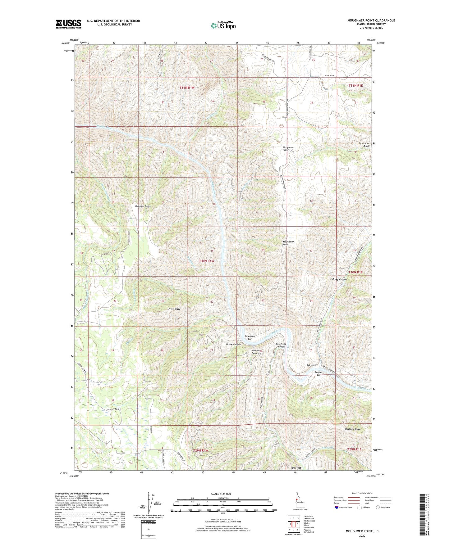
Moughmer Point Idaho US Topo Map
Couldn't load pickup availability
Also explore the Moughmer Point Forest Service Topo of this same quad for updated USFS data
2024 topographic map quadrangle Moughmer Point in the state of Idaho. Scale: 1:24000. Based on the newly updated USGS 7.5' US Topo map series, this map is in the following counties: Idaho. The map contains contour data, water features, and other items you are used to seeing on USGS maps, but also has updated roads and other features. This is the next generation of topographic maps. Printed on high-quality waterproof paper with UV fade-resistant inks.
Quads adjacent to this one:
West: Boles
Northwest: Westlake
North: Keuterville
Northeast: Cottonwood
East: Fenn
Southeast: White Bird
South: Joseph
Southwest: Wolf Creek
This map covers the same area as the classic USGS quad with code o45116h4.
Contains the following named places: American Bar, Andrews Canyon, Bingman Ridge, Bug Slope, Center Creek, Cooper Bar, Devils Garden, First Creek, Maple Canyon, Moughmer Point, Moughmer Ridge, Packers Creek, Price Ridge, Rice Creek, Rice Creek Bridge, Rock Creek, Rocky Canyon, Second Creek, Telcher Creek, The Basin, Wickiup Creek