MyTopo
Keuterville Idaho US Topo Map
Couldn't load pickup availability
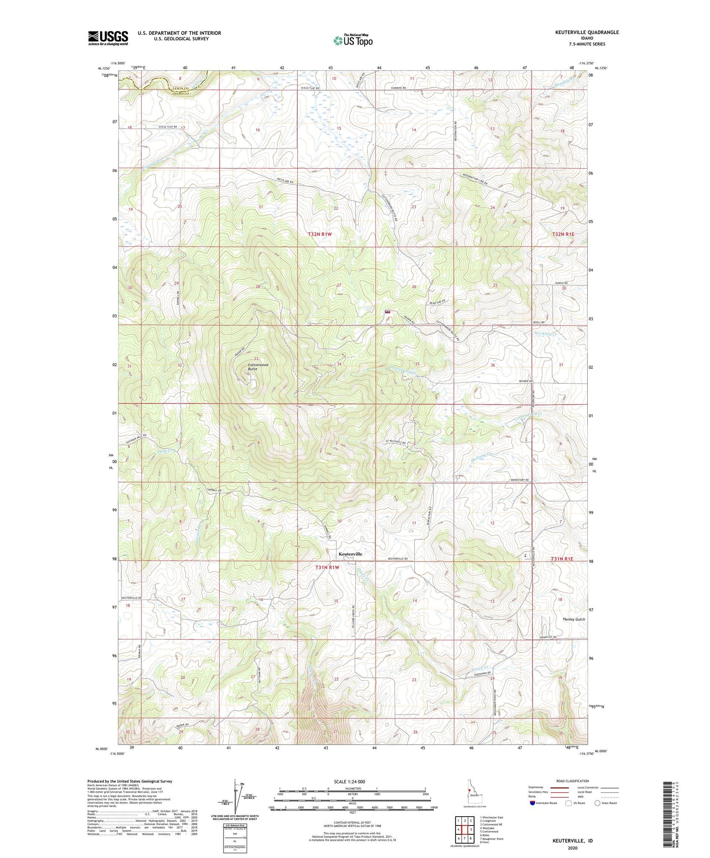
2024 topographic map quadrangle Keuterville in the state of Idaho. Scale: 1:24000. Based on the newly updated USGS 7.5' US Topo map series, this map is in the following counties: Idaho, Lewis. The map contains contour data, water features, and other items you are used to seeing on USGS maps, but also has updated roads and other features. This is the next generation of topographic maps. Printed on high-quality waterproof paper with UV fade-resistant inks.
Quads adjacent to this one:
West: Westlake
Northwest: Winchester East
North: Craigmont
Northeast: Cottonwood NE
East: Cottonwood
Southeast: Fenn
South: Moughmer Point
Southwest: Boles
This map covers the same area as the classic USGS quad with code o46116a4.
Contains the following named places: Cottonwood Air Force Station, Cottonwood Butte, Cottonwood Job Corps Center, Keuterville, Lawyer Creek, North Idaho Correctional Institution, North Idaho Correctional Institution Fire Department, Prairie High School, Saint Gertrude Academy