MyTopo
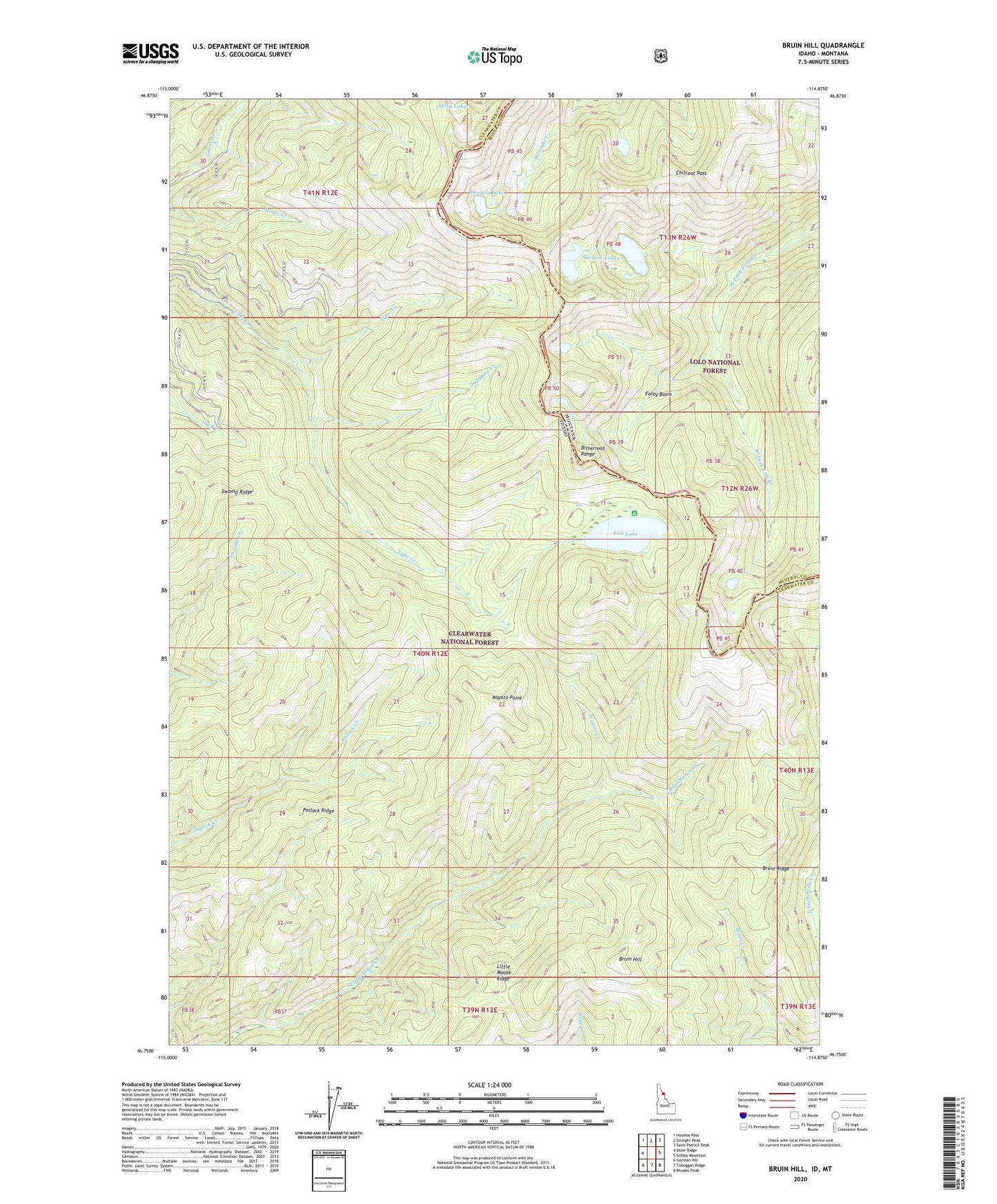
Bruin Hill Idaho US Topo Map
Couldn't load pickup availability
Also explore the Bruin Hill Forest Service Topo of this same quad for updated USFS data
2024 topographic map quadrangle Bruin Hill in the states of Idaho, Montana. Scale: 1:24000. Based on the newly updated USGS 7.5' US Topo map series, this map is in the following counties: Clearwater, Mineral. The map contains contour data, water features, and other items you are used to seeing on USGS maps, but also has updated roads and other features. This is the next generation of topographic maps. Printed on high-quality waterproof paper with UV fade-resistant inks.
Quads adjacent to this one:
West: Osier Ridge
Northwest: Hoodoo Pass
North: Straight Peak
Northeast: Saint Patrick Peak
East: Schley Mountain
Southeast: Rhodes Peak
South: Toboggan Ridge
Southwest: Gorman Hill
Contains the following named places: Bruin Hill, Bruin Ridge, Chilcoot Pass, Fish Lake, Foley Basin, Japanese Creek, Little Moose Ridge, Siam Creek, Siamese Lakes, Straight Lake, Swamp Ridge, Wapito Creek, Wapito Point