MyTopo
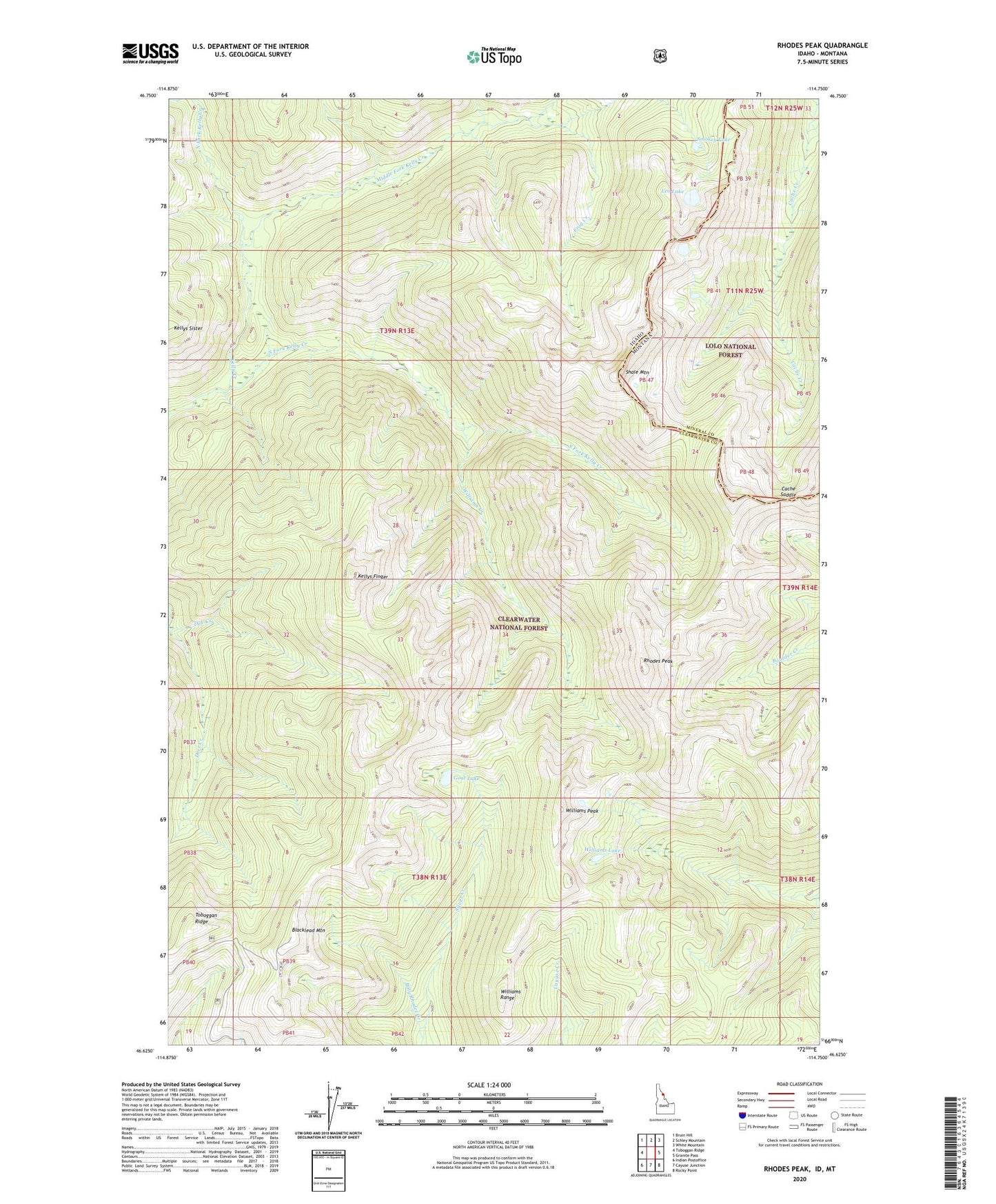
Rhodes Peak Idaho US Topo Map
Couldn't load pickup availability
Also explore the Rhodes Peak Forest Service Topo of this same quad for updated USFS data
2024 topographic map quadrangle Rhodes Peak in the states of Idaho, Montana. Scale: 1:24000. Based on the newly updated USGS 7.5' US Topo map series, this map is in the following counties: Clearwater, Mineral. The map contains contour data, water features, and other items you are used to seeing on USGS maps, but also has updated roads and other features. This is the next generation of topographic maps. Printed on high-quality waterproof paper with UV fade-resistant inks.
Quads adjacent to this one:
West: Toboggan Ridge
Northwest: Bruin Hill
North: Schley Mountain
Northeast: White Mountain
East: Granite Pass
Southeast: Rocky Point
South: Cayuse Junction
Southwest: Indian Postoffice
Contains the following named places: Billy Rhodes Creek, Blacklead Mountain, Bruin Creek, Cache Saddle, Doe Creek, Frog Creek, Goat Lake, Kellys Finger, Kellys Sister, Kid Lake Creek, Leo Lake, Middle Fork Kelly Creek, North Fork Kelly Creek, Rhodes Peak, Shale Mountain, Smokey Lake, South Fork Kelly Creek, Williams Creek, Williams Lake, Williams Peak, Williams Range