MyTopo
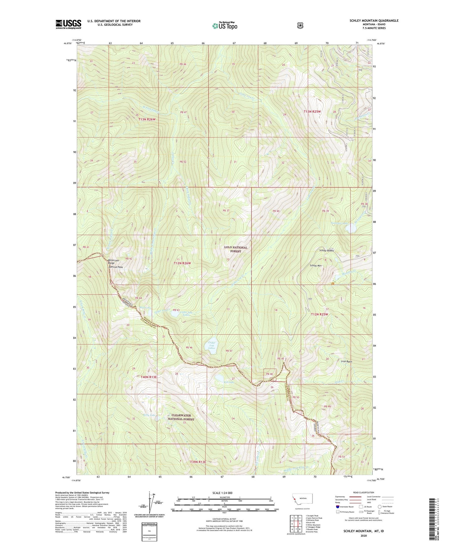
Schley Mountain Montana US Topo Map
Couldn't load pickup availability
Also explore the Schley Mountain Forest Service Topo of this same quad for updated USFS data
2024 topographic map quadrangle Schley Mountain in the states of Montana, Idaho. Scale: 1:24000. Based on the newly updated USGS 7.5' US Topo map series, this map is in the following counties: Mineral, Clearwater. The map contains contour data, water features, and other items you are used to seeing on USGS maps, but also has updated roads and other features. This is the next generation of topographic maps. Printed on high-quality waterproof paper with UV fade-resistant inks.
Quads adjacent to this one:
West: Bruin Hill
Northwest: Straight Peak
North: Saint Patrick Peak
Northeast: Williams Peak
East: White Mountain
Southeast: Granite Pass
South: Rhodes Peak
Southwest: Toboggan Ridge
This map covers the same area as the classic USGS quad with code o46114g7.
Contains the following named places: Admiral Peak, Cedar Log Creek, Cedar Log Lakes, East Fork Indian Creek, Indian Creek, Indian Creek Lodge, Irish Basin, Kelly Lake, Kid Lake, Middle Fork Indian Creek, Mud Lake, Schley Mountain, Schley Saddle, Snowshoe Mine, Surveyor Lake, West Fork Indian Creek