MyTopo
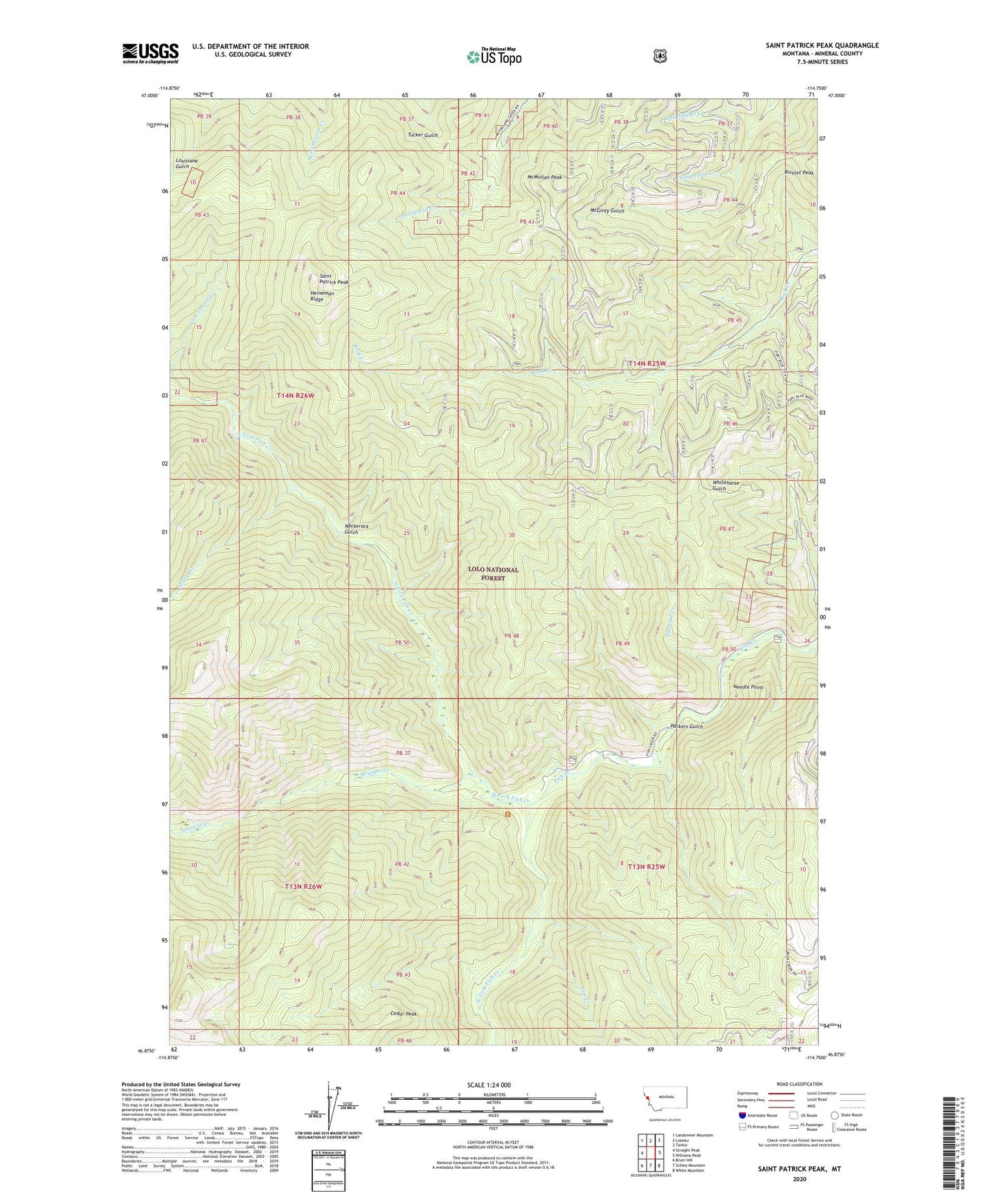
Saint Patrick Peak Montana US Topo Map
Couldn't load pickup availability
Also explore the Saint Patrick Peak Forest Service Topo of this same quad for updated USFS data
2024 topographic map quadrangle Saint Patrick Peak in the state of Montana. Scale: 1:24000. Based on the newly updated USGS 7.5' US Topo map series, this map is in the following counties: Mineral. The map contains contour data, water features, and other items you are used to seeing on USGS maps, but also has updated roads and other features. This is the next generation of topographic maps. Printed on high-quality waterproof paper with UV fade-resistant inks.
Quads adjacent to this one:
West: Straight Peak
Northwest: Landowner Mountain
North: Lozeau
Northeast: Tarkio
East: Williams Peak
Southeast: White Mountain
South: Schley Mountain
Southwest: Bruin Hill
This map covers the same area as the classic USGS quad with code o46114h7.
Contains the following named places: Baileys Lodge, Blacktail Creek, Cedar Peak, Clear Water Crossing Ranger Station, Clearwater Crossing Campground, Crater Creek, Fire Creek, Heineman Ridge, Hells Thicket Creek, Hole-in-the-Wall Ranch, McMullan Peak, Needle Point, North Fork Fish Creek, Packers Gulch, Rivulet Peak, Saint Patrick Peak, Straight Creek, Tanglefoot Creek, West Fork Fish Creek, Whiterock Gulch