MyTopo
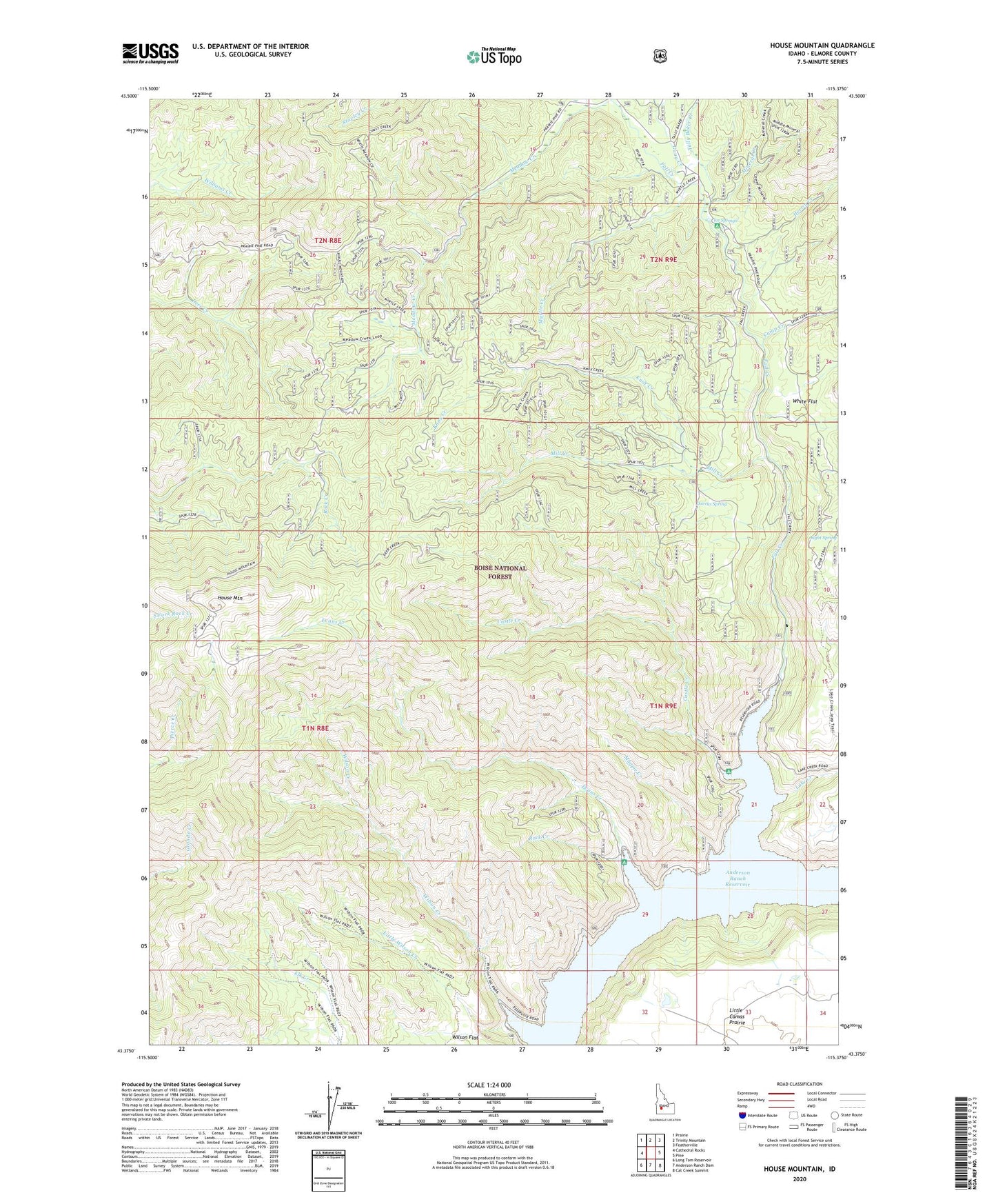
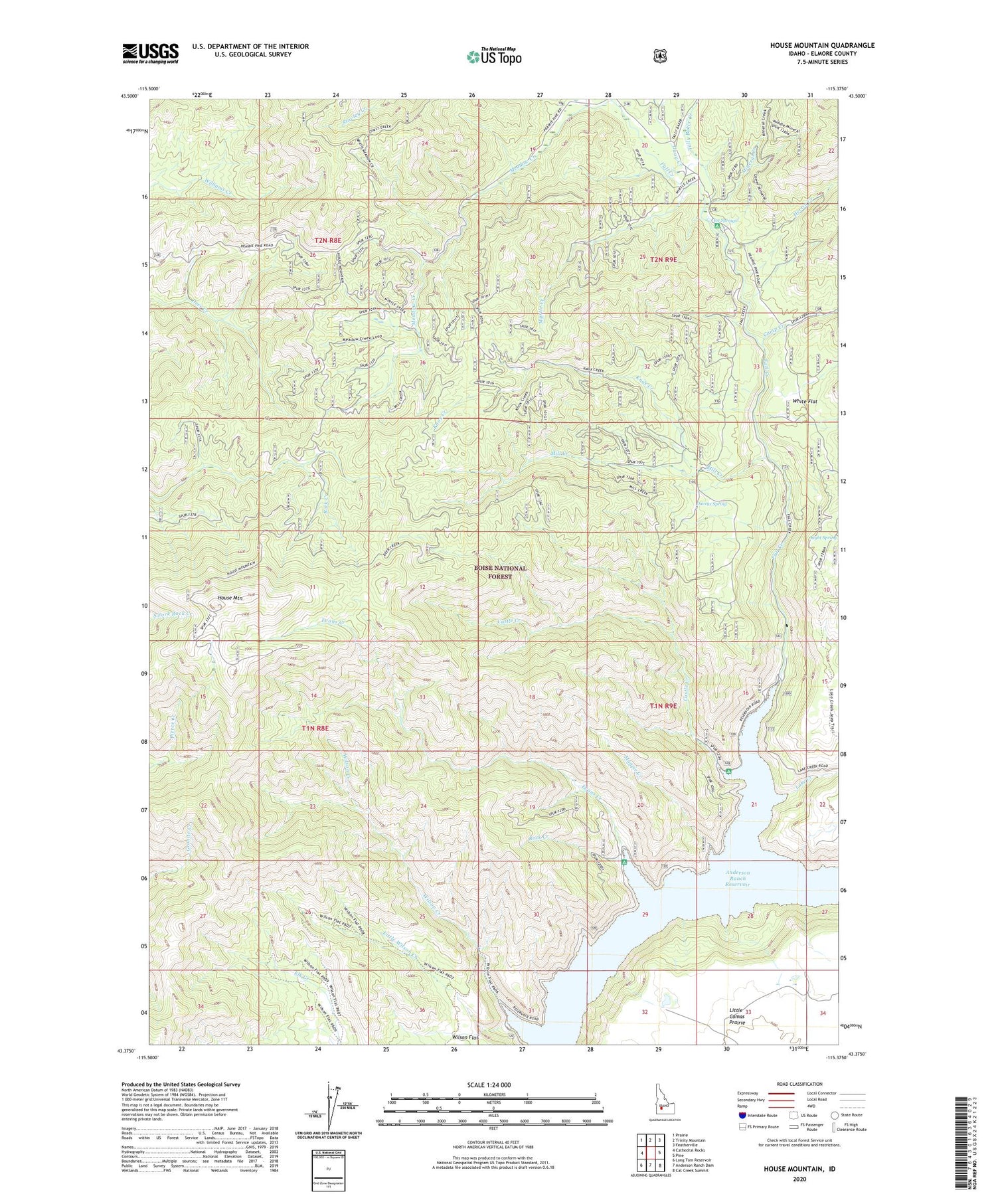
House Mountain Idaho US Topo Map
Couldn't load pickup availability
Also explore the House Mountain Forest Service Topo of this same quad for updated USFS data
2024 topographic map quadrangle House Mountain in the state of Idaho. Scale: 1:24000. Based on the newly updated USGS 7.5' US Topo map series, this map is in the following counties: Elmore. The map contains contour data, water features, and other items you are used to seeing on USGS maps, but also has updated roads and other features. This is the next generation of topographic maps. Printed on high-quality waterproof paper with UV fade-resistant inks.
Quads adjacent to this one:
West: Cathedral Rocks
Northwest: Prairie
North: Trinity Mountain
Northeast: Featherville
East: Pine
Southeast: Cat Creek Summit
South: Anderson Ranch Dam
Southwest: Long Tom Reservoir
This map covers the same area as the classic USGS quad with code o43115d4.
Contains the following named places: Camp Creek, Castle Creek, Castle Rock Campground, Daveys Spring, Evans Creek, Evans Creek Campground, Fall Creek, Fall Creek Lodge, Fall Creek Recreation Site, Granite Mountain, Guay Creek, Herrin Creek, House Mountain, Ice Springs, Ice Springs Campground, Knox Creek, Lake Creek, Little Wilson Creek, Little Wilson Creek Campground, Magpie Creek, Meadow Creek, Mill Creek, Mineral Creek, Myrtle Creek, Rhead Dam, Rock Creek, Tally Baker Creek, White Flat, Wilson Creek