MyTopo
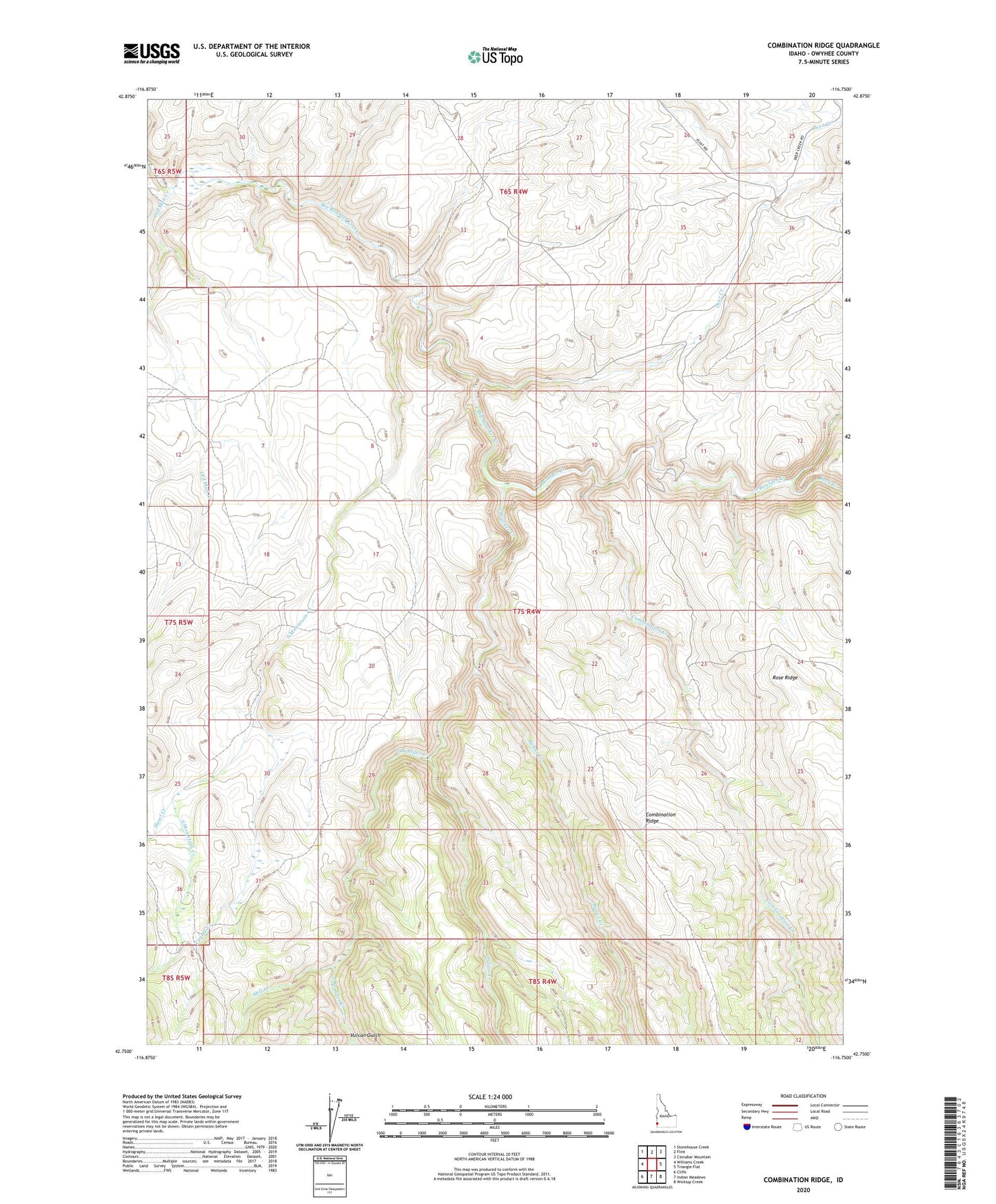
Combination Ridge Idaho US Topo Map
Couldn't load pickup availability
2023 topographic map quadrangle Combination Ridge in the state of Idaho. Scale: 1:24000. Based on the newly updated USGS 7.5' US Topo map series, this map is in the following counties: Owyhee. The map contains contour data, water features, and other items you are used to seeing on USGS maps, but also has updated roads and other features. This is the next generation of topographic maps. Printed on high-quality waterproof paper with UV fade-resistant inks.
Quads adjacent to this one:
West: Williams Creek
Northwest: Stonehouse Creek
North: Flint
Northeast: Cinnabar Mountain
East: Triangle Flat
Southeast: Wickiup Creek
South: Indian Meadows
Southwest: Cliffs
This map covers the same area as the classic USGS quad with code o42116g7.
Contains the following named places: Bogus Creek, Combination Creek, Coyote Creek, Deer Creek, Howl Creek, Indian Creek, Mill Creek, North Boulder Creek, Old Man Creek, Rock Creek, South Boulder Creek, South Mountain Creek, Vulcan Gulch