MyTopo
Parsnip Peak Oregon US Topo Map
Couldn't load pickup availability
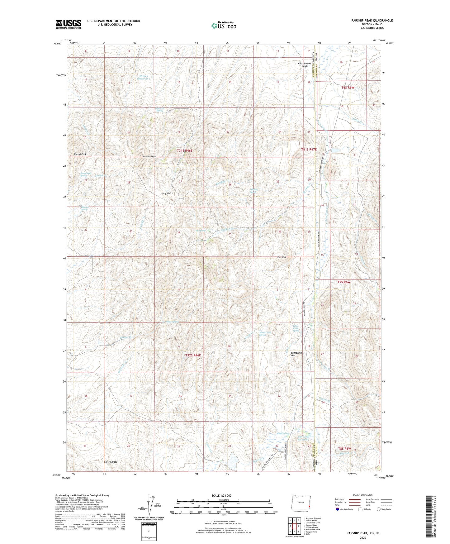
2024 topographic map quadrangle Parsnip Peak in the states of Oregon, Idaho. Scale: 1:24000. Based on the newly updated USGS 7.5' US Topo map series, this map is in the following counties: Malheur, Owyhee. The map contains contour data, water features, and other items you are used to seeing on USGS maps, but also has updated roads and other features. This is the next generation of topographic maps. Printed on high-quality waterproof paper with UV fade-resistant inks.
Quads adjacent to this one:
West: Juniper Ridge
Northwest: Antelope Reservoir
North: Jordan Valley
Northeast: Stonehouse Creek
East: Williams Creek
Southeast: Cliffs
South: Juniper Point
Southwest: Whitehorse Butte
This map covers the same area as the classic USGS quad with code o42117g1.
Contains the following named places: Big Spring, Castro Ridge, Cattle Creek, Chicken Creek, Coffee Pot Spring, Cottonwood Gulch, Eiguren Spring, Horse Creek, Horse Creek Spring, Little Creek, Little Creek Spring, Lone Tree Ranch, Minear Creek, Mud Spring, Owl Creek, Parsnip Peak, Red Hill, Round Peak, Round Peak Spring, Sagebrush Mountain, Salt Lick Dam, Salt Lick Reservoir, Whiskey Creek, Whiskey Spring, Willow Spring, Wroten Reservoir 2