MyTopo
Flint Idaho US Topo Map
Couldn't load pickup availability
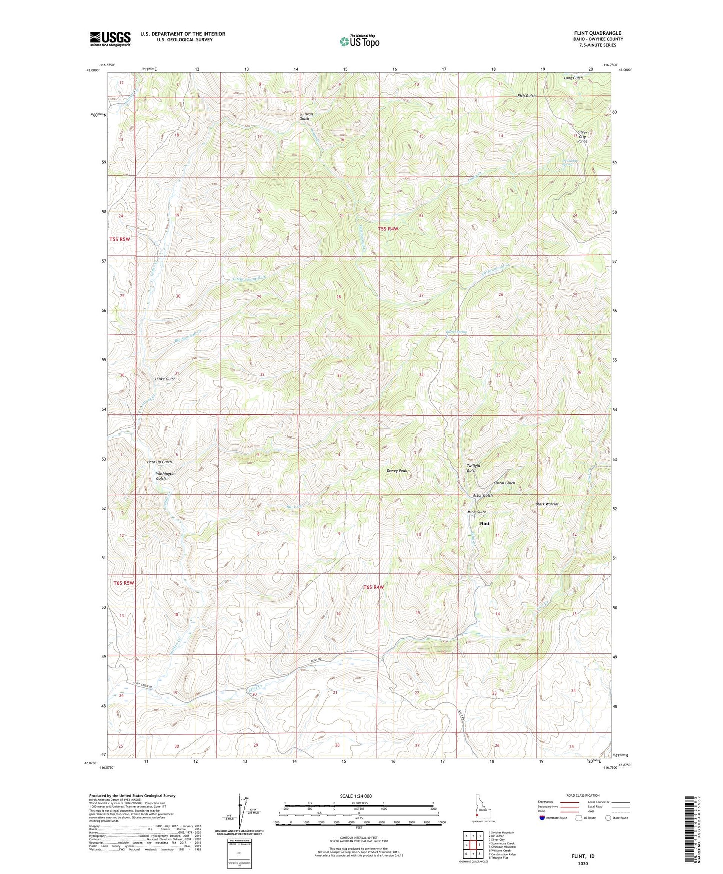
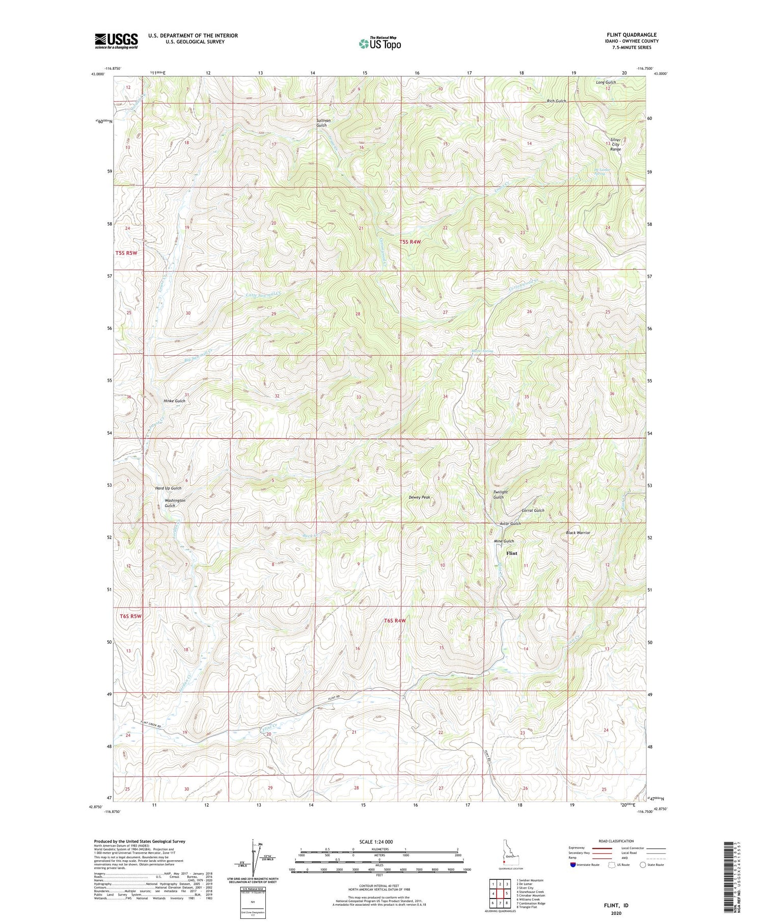
2024 topographic map quadrangle Flint in the state of Idaho. Scale: 1:24000. Based on the newly updated USGS 7.5' US Topo map series, this map is in the following counties: Owyhee. The map contains contour data, water features, and other items you are used to seeing on USGS maps, but also has updated roads and other features. This is the next generation of topographic maps. Printed on high-quality waterproof paper with UV fade-resistant inks.
Quads adjacent to this one:
West: Stonehouse Creek
Northwest: Swisher Mountain
North: De Lamar
Northeast: Silver City
East: Cinnabar Mountain
Southeast: Triangle Flat
South: Combination Ridge
Southwest: Williams Creek
This map covers the same area as the classic USGS quad with code o42116h7.
Contains the following named places: Astor Gulch, Barrel Spring, Big I Grade, Big Sawmill Creek, Black Warrior, Buck Creek, Corral Gulch, Cottonwood Creek, Crescent Mine, De Lamar Spring, Dewey Peak, Doughboy Mine, East Creek, Flint, Flint Creek, Hard Up Gulch, Hinke Gulch, Hornet Mine, Jefferson Mine, Little Sawmill Creek, Louse Creek, Mine Gulch, Nellie Ann Mine, Perseverance Mine, Rising Star Mine, Silver Queen Mine, Sullivan Gulch, Treasure Vault Mine, Twilight Gulch, Washington Gulch