MyTopo
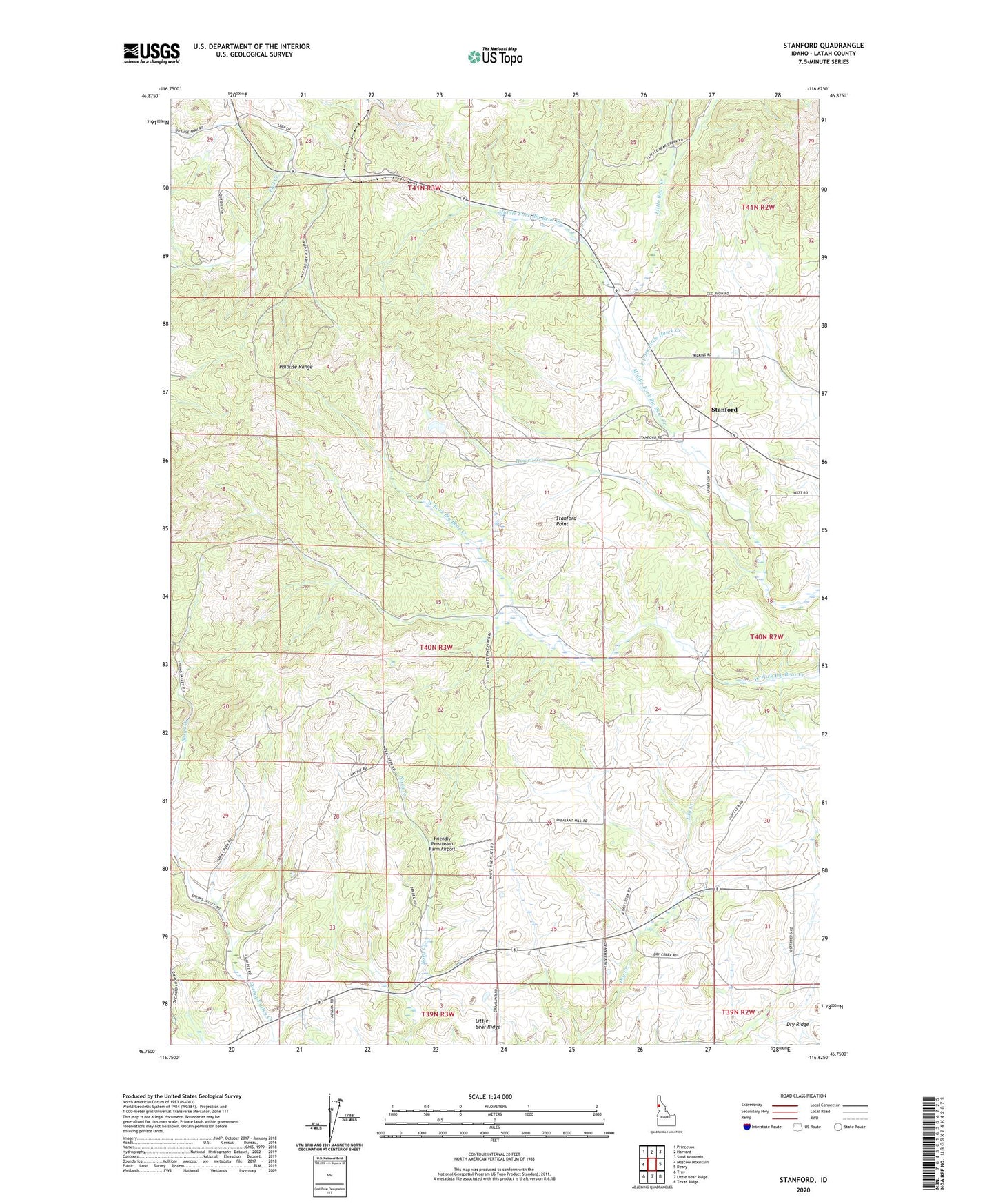
Stanford Idaho US Topo Map
Couldn't load pickup availability
Also explore the Stanford Forest Service Topo of this same quad for updated USFS data
2024 topographic map quadrangle Stanford in the state of Idaho. Scale: 1:24000. Based on the newly updated USGS 7.5' US Topo map series, this map is in the following counties: Latah. The map contains contour data, water features, and other items you are used to seeing on USGS maps, but also has updated roads and other features. This is the next generation of topographic maps. Printed on high-quality waterproof paper with UV fade-resistant inks.
Quads adjacent to this one:
West: Moscow Mountain
Northwest: Princeton
North: Harvard
Northeast: Sand Mountain
East: Deary
Southeast: Texas Ridge
South: Little Bear Ridge
Southwest: Troy
This map covers the same area as the classic USGS quad with code o46116g6.
Contains the following named places: East Fork Little Hawk Creek, Friendly Persuasion Farm Airport, Howell Creek, Latah County, Little Bear Creek, Little Hawk Creek, Nora, Stanford, Stanford Point, West Fork Little Hawk Creek, Yale