MyTopo
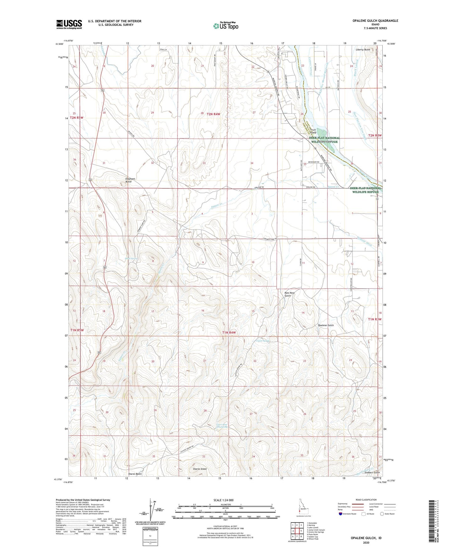
Opalene Gulch Idaho US Topo Map
Couldn't load pickup availability
2024 topographic map quadrangle Opalene Gulch in the state of Idaho. Scale: 1:24000. Based on the newly updated USGS 7.5' US Topo map series, this map is in the following counties: Owyhee, Canyon. The map contains contour data, water features, and other items you are used to seeing on USGS maps, but also has updated roads and other features. This is the next generation of topographic maps. Printed on high-quality waterproof paper with UV fade-resistant inks.
Quads adjacent to this one:
West: Jump Creek Canyon
Northwest: Homedale
North: Marsing
Northeast: Lake Lowell
East: Givens Hot Springs
Southeast: Wilson Peak
South: Soldier Cap
Southwest: Piute Butte
This map covers the same area as the classic USGS quad with code o43116d7.
Contains the following named places: Alkali Spring, Boy Scout Camp, Cottontail Island, Coyote Spring, Dilley Island, Elephant Butte, Fruit Island, Liberty Butte, Opalene Gulch, Opalene School, Rats Nest Gulch, Shares Snout, Sommercamp, Squaw Creek, Stewart Gulch, Upper Rats Nest Spring, ZIP Code: 83639