MyTopo
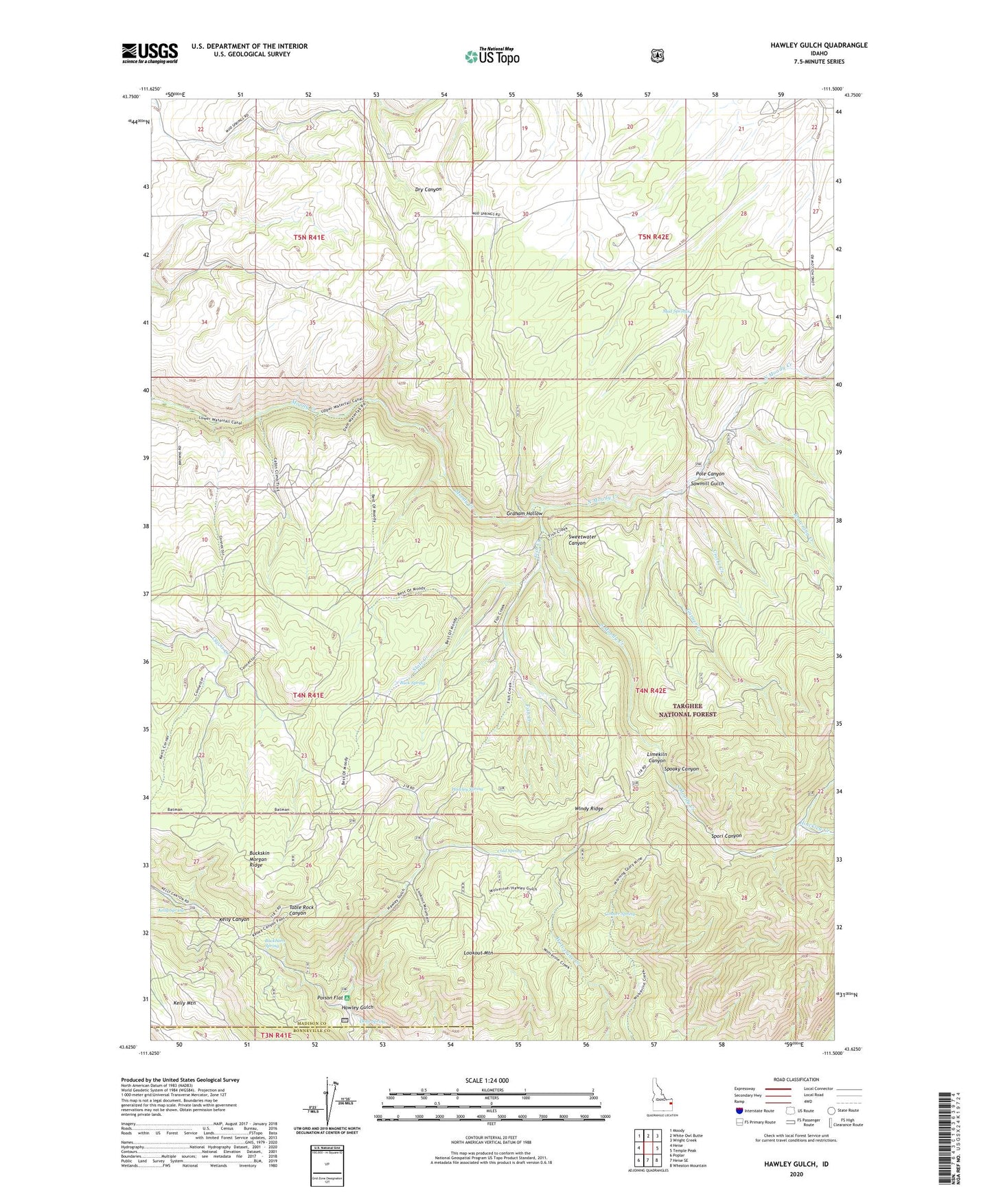
Hawley Gulch Idaho US Topo Map
Couldn't load pickup availability
Also explore the Hawley Gulch Forest Service Topo of this same quad for updated USFS data
2024 topographic map quadrangle Hawley Gulch in the state of Idaho. Scale: 1:24000. Based on the newly updated USGS 7.5' US Topo map series, this map is in the following counties: Madison, Bonneville. The map contains contour data, water features, and other items you are used to seeing on USGS maps, but also has updated roads and other features. This is the next generation of topographic maps. Printed on high-quality waterproof paper with UV fade-resistant inks.
Quads adjacent to this one:
West: Heise
Northwest: Moody
North: White Owl Butte
Northeast: Wright Creek
East: Temple Peak
Southeast: Wheaton Mountain
South: Heise SE
Southwest: Poplar
This map covers the same area as the classic USGS quad with code o43111f5.
Contains the following named places: Browning Creek, Buck Spring, Buckhorn Spring, Buckskin Morgan Ridge, Clarke Creek, Cold Spring, Conner Spring, Dora Spring, East Fork Hilton Creek, Fish Creek, Garner Creek, Graham Hollow, Hawley Gulch, Hawley Gulch Ranger Station, Hawley Spring, Hinckley Creek, Kelly Spring, Limekiln Canyon, Lookout Mountain, Morning Glory Mine, Mud Springs, North Moody Creek, Poison Flat, Pole Canyon, Sawmill Gulch, South Moody Creek, Spooky Canyon, Spori Canyon, State Creek, Windy Ridge