MyTopo
Fenn Idaho US Topo Map
Couldn't load pickup availability
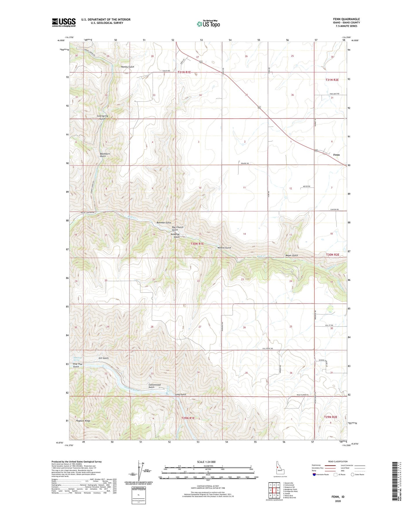
2024 topographic map quadrangle Fenn in the state of Idaho. Scale: 1:24000. Based on the newly updated USGS 7.5' US Topo map series, this map is in the following counties: Idaho. The map contains contour data, water features, and other items you are used to seeing on USGS maps, but also has updated roads and other features. This is the next generation of topographic maps. Printed on high-quality waterproof paper with UV fade-resistant inks.
Quads adjacent to this one:
West: Moughmer Point
Northwest: Keuterville
North: Cottonwood
Northeast: Nezperce SW
East: Grangeville West
Southeast: White Bird Hill
South: White Bird
Southwest: Joseph
This map covers the same area as the classic USGS quad with code o45116h3.
Contains the following named places: Blackburn Gulch, Boise Trail, Bowman Gulch, Cold Spring Gulch, Cottonwood Gulch, Fenn, Gill Gulch, Grave Creek, Hanley Gulch, Hells Gate Creek, Hogback Ridge, Johns Creek, Long Gulch, Meyer Gulch, Murdicks Spring, Pine Bar Rapids, Pine Tree Gulch, Ray Church Gulch, Telcher Creek, Vonberge Gulch, Wilkins Gulch