MyTopo
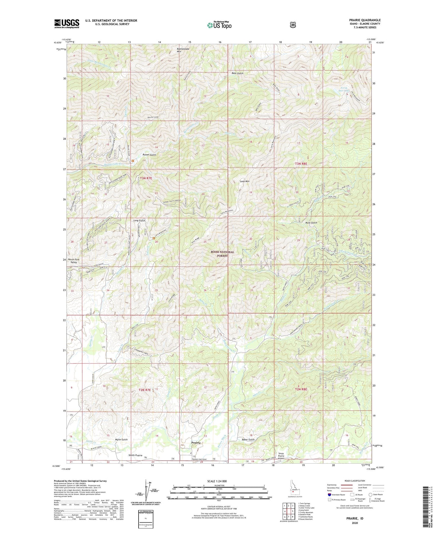
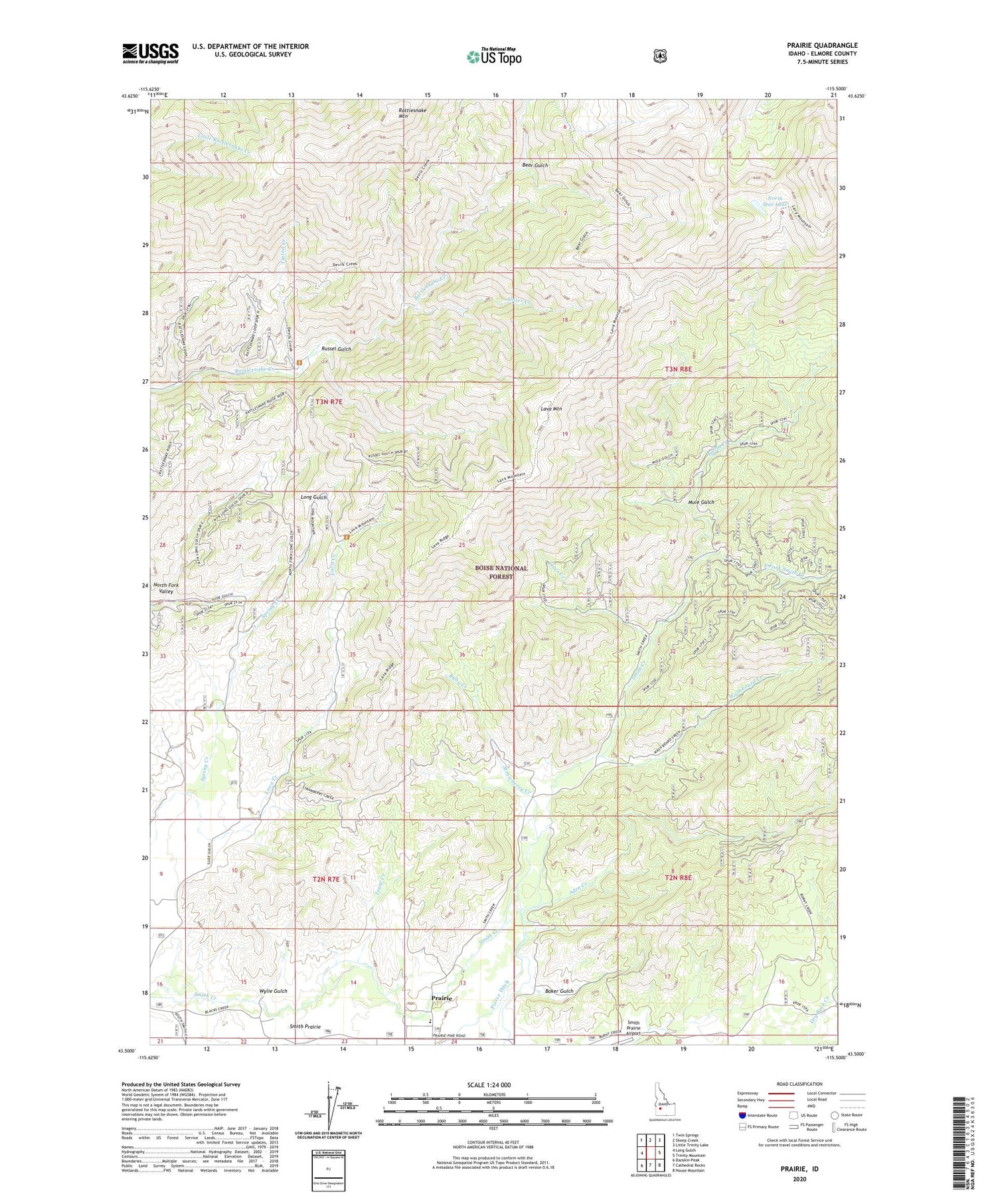
Prairie Idaho US Topo Map
Couldn't load pickup availability
Also explore the Prairie Forest Service Topo of this same quad for updated USFS data
2023 topographic map quadrangle Prairie in the state of Idaho. Scale: 1:24000. Based on the newly updated USGS 7.5' US Topo map series, this map is in the following counties: Elmore. The map contains contour data, water features, and other items you are used to seeing on USGS maps, but also has updated roads and other features. This is the next generation of topographic maps. Printed on high-quality waterproof paper with UV fade-resistant inks.
Quads adjacent to this one:
West: Long Gulch
Northwest: Twin Springs
North: Sheep Creek
Northeast: Little Trinity Lake
East: Trinity Mountain
Southeast: House Mountain
South: Cathedral Rocks
Southwest: Danskin Peak
This map covers the same area as the classic USGS quad with code o43115e5.
Contains the following named places: Aden Creek, Baker Gulch, Bear Gulch, East Fork Smith Creek, Lava Creek, Lava Mountain, Louse Creek, Mule Gulch, North Fork Valley, North Star Lake, Pierce Ditch, Prairie, Prairie Elementary - Junior High School, Rattlesnake Mountain, Ruby Creek, Russel Gulch, Slater Creek, Strawberry Creek, Tiger Creek, Tipton Creek, Tipton Flat Campground, Washboard Creek, Wylie Gulch