
MyTopo
Trinity Mountain Idaho US Topo Map
Couldn't load pickup availability
Also explore the Trinity Mountain Forest Service Topo of this same quad for updated USFS data
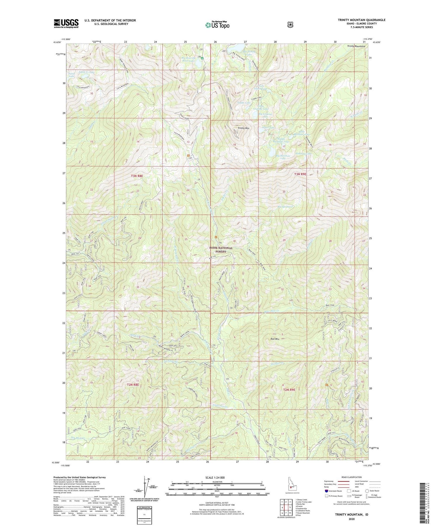
2023 topographic map quadrangle Trinity Mountain in the state of Idaho. Scale: 1:24000. Based on the newly updated USGS 7.5' US Topo map series, this map is in the following counties: Elmore. The map contains contour data, water features, and other items you are used to seeing on USGS maps, but also has updated roads and other features. This is the next generation of topographic maps. Printed on high-quality waterproof paper with UV fade-resistant inks.
Quads adjacent to this one:
West: Prairie
Northwest: Sheep Creek
North: Little Trinity Lake
Northeast: Rocky Bar
East: Featherville
Southeast: Pine
South: House Mountain
Southwest: Cathedral Rocks
This map covers the same area as the classic USGS quad with code o43115e4.
Contains the following named places: Anderson Creek, Baker Creek, Bear Hole Creek, Big Lookout Lake, Big Rainbow Lake, Big Roaring River Lake, Big Roaring River Lake Campground, Big Spring Creek, Big Trinity Lake, Big Trinity lake Campground, Burnt Creek, Cold Spring Campground, Cougar Creek, East Fork Fall Creek, Fiddle Lake, Green Island Lake, Heart Lake, Hideway Lake, Left Fork Tally Creek, Little Lookout Lake, Little Rainbow Lake, Middle Rainbow Lake, No Name Creek, Packer Creek, Potter Lake, Red Mountain, Sheldon Creek, Smith Creek Lake, Stavley Creek, Trinity Mountain, Twin Sisters Lakes, West Fork Fall Creek, Windy Creek


