MyTopo
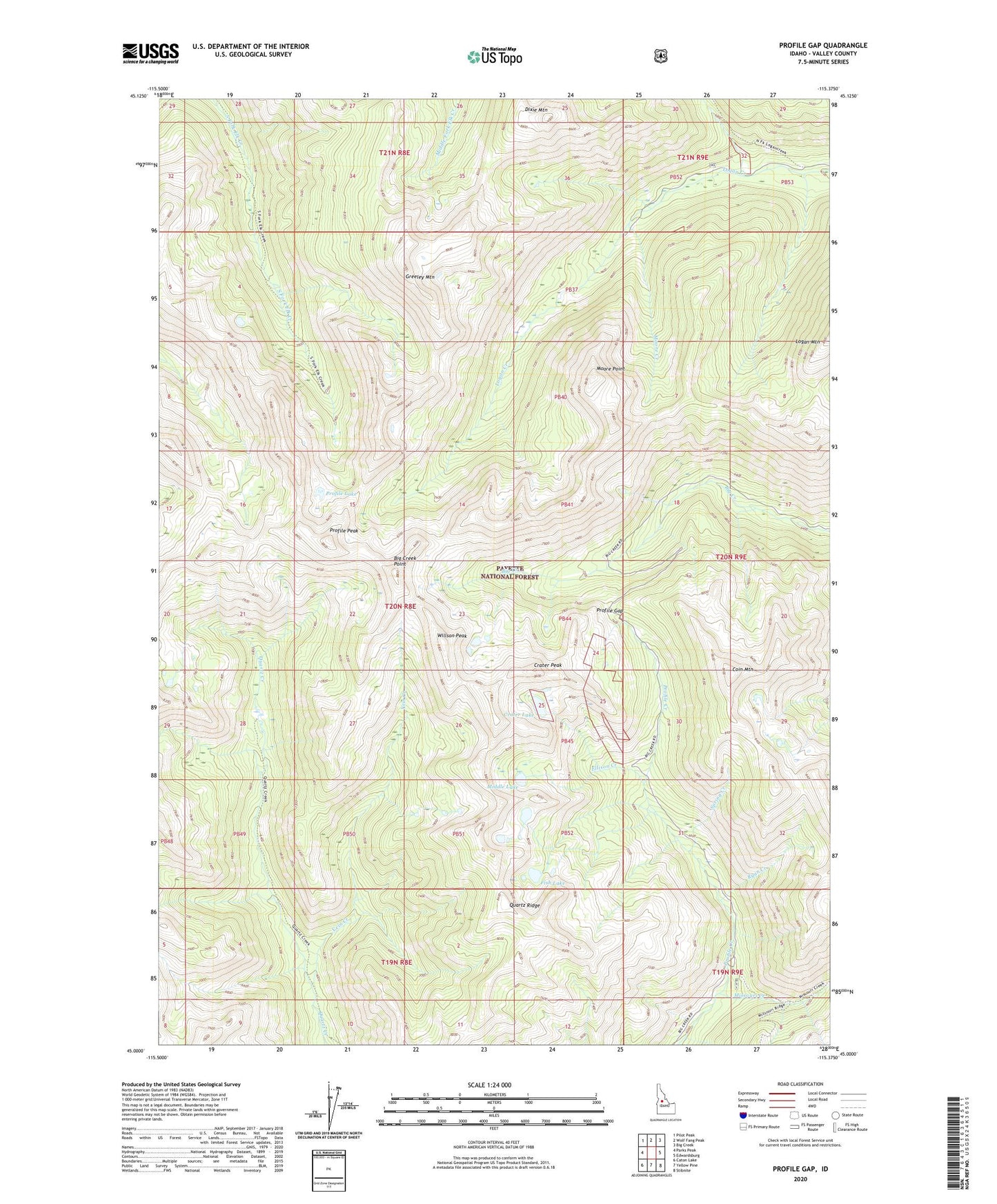
Profile Gap Idaho US Topo Map
Couldn't load pickup availability
Also explore the Profile Gap Forest Service Topo of this same quad for updated USFS data
2024 topographic map quadrangle Profile Gap in the state of Idaho. Scale: 1:24000. Based on the newly updated USGS 7.5' US Topo map series, this map is in the following counties: Valley. The map contains contour data, water features, and other items you are used to seeing on USGS maps, but also has updated roads and other features. This is the next generation of topographic maps. Printed on high-quality waterproof paper with UV fade-resistant inks.
Quads adjacent to this one:
West: Parks Peak
Northwest: Pilot Peak
North: Wolf Fang Peak
Northeast: Big Creek
East: Edwardsburg
Southeast: Stibnite
South: Yellow Pine
Southwest: Caton Lake
This map covers the same area as the classic USGS quad with code o45115a4.
Contains the following named places: Big Creek Point, Coin Mountain, Crater Lake, Crater Peak, Dixie Mountain, Ellison Creek, Fish Lake, Glasgow Mine, Greeley Mountain, Lotspiech Mine, Middle Lake, Missouri Creek, Moore Creek, Moore Point, Moscow Mine, Profile Gap, Profile Lake, Profile Peak, Quartz Ridge, Red Metals Mine, Ryan Creek, Spring Creek, Vein Creek, Willson Mine, Willson Peak, ZIP Code: 83677